
When Cirrus clouds are arranged like the backbone of a fish, they are given the name ‘vertebratus’…
Category: Cloud of the Month
Every month, we choose one of our favourite photographs from the Cloud Gallery to become our Cloud of the Month.
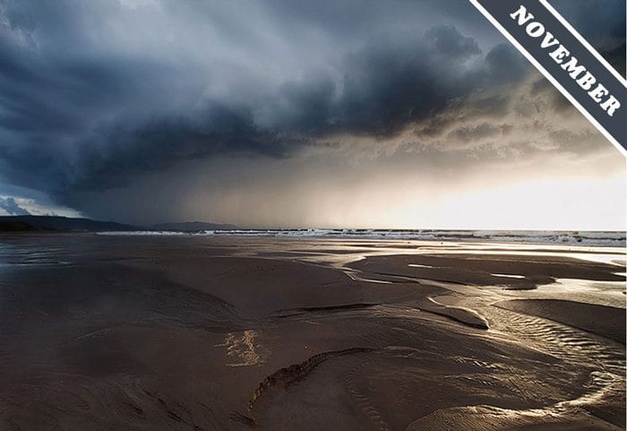
November 30, 2012
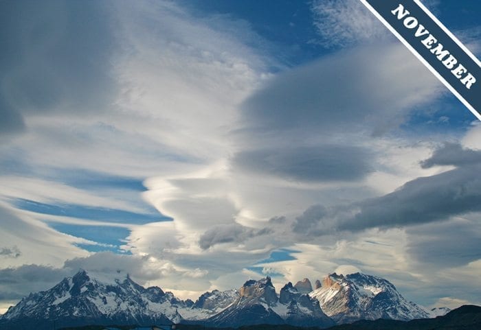
November 5, 2012
Lenticularis clouds dominate the cloudscape over the Torres del Paine mountains, Chile…
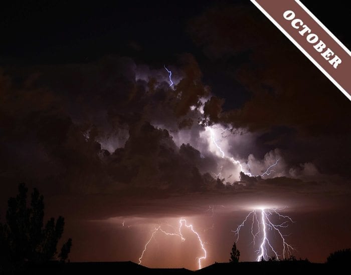
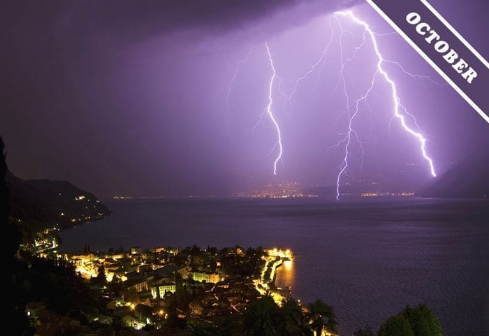
October 17, 2012
Lightning can take many different paths as the enormous electrical charges that build up with in Cumulonimbus storm clouds suddenly redistribute themselves…
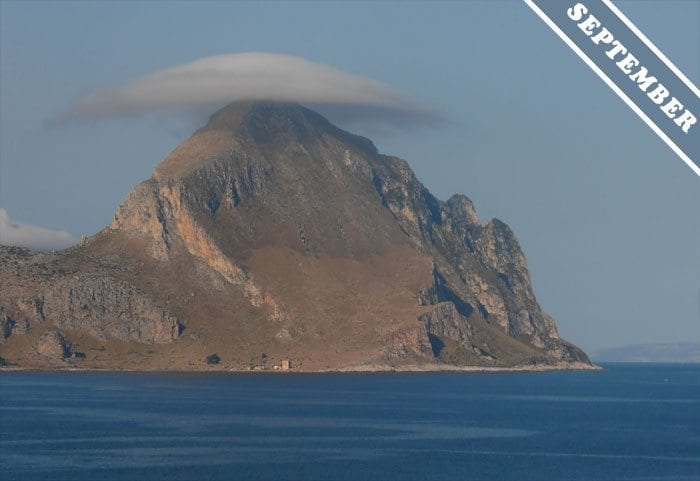
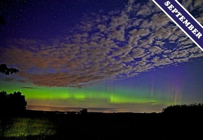
September 5, 2012
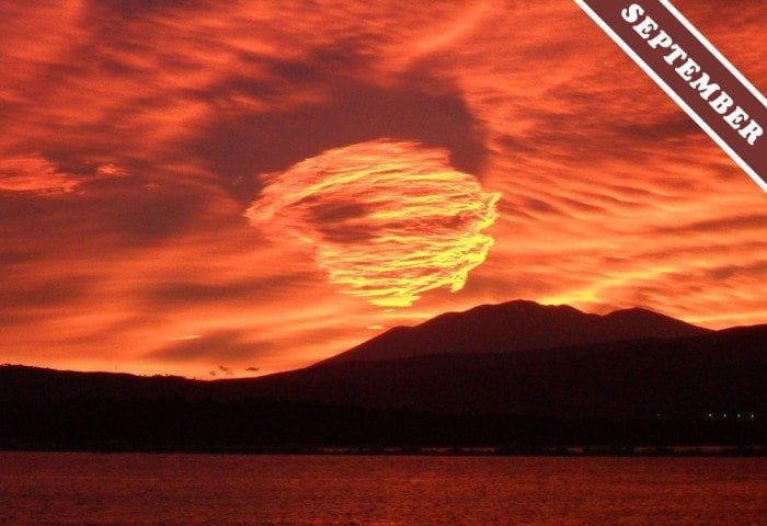
The cloud of the month for September was spotted by Sebastian Luciano Ferla over Monte Cofano in Sicily, Italy…
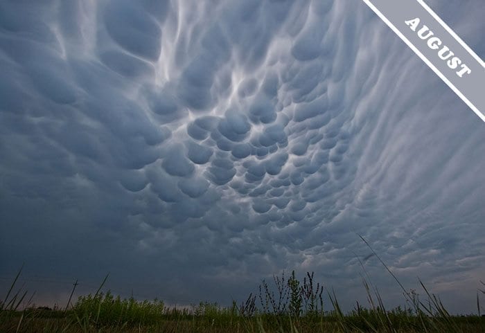
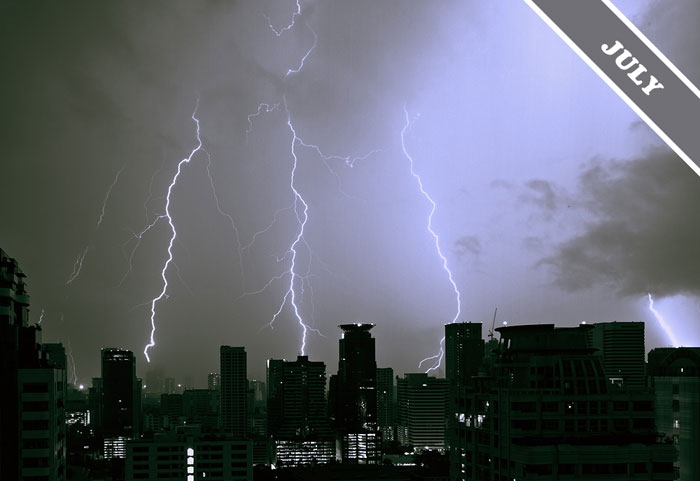
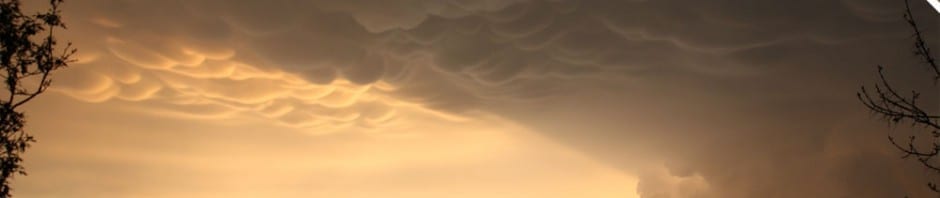
August 2, 2012
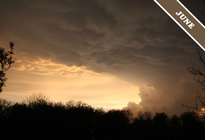
The Cloud of the Month for August is a display of mamma clouds photographed by Kamila Mazurkiewicz over Puławy, Poland…
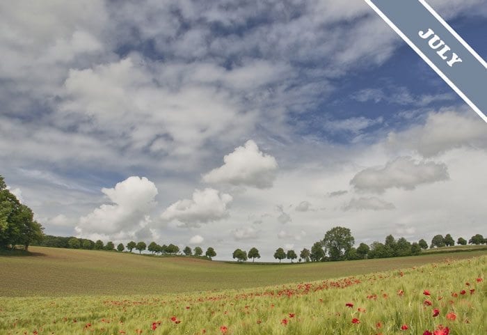
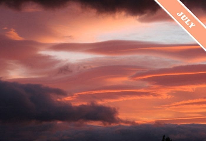
July 2, 2012
A Picture Postcard from The Netherlands
Clouds appearing simultaneously at several different levels of our atmosphere is a common sight, one that is sometimes described as a ‘mixed sky’. The tranquil concoction of clouds chosen as July’s Cloud of the Month was spotted over the hamlet of Huls in the south of The Netherlands.
© Photograph Math Gossens.
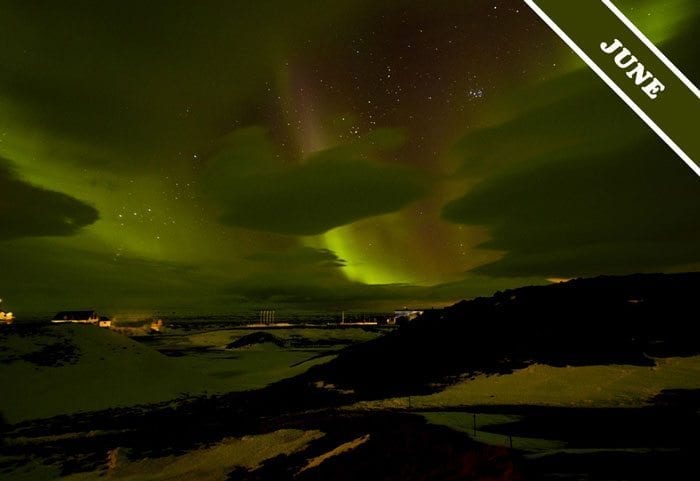
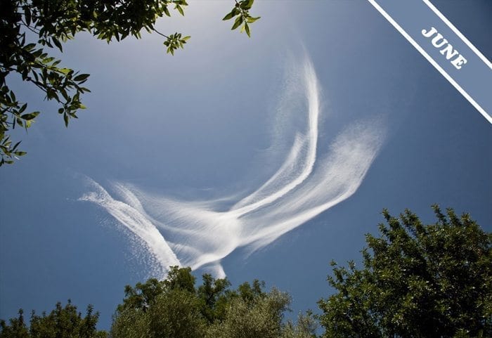
June 1, 2012
The Northern Lights
This month’s image is the notoriously elusive Aurora Borealis, also described as The Northern Lights. Photographer, Norman Shulman, was very fortunate in spotting this enchanting display over Myvatn, in N.E. Iceland. The natural light show in the sky occurs at its most spectacular over Arctic and Antarctic regions and is caused by the collision of energetic charged particles with atoms in the earth’s high altitude atmosphere. The particles originate from solar storms are carried on solar winds before being lured to our atmosphere by the Earth’s magnetic field. And in the foreground? None other than our beloved Altocumulus lenticularis clouds, of course.
© Photograph Norman Shulman.
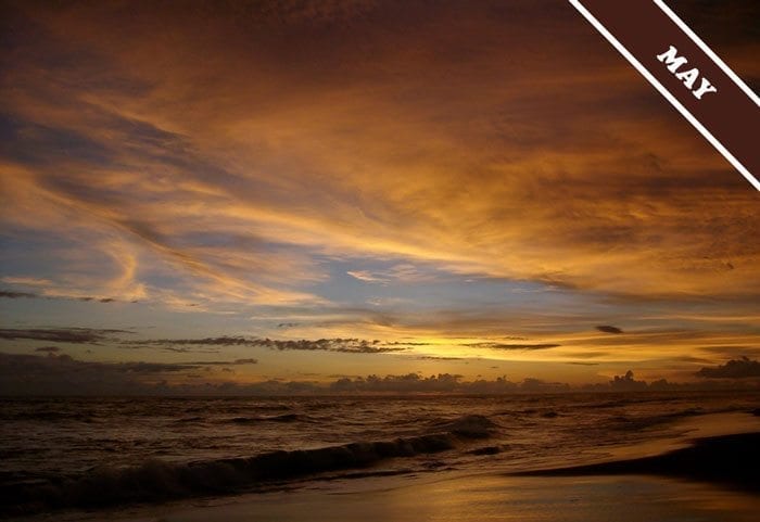
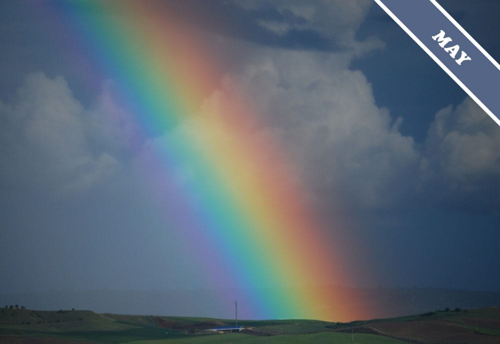
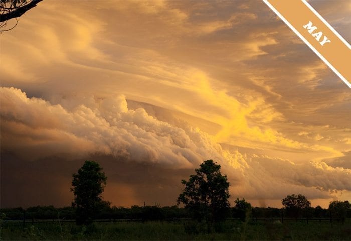
May 1, 2012
The Sun Sets Over Bali
This month’s image is from the island of Bali in Indonesia. Unwind beneath the golden Altocumulus clouds. Bathe in the warmth of the sunset colours. On the horizon, the towering Cumulus are darkening in the shadow of the Earth, as the waves lap at your feet on the rippled sand of the water’s edge.
© Photograph Willem Tesselaar.
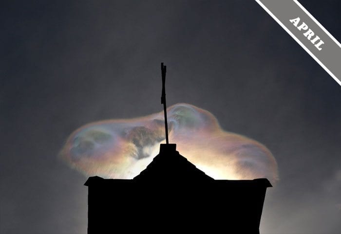
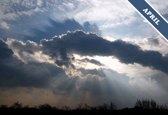
April 6, 2012
Iridescence over Independence
This month’s cloud formation is a display of cloud iridescence. This colourful optical effect is caused by sunlight being diffracted as it passes around the cloud particles, and is seen mostly often when a cloud is forming or dissipating, which means its water droplets are all of a similar size. The beautiful and eery example shown here is in an Altocumulus cloud spotted by Andrew Kirk over Independence, California, US.
© Photograph Andrew Kirk.
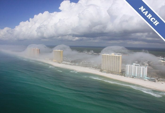
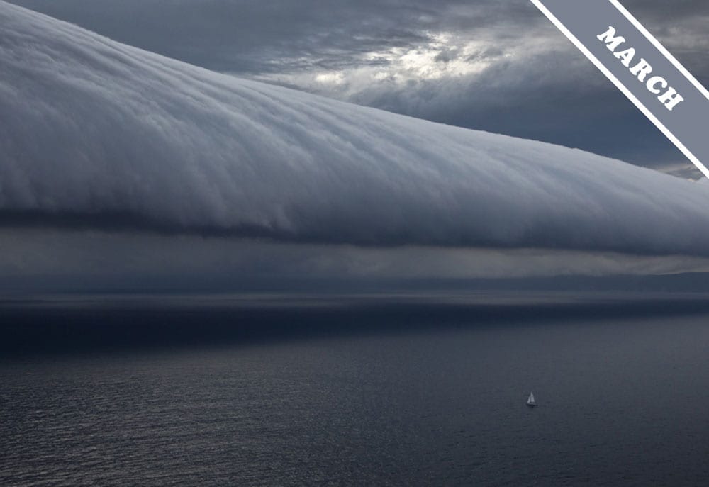
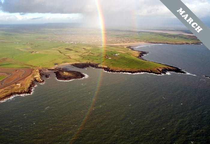
March 6, 2012
Florida Fog
This month’s dramatic image of stratus cloud pouring over condominiums, was observed initially by helicopter pilot Mike Schaeffer. He was completing a sightseeing tour when he spotted this strange weather phenomenon along Panama City Beach, Florida. On landing, he told the helicopter company owner, J.R. Hott, about the cloud formation and they both went up for a better view. They moved quickly, knowing that this beautiful effect could only occur in very specific weather conditions.
The fog formation has since been described in the media as a “cloud tsunami” but J.R. disagrees with this name. “The term tsunami implies a natural disaster,” he explained, “but this cloud effect, though it can form quickly, moves in a gradual manner. It only occurs in the presence of a gentle breeze.”
Photograph © JR Hott.
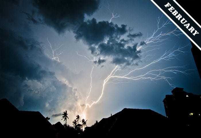
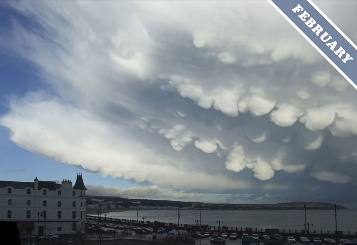
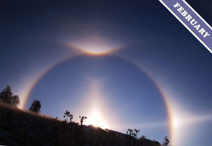
February 2, 2012
Upside Down Lightning Over Penang, Malaysia.
This month’s image shows a dramatically different perspective on lightning, which here appears to be travelling upwards within the Cumulonimbus storm cloud. This type of lightning is sometimes described as spider or anvil crawler lightning, and was spotted over Penang, Malaysia, by Mike Sharp. He describes the area as “most exciting weatherwise”. How could we disagree?
Photograph © Mike Sharp.
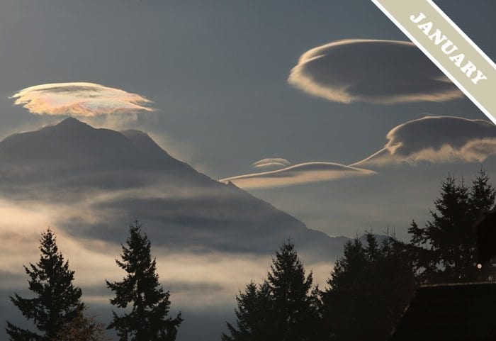
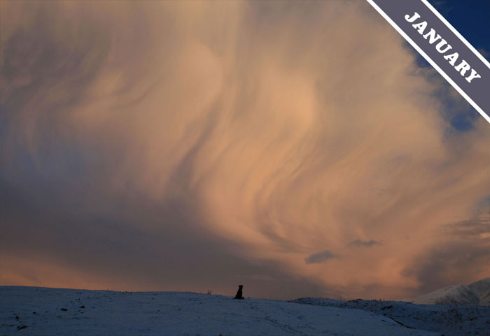
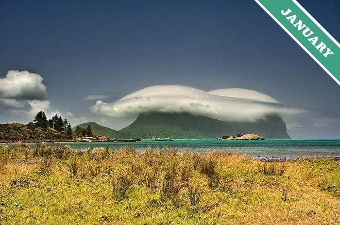
January 5, 2012
Iridescent Lenticular clouds over Mount Rainier
This month’s image shows the beautiful effect that can result from the sunlight shining through thin parts of a cloud where the tiny droplets or ice crystals all have similar sizes. The sunlight can be ‘diffracted’ as it passes around the miniscule particles. The result is that it is split into different wavelengths, which appear as the colours of the rainbow. This optical effect is called iridescence or irisation and tends to appear at the fringes of clouds. This fantastic example, captured by Ryan Verwest, shows iridescence in lenticular clouds, and was spotted over Mount Rainier, Washington, US.
Photograph © Ryan Verwest.

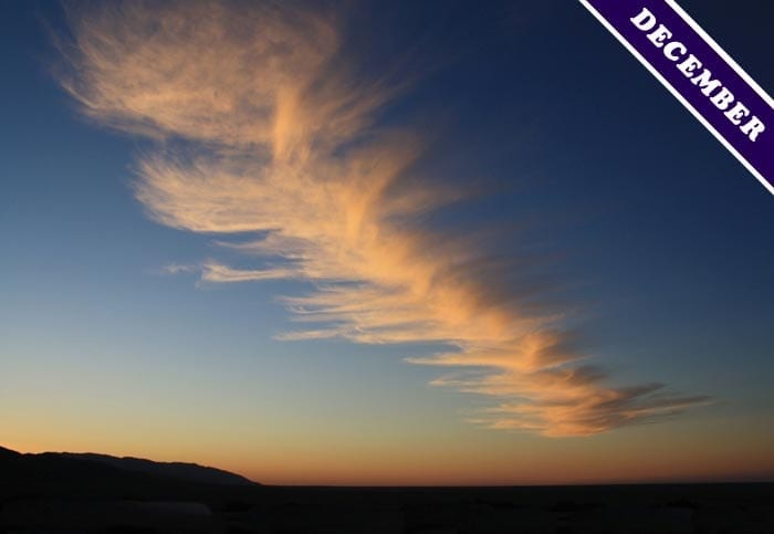
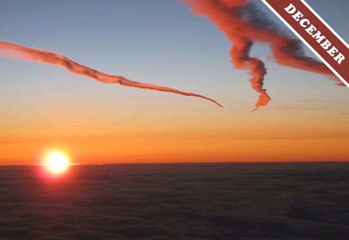
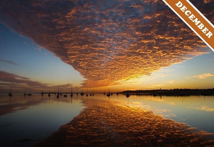
December 11, 2011
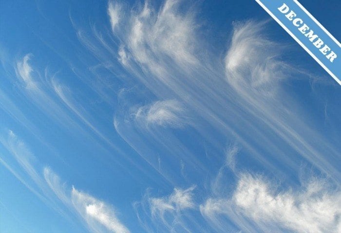
Classic Cirrus
This month’s image was spotted over South Carolina, US.
© Photograph Betty Owen.

November 11, 2011
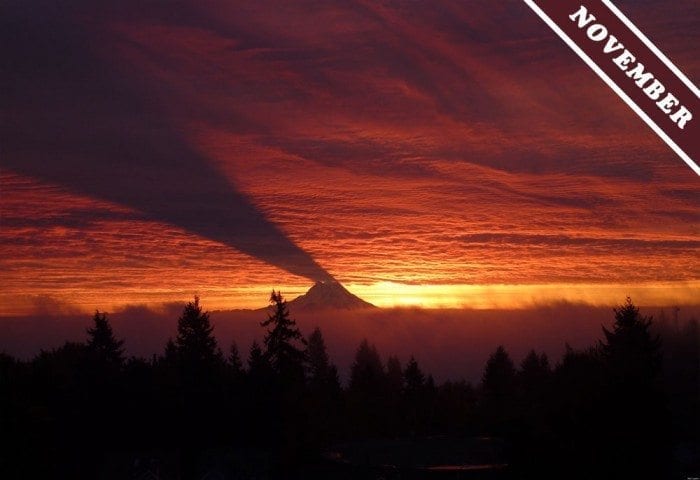
A sunset over Mount Rainier
Mount Rainier’s shadow being cast onto the clouds above makes it look like it is erupting. The dramatic light effect was spotted over Washington, US.
Photograph © Nick Lippert.
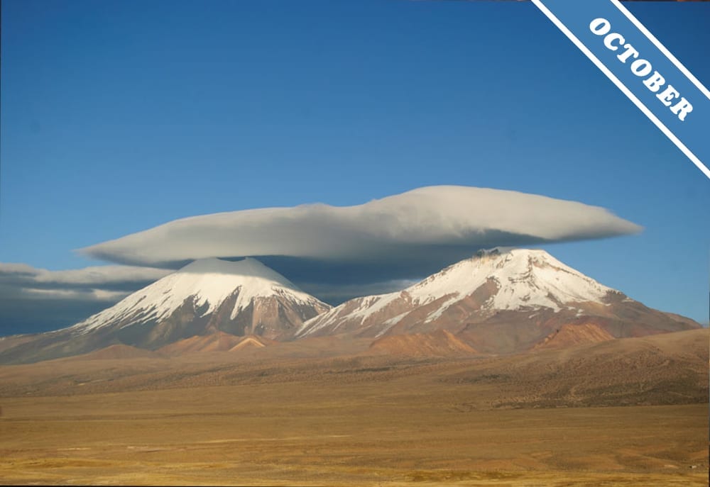
September 30, 2011

Cap clouds over the volcano brothers
The cloud-capped twin volcano brothers, Nevados de Payachata. The one with the crater at the top is the Parinacota volcano. The other is the Pomerape volcano. Location Bolivia, near the border of Chile.
Photograph © Alexandre Militao.

September 2, 2011
A Singer Serenading the Sunset
Well, at least, it looks like one to us. Spotted over Valona, Albania.
Photograph © Maurizio Barbieri.
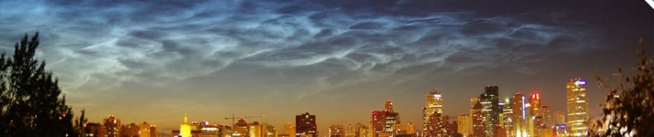
August 4, 2011
Noctilucents over Edmonton
This month’s fantastic display of noctilucent clouds was spotted over Edmonton, Alberta, Canada.
Photograph © Hayley Dunning.
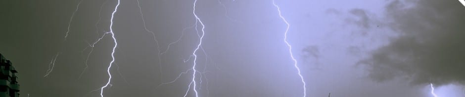
July 3, 2011
A Light Show over Bangkok
This month’s electric display was spotted over Bangkok, Thailand.
Photograph © Sitthivet Santikarn.
May 29, 2011
Minnesota Mammatus
The mammatus clouds that are this month’s pinups appeared below a storm rolling in at sunset over Lino Lakes, Minnesota, US.
Photograph © Jackie Zeleznikar.
April 30, 2011

A Stroke of Colours
This month’s rainbow pinup was spotted over Alcalá de Henares, Spain.
Photograph © Adolfo Garcia-Marin.

March 31, 2011
Rays and Shadows
These crepuscular rays and cloud shadows bursting out from around some Cumulus clouds were spotted over Bergamo, Italy.
Photograph © Fulvio Crotti Spreafico.
February 28, 2011
Racing The Roll Cloud
This fantastic example of a roll cloud was spotted between Sydney and Marimbula during the Rolex Sydney Hobart Race 2010/2011.
Photograph © Carlo Borlenghi/Rolex.

February 1, 2011
Faces in the Mammatus
Can you see them? Faces or no faces, we feel these dramatic mammatus clouds forming on a Cumulonimbus storm cloud over Douglas Bay, the Isle of Man, UK, are worthy winners of the title ‘Cloud of the Month’.
Photograph © Patricia Tutt.

December 31, 2010
A Cloudspotting Dog
We always like to see cloudspotting pets, which is why our Cloud of the Month for this month features Bella Pumpkin, the cloudspotting dog, gazing up at a Cumulonimbus over Skiddaw and Bassenthwaite Lake, Cumbria, UK.
Photograph © Heidi Bailey.
December 2, 2010
Contrail Creatures
This month’s image was spotted on a flight from Dublin to Spain, and do the contrails look to anyone else like, a Snake exiting stage left and a Frog leaping out of frame, top right?.
Photograph © John Gale.
October 29, 2010
Storm Front Surprise
This month’s cloud is known as an arcus, or shelf cloud, which sometimes prodrudes from the front base of a Cumulonimbus storm cloud. It was spotted by Eunice Clarke over Turnberry, Ayrshire in Scotland. “It was amazing standing there,” Eunice told us, “I was taking landscape pics on a nice sunny evening, when this strong gusting wind came from nowhere. When I looked behind me, this is what I saw coming towards me.”
© Photograph Eunice Clarke.
October 1, 2010
A Summer Storm
This month’s cloud is a Cumulonimbus cloud over Italy. Seen from below, it is unleashing ferocious lightning strikes on and around Lake Como.
Photograph © Barbara Mezzera.
September 3, 2010
The Northern Lights
This month’s image shows the beautiful atmospheric display known as the ‘aurora borealis’. It was given this name by Pierre Gassendi in 1621, after the Roman goddess of dawn, Aurora, and the Greek name for the north wind, Boreas. Also known as the northern lights, the display of shifting colours results from the collision of energetic charged particles from solar storms with atoms in the Earth’s high atmosphere. Because of the Earth’s magnetic field, the displays only occur in northern latitudes, like this beautiful example over Denmark.
Photograph © Jesper Grønne.
August 1, 2010
A Cloud Smile
The most beautiful of halos, officially known as a circumzenithal arc, is created by tiny ice crystals. It is sometimes known as a ‘cloud smile’, and rightly so, it can’t fail to bring joy to any cloudspotter. The delightful example shown here was spotted over Stratford-Upon-Avon, UK.
Photograph © Emma Jukes.
June 30, 2010
Sunset Lenticularis
The image chosen this month shows a group of U.F.O. lookalikes, namely altocumulus lenticularis clouds, highlighted in a colourful sunset over Fiordland, New Zealand.
© Photograph Shirley Moodie.
June 1, 2010
On the Wing
This month’s image is a high flying Altocumulus cloud over Southern Spain.
© Photograph Christina Chelmick.
April 30, 2010
Squall Line
This month’s image taken in Derby, Australia, is a line of severe thunderstorms known as a squall line, they form along or ahead of a cold front.
© Photograph Hans Leenaarts.

April 2, 2010
Touching the Clouds
This month’s image of Altocumulus stratiformis clouds was taken at Disneyland, Paris. ‘Altocumulus’ are mid-level clumps of cloud that often appear in a layer which, when it is also described as ‘stratiformis’ spreads over the majority of the visible sky.
Photograph © Dawn James.
March 1, 2010
A Bow from the Air
This month’s image comes from the above the clouds category of our gallery. It is different view of a rainbow from the normal one, and was spotted on a flight above Anglesey, North Wales.
Photograph © John Rowlands.
February 12, 2010
Diamond Dust over Silvercreek
This month’s image is a true gem, a cloud of Diamond Dust. Early morning temperatures hovering around minus 27 degrees and falling ice crystals, created this varied collection of arcs and halos spotted by Jay Brazel at approx 8,700 feet above a small United States town called Silvercreek in Colorado.
© Photograph Jay Brazel.
January 17, 2010
Twin Peaks
This month’s image portrays classic Altocumulus Lenticularis forming as cap clouds over Mount Lidgbird and Mount Gower on the south east coast of Australia. Photograph taken from Lord Howe Island.
© Photograph Matthew Brennan.
December 9, 2009
Looking Down at The Clouds
As any angler will tell you, sitting in front of still water can give you a different perspective on the sky – one that allows you to look up at the clouds without straining your neck. And when the expanse of water is large, it can act like an enormous mirror that reflects huge areas of the sky, like this glorious Altocumulus sunset over southern Australia.
Perhaps the most dramatic example of water mirroring the sky is found on the Salar de Uyuni in Bolivia. This is the world’s largest region of salt flats, and is situated in the Andes, at an elevation of over 3,500m. The salt deposits are incredibly level and become flooded at certain times of the year to be covered in just an inch or two of water. Too shallow to develop any waves, the reflections appear to double the sky.
But you don’t have to cross the world to enjoy the pleasures of cloud reflections. Watch the clouds in any pond or slow river when the day is still, and you will see them sway dreamily with the water’s undulations, as if dancing to a music only they can hear.
© Photograph Heather Hartkamp.
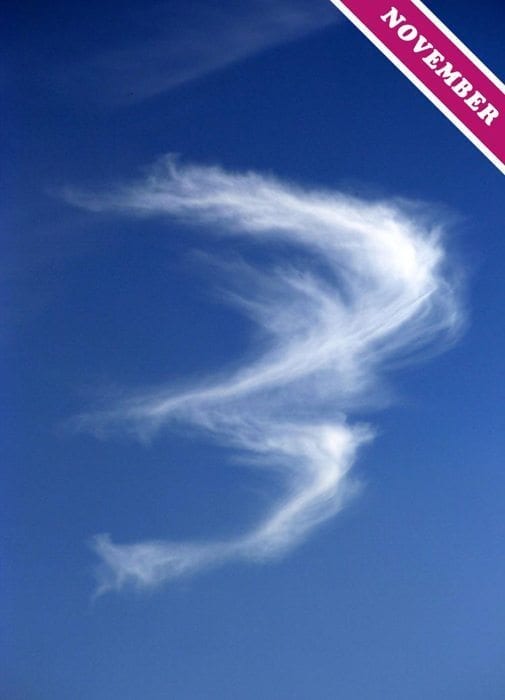
November 9, 2009
Numbers in the Clouds
Every now and then, someone sends us a cloud in the shape of a number. This month, for instance, it is a Cirrus cloud in the shape of the number three.
In fact, number three is the most common. We’ve also had threes in from Palm Desert, California, Uppsala, Sweden, Margate, UK. There have been a couple of number twos over Cambridge and Stafford. But only one number one over Mercogliano, Italy, (also photographed by Modestino Carbone, who took the image above). We’ve even had a bunch of zeros, mostly photographs of the same cloud, over Dorset, UK.
But we only ever get low numbers. What’s going on? What about the other digits? Now that the collection is started, we think it’s time we graduated to higher numbers. In fact, we have developed an obsession about completing the set. What about fours? Fives? Someone must have seen a six, a seven… an eight? Most of all, we’re desperate for one of our members to capture the elusive cloud nine.
So please do send us your cloud digits – all will be gratefully received.
Except for threes. We are not interested in is any more of those.
© Photograph Modestino Carbone.
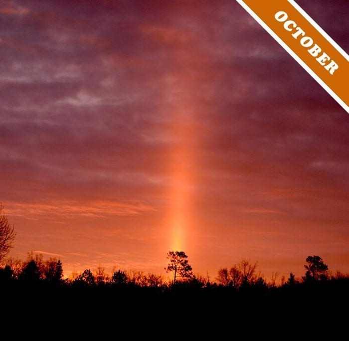
October 7, 2009
The Poor Man’s Optical Effect
Sun pillars are vertical streaks of light that appear above and below a low Sun as it shines through clouds that contain ice crystals, such as the Altocumulus clouds shown here. At night, they are known as moon pillars.
The optical effect is one of the ones that are collectively described as ‘halo phenomena’, and appears on about 25 days of the year over Europe. Sun pillars are caused by the sunlight reflecting off the surface of the ice crystals. So they are rather like an aerial version of the ‘glitter paths’ that appear below the bright sun on the surface of the sea, but it is the faces of tumbling ice crystals that cause the reflections here, rather than then rippled peaks on the ocean. A pillar extending above the Sun like this fine example, spotted over Lively Ontario, looks brightest when the Sun is just below the horizon.
Most of the other the arcs, rings and spots of light that are called halo phenomena only appear when the clouds’ crystals are optically pure, regularly shaped and neatly aligned. But this is not the case for sun pillars. They are like a poor man’s halo phenomenon, for they appear when cloud crystals aren’t so exquisitely refined. Since the sunlight needs only to glance off a surface of the crystals, they can be rough, irregular and jumbled.
© Photograph Paul Laplante.

September 6, 2009
Thick and Puffy
‘Convection clouds’ are ones that form and grow by the process known as convection. Cumulus and Cumulonimbus are examples of this type of cloud.
Convection in the atmosphere is the way air floats upwards on account of being warmer than the surrounding air. You can see this sort of movement close up when a shaft of sunlight picks out the tiny motes of dust suspended in the air of your room. Since the dust reveals the invisible swirling currents of the air, it lets you see the air near to a radiator rising upwards. The radiator warms the air beside it, making it expand and become less dense than the air further away. This causes the air near the radiator to gently float up towards the ceiling. The same convection currents, on a much larger scale, drive the formation and development of convection clouds like the large Cumulus shown above.
Out in the atmosphere, patches of sun-warmed ground can act as enormous radiators that set the air rising. These convection currents are known as thermals, and produce fair-weather Cumulus clouds. But convection can also produce clouds when the Sun is not shining. This happens when a huge region of colder air from the poles collides with a region of warmer air from the tropics. When this happens, some of the colder air can ride up over the warmer. The result is in an unstable region of the atmosphere that produces large convection clouds. The less dense, warmer air below rises rapidly through the denser, cooler air above. And whenever air rises like this it cools. This means that some of the invisible water vapour it contains can condense into droplets that appear as cloud.
Since they tend to form rapidly in the rising columns of air, convection clouds are ‘optically dense’. They contain a lot of very small droplets, the surfaces of which scatter the sunlight more than in clouds made of fewer, larger droplets or ice crystals. For this reason, convection clouds often look bright white on the sides facing the Sun and dark grey on the sides away from it.
Cumulus congestus spotted over Cividale del Friuli, Italy by Tommaso Zamò (Member 14,276)..
