
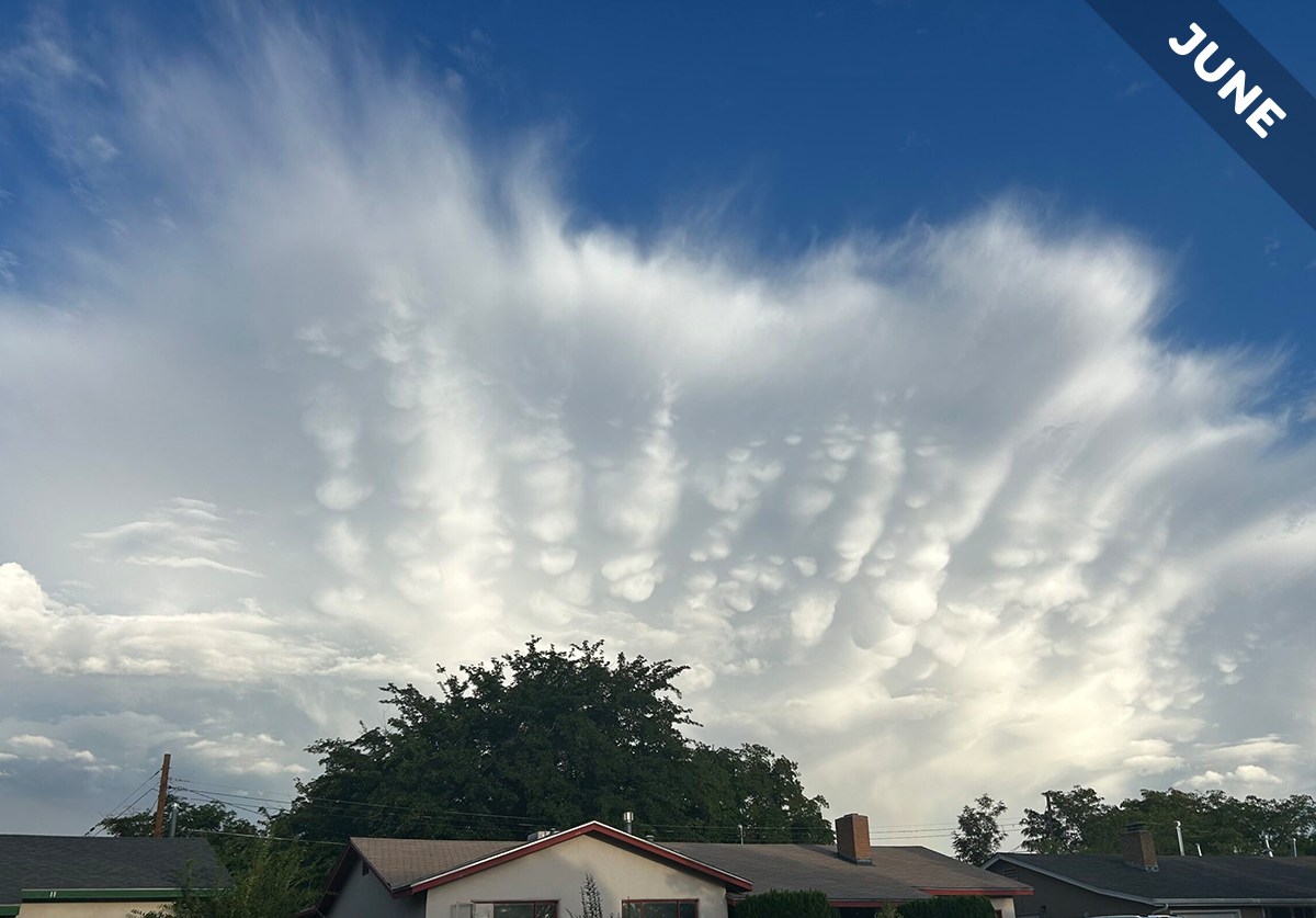
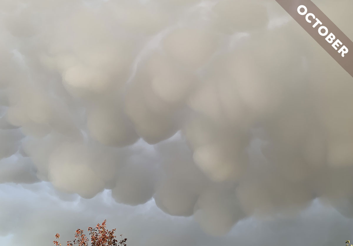
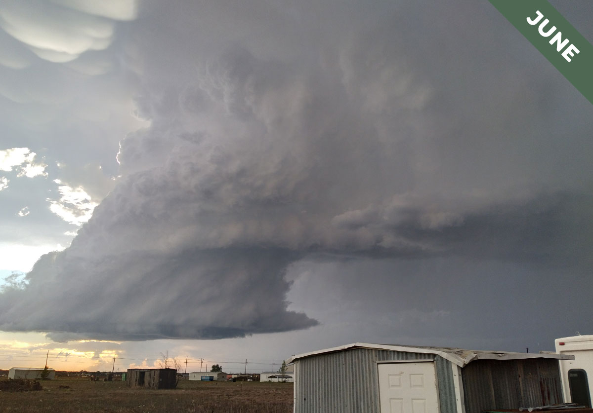
Meet mamma cloud features. They’re pouches that can appear on the underside of clouds, they develop in a way that’s upside-down compared to most clouds, and they’re our Cloud of the Month for June…
Category: Cloud of the Month
Every month, we choose one of our favourite photographs from the Cloud Gallery to become our Cloud of the Month.
June 1, 2026

April 30, 2026
Meet the horseshoe vortex cloud. It’s the gentle twister of the sky, and if you blink you’ll miss it, as we explain in Cloud of the Month for May…
April 1, 2026
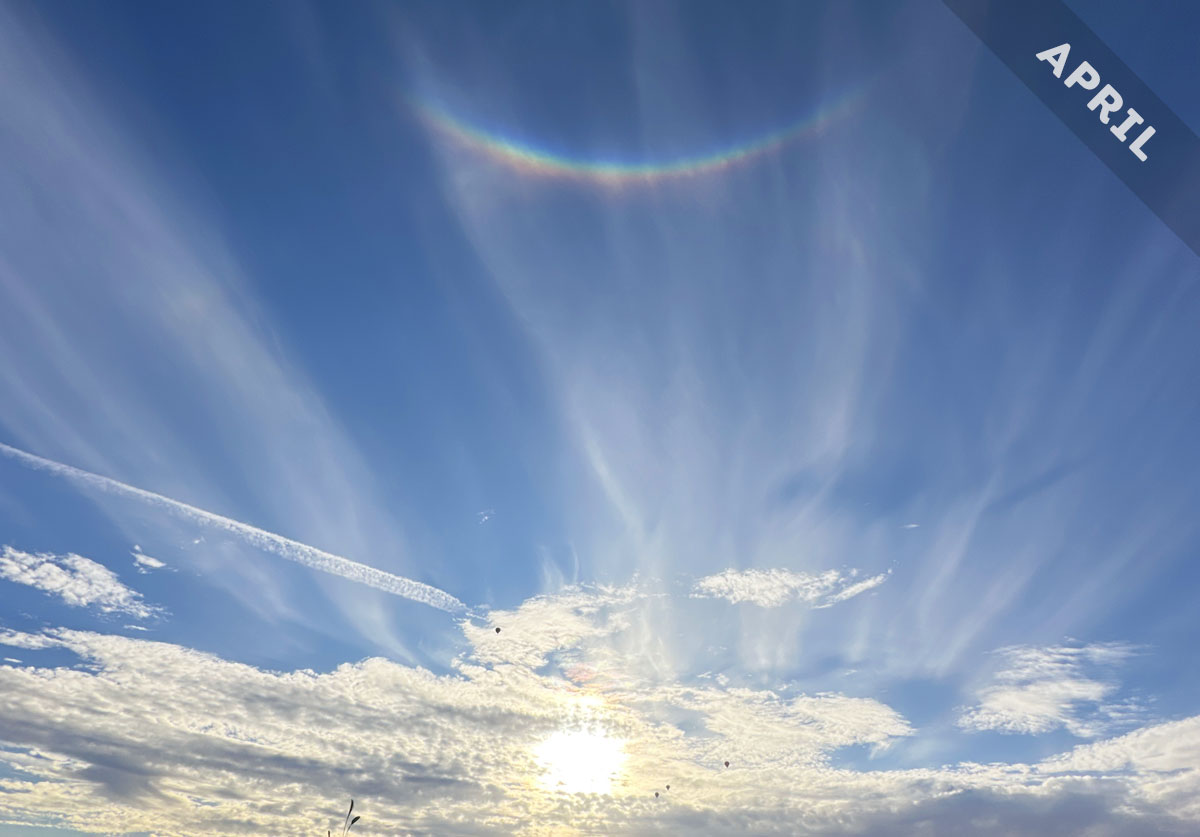
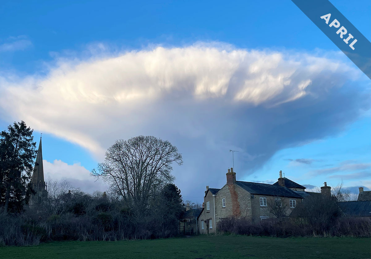
The brightest and most dramatic of all the halo phenomena turns out to be the one most people miss. As we explain in April’s Cloud of the Month, that’s because it is hiding in a part of the sky no one thinks to look…
March 1, 2026
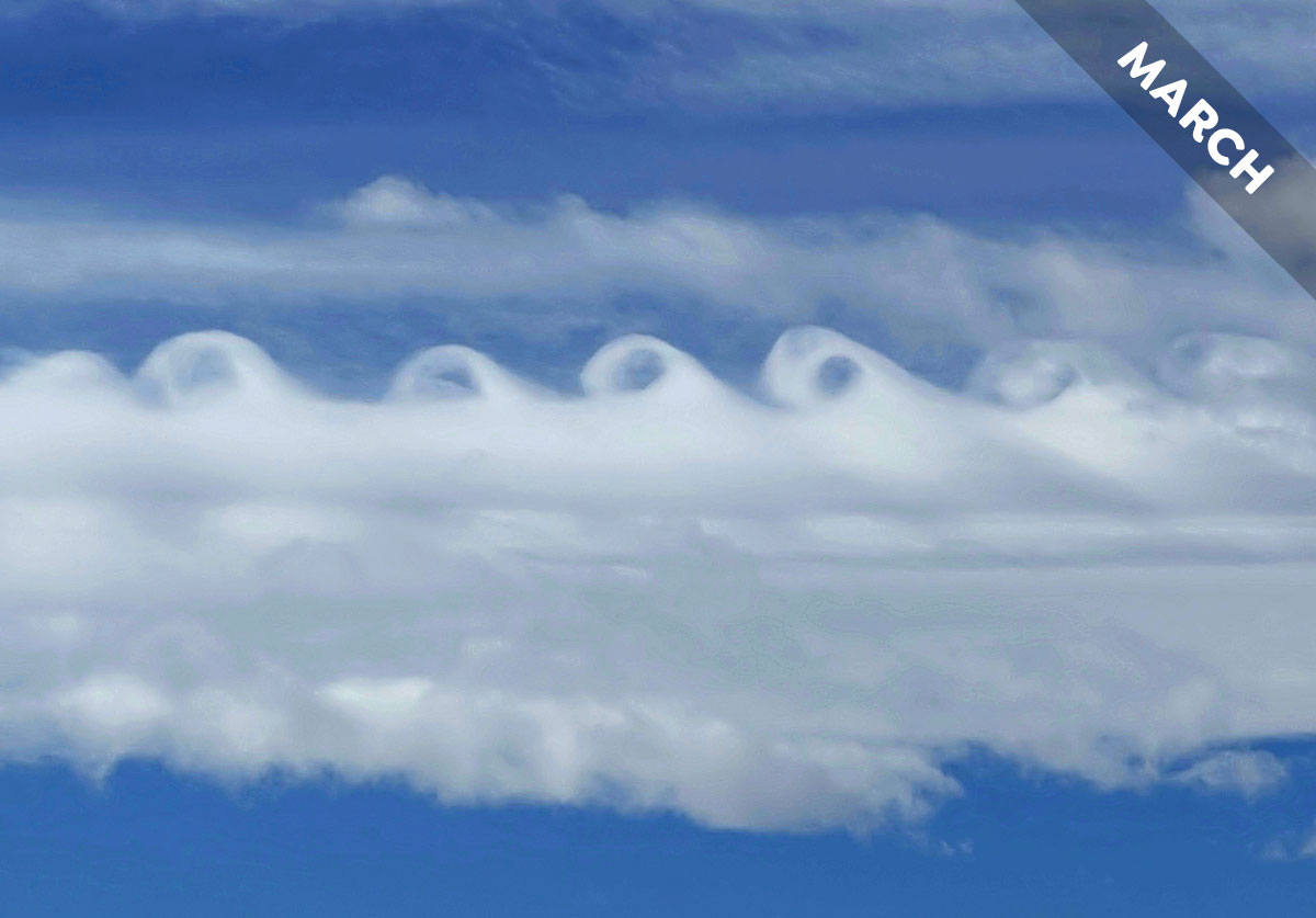
Find out what’s up with this curly cloud, spotted over Brighton, Colorado, US, and how is it caused by the Rocky Mountains below, in Cloud of the Month for March…
February 1, 2026
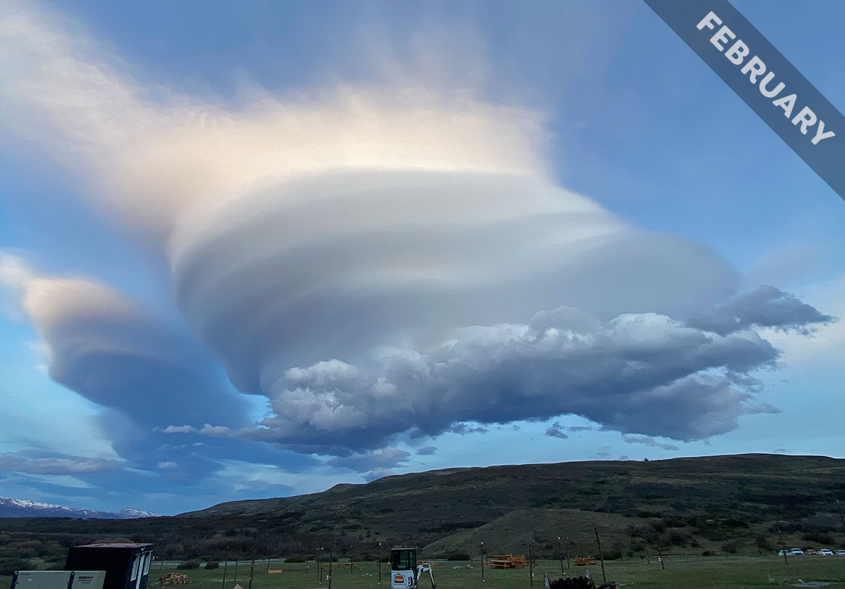
The flow of moist air over mountains can give rise to two very different forms of cloud. Meet the smooth lenticularis cloud and the rough rotor cloud, captured over Patagonia, Chile in February’s Cloud of the Month…
January 1, 2026
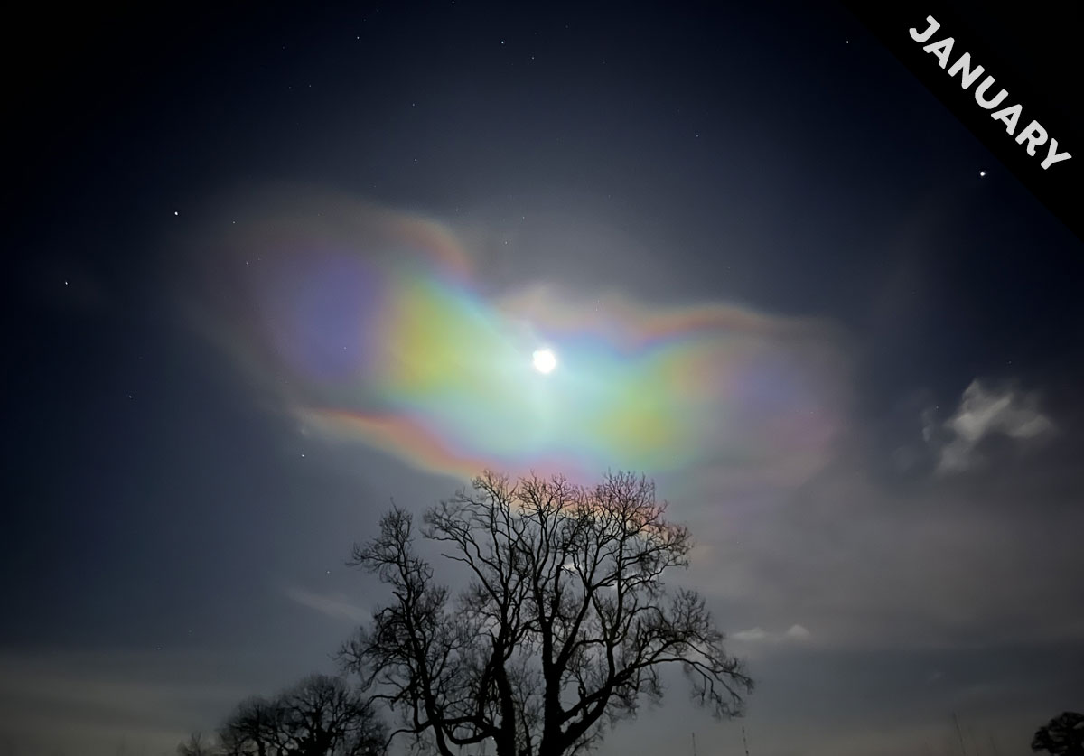
When is the rare, extreme altitude, nacreous cloud even rarer than usual? Find out in Cloud of the Month for January…

December 1, 2025
Burketown in northern Queensland, Australia has a cloud visitor, known locally as the Morning Glory cloud, which glider pilots surf like the atmospheric equivalent of regular surfers on an ocean wave…
November 1, 2025
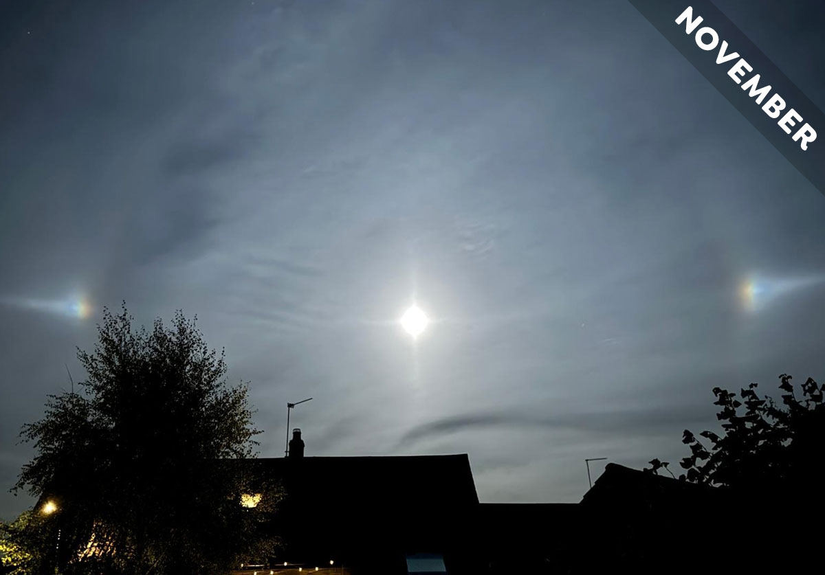
Meet the optical effects that are the Moon’s best friend, in Cloud of the Month for November…

October 1, 2025
The common, but often stunning, undulatus variety of cloud is a gentle reminder that our atmosphere is an ocean of air…

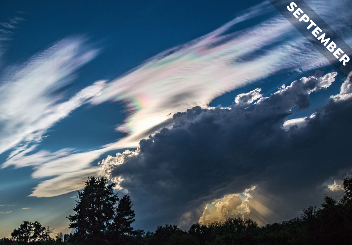
September 1, 2025
When you see an arcus cloud feature stretching across the sky ahead, you can be sure that heavy showers will soon follow – as we explain in Cloud of the Month for September…
July 31, 2025
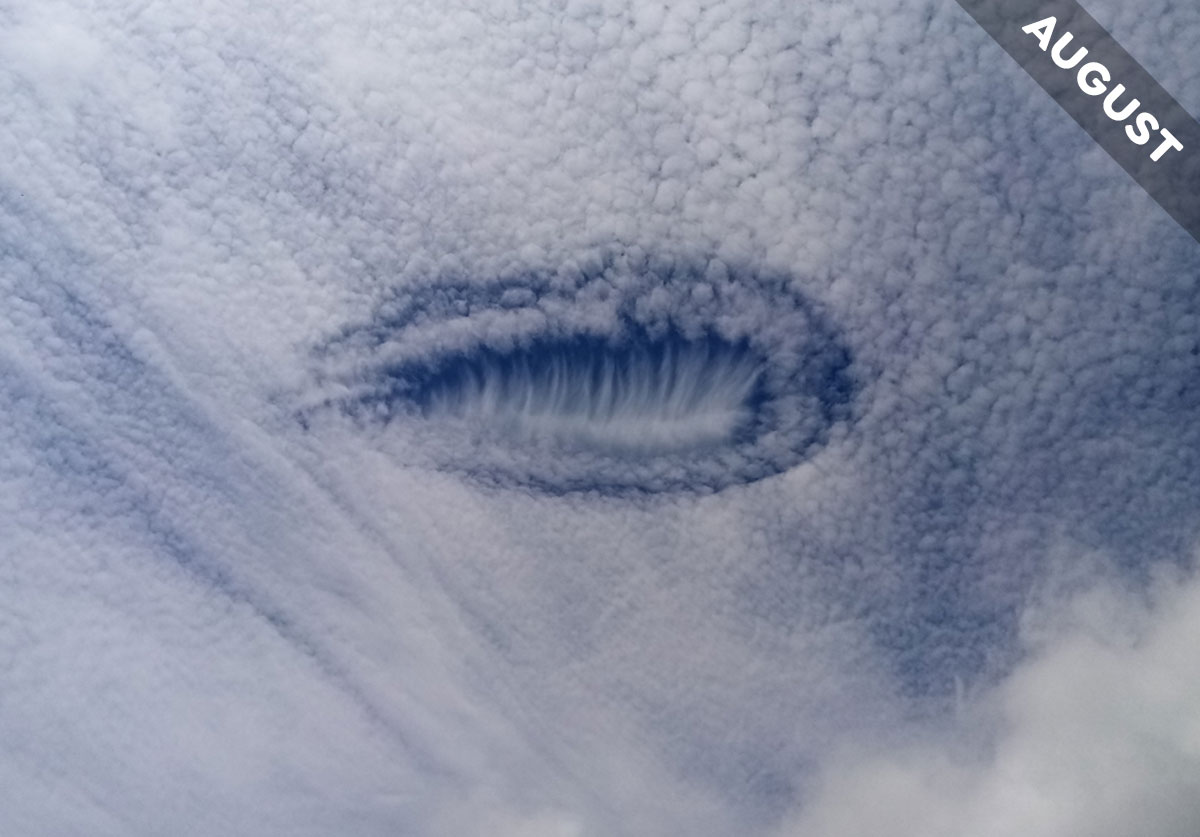
Anne Ducret saw this strange hole in a layer of Altocumulus clouds she spotted over Lot, Occitanie, France. We explain what caused it in Cloud of the Month for August…

July 1, 2025
The circumhorizon arc is an optical effect cause by sunlight shining through ice crystals. It looks like a flat rainbow, it forms in the middle of the summer, and it’s Cloud of the Month for July…

June 1, 2025
Imagine looking up and seeing the sky behave like the underside of a choppy ocean. That’s the dramatic effect of asperitas clouds…
May 1, 2025
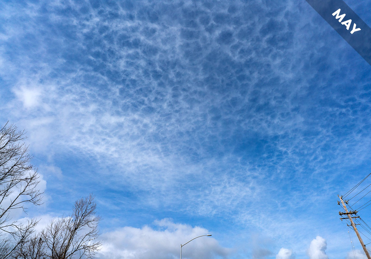
Cloud classifications are mostly based on their appearance. The names typically refer to what the clouds look like. We just say them in Latin to make it feel more official. The lacunosus variety of cloud is a case in point…
April 1, 2025
The Cumulonimbus storm cloud is the royalty of the cloud world and it wears a crown of ice, which we have featured as the Cloud of the Month for April…

March 1, 2025
In Cloud of the Month for March, we introduce an atmospheric magic trick…

February 1, 2025
Cumulus and Altocumulus are like siblings of the cloud family, as we explain in February’s Cloud of the Month…
January 1, 2025
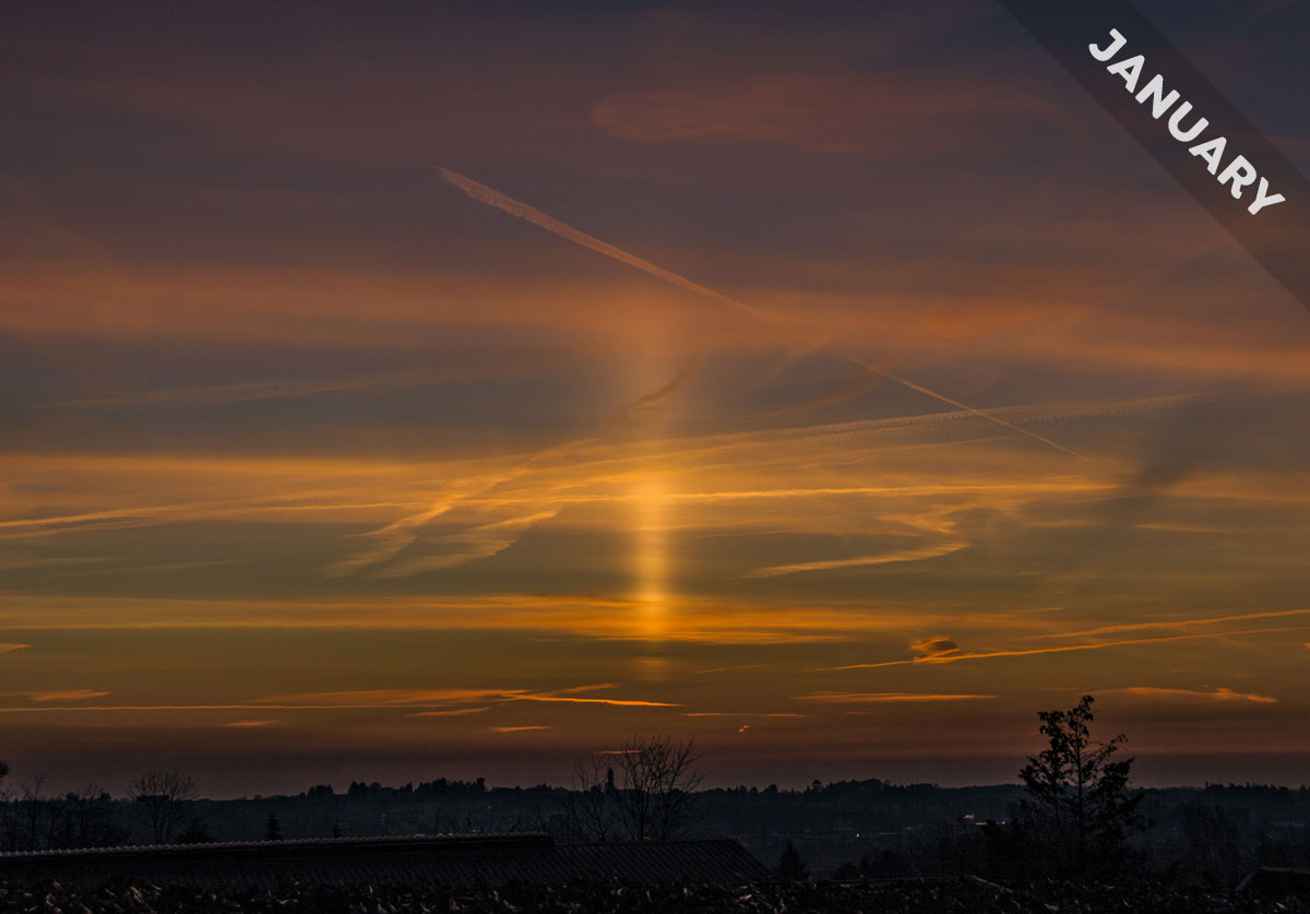
A sun pillar at sunrise heralds the start of a new day in January’s Cloud of the Month…

December 1, 2024
Many optical effects caused by clouds exhibit precise, geometric shapes but not the corona. We embrace this often wonky light effect in Cloud of the Month for December…

October 31, 2024
Want to learn how to read clouds to forecast the weather? Look for the comma-shaped formations known as Cirrus uncinus that feature as Cloud of the Month for November…
October 1, 2024
Meet the mother of all storm cloud features, and learn if it tells you that the storm’s heading towards you or away from you, in Cloud of the Month for October…

September 1, 2024
For many cultures, rainbows are symbols of hope. Why is that? We think it comes down to the way a rainbow forms, as we explain in Cloud of the Month for September…

August 1, 2024
Eyebrow clouds with disco colours! Meet the cloud that deserves an official classification, and which we featured as Cloud of the Month for August…

July 1, 2024
Meet the highest clouds in our atmosphere. They’re ghostly blue and they shine at night and they feature as Cloud of the Month for July…

June 1, 2024
The illusion of perspective is at its most impressive when you observe beams of light and shade, known as anti-crepuscular rays, from the window of an aircraft. That’s why we featured some as Cloud of the Month for June…

May 1, 2024
Only one of the ten main types of cloud can produce lightning. Only Cumulonimbus has the superpower to shoot electricity through the air, which is why we’re featuring it as Cloud of the Month for May…
March 31, 2024
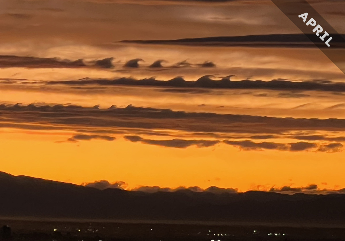
Fluctus is a cloud formed by a particular wind pattern known as wind shear. With its breaking-wave curls, it is the most iconic of all the wave clouds, and it features as Cloud of the Month for April…

February 29, 2024
It’s this season’s ultimate in mountain fashion. Check out the cap cloud, which we feature as Cloud of the Month for March…

February 1, 2024
Ever wondered how low a low cloud can go? In Cloud of the Month for February, we introduce you to the blanket of cloud that can form right down at the ground and fill mountain valleys to the brim…

January 1, 2024
Last month saw the most dramatic display over Europe in over 15 years of the most colourful cloud in our skies. We explain all in Cloud of the Month for January…

December 1, 2023
Spotting a dramatic display of ice-crystal optical effects is about being in the right place, at the right time, with the right cloud…

November 1, 2023
Meet the cloud that glider pilots surf like an ocean wave…

October 1, 2023
Cirrocumulus usually appears in patches that don’t hang around for long. October’s Cloud of the Month shows an unusually rare expansive form of this fleeting cloud…
August 31, 2023
What makes a cloud turn multicoloured? We explain in September’s Cloud of the Month…

August 2, 2023
On a hot, still day in the height of summer, a spinning cloud of dust can develop. It’s known as a dust devil, and it features as a very dry Cloud of the Month for August…

July 2, 2023
A cavum, or fallstreak hole, is the perfect cloud feature for any clouspotter with a sweet tooth, as we explain in Cloud of the Month for July…
June 1, 2023
In Cloud of the Month for June, we introduce the murus cloud, which appears beneath huge storm systems and likes to give birth to tornadoes…

April 30, 2023
When the sky imitates a turbulent sea and giant meringue peaks, you’re likely looking at an asperitas cloud…

April 1, 2023
Cloud of the Month for April is the rare and fleeting horseshoe vortex cloud. Keen to spot one? Don’t get your hopes up…

February 28, 2023
Why do clouds sometimes line up in long, parallel streaks? We explain with the help of a cloud called Cirrus fibratus…
