
A Dust Devil in Quebec, Canada
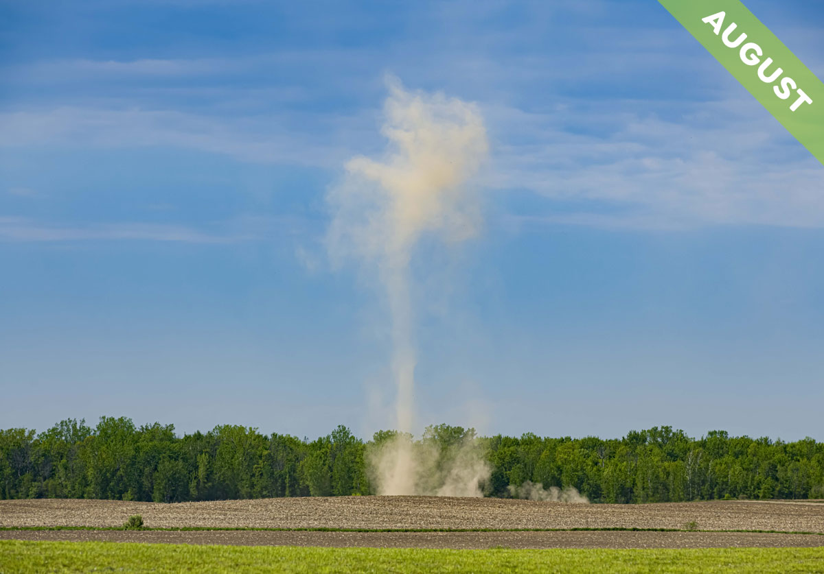
On a hot, still day in the height of summer, as the Sun beats down on flat, open land, invisible columns of air known as thermals can start to rise off the surface. When the air carries enough moisture, a thermal can develop into a Cumulus, but when conditions are arid, it can make a cloud of dust instead – one that’s twisted into a column, which we call a dust devil.
The energy that forms dust devils comes from the ground’s heat – more specifically, the difference in temperature between the ground and the cooler air above. The air in contact with the hot ground warms and expands. It becomes less dense than the cooler air above that isn’t touching with the ground and so it floats upwards. The greater the temperature difference between ground and air, the more ‘unstable’ the atmosphere in the region becomes – and, when conditions are dry and dusty, the more likely a dust devil will form.
It’s the air rushing in from all sides that sets up the spin. As a thermal rises rapidly in one spot and surrounding air draws in to fill the void, the slightest differences in breeze around the area can start a rotation, which soon picks up speed. It’s like water going down a plug hole. Except that it’s air instead of water. And it’s going up. Spinning air is normally invisible, but you see it as a dust devil when dry soil or sand is picked up and drawn into the vortex.
They vary greatly in width, from 0.5 metres (1.6 feet) across to over a hundred of metres (330 feet) in diameter, and they reach as high as 300 metres (980 feet). But even the larger dust devils, though they resemble tornados, are generally mild weather phenomena. Their wind speeds rarely exceed around 30 mph (45 km/h), and they only tend to hang about for a few minutes before breaking up. These benign qualities are thanks to their dryness. Since no water droplets form in the rising air of a dust devil, none of the heat that is released with water condensing can add buoyancy and fuel the wind speeds of a dust devil to become destructive like those of a tornado. Just sometimes, it’s better for clouds not to be involved.
Dust devil, with Altocumulus clouds above, spotted over Noyan, Quebec, Canada by Daniel Thomas (Member 55,137). View it in the Photo Gallery.
