
Horseshoe Vortex – A Cloud with a Twist
The horseshoe vortex cloud is a twisting curl that bends up in the middle to resemble a horseshoe. It lasts no more than a few minutes before breaking up and dissipating away. And although the horseshoe vortex is one of the rarest cloud formations, it is related to one of the most common: the everyday Cumulus.
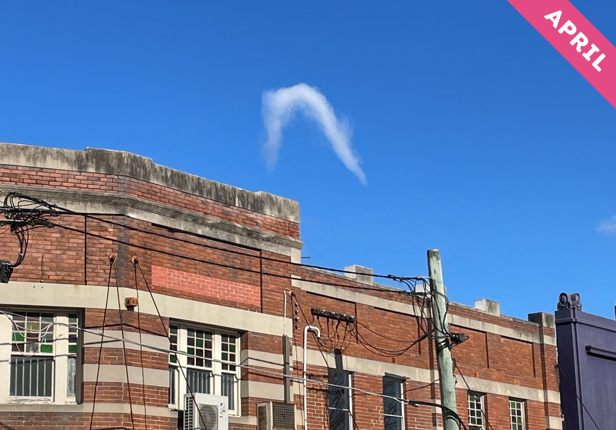
Horseshoe vortex clouds, like the one spotted here by Anne Brophy (Member 33,066) over Randwick, Sydney, New South Wales, Australia, develop on thermals. These are the invisible columns of rising air that lift off the Sun-warmed ground that also produce fair-weather Cumulus. The air in a thermal expands as it rises, and this can cool it enough for some of its moisture to condense into droplets and appear as a Cumulus. For the thermal to form the rare and fleeting horseshoe vortex cloud, another atmospheric ingredient is needed: wind shear.
Wind shear is when the speed or direction of the wind varies significantly with altitude. Usually, it is when the wind becomes suddenly faster as you gain height. When a thermal encounters, as it rises, a sudden change in the speed or direction of crosswinds like this, it can take on the spin that leads to a horseshoe vortex cloud.
The warmest part of the thermal is at its centre, and this is where the air rises fastest. Ascending into wind shear aloft, this middle part of the thermal can take on a spin, forming a horizontal vortex of air. This rotation is like a mini twister on its side. And if the moisture and temperature conditions are just right, the low pressure within this vortex cools the air enough for droplets to appear as a twisting ribbon of cloud. The twist of cloud bends up in the middle where the air is rising fastest, and the cloud’s iconic shape is forged. In even rarer circumstances, an already-existing Cumulus cloud can get tangled up in the vortex of another thermal, and the cloud feature forms like a curl of yarn twisted from the woolly tuft of the Cumulus.
You are most likely to spot a horseshoe vortex cloud on a long, sunny afternoon once the ground has been heated enough by the Sun for the thermals to have become powerful. Sometimes, the cloud can appear in the vicinity of a violent, rotating thunderstorm known as a supercell, where thermals and wind shear are found in abundance. But spotting a rare and ephemeral cloud formation like this is mostly about luck. You just have to be in the right place at the right time – and in the right frame of mind. Pay regular attention to the everyday twists and turns of the sky, and you’ll eventually be lucky enough to spot the fleeting horseshoe vortex cloud.
Horseshoe vortex cloud spotted over Randwick, Sydney, New South Wales, Australia by Anne Brophy (Member 33,066).
