Forum Replies Created
-
AuthorPosts
-
 George PreoteasaParticipant
Hi Maria,
I’ll try but I am not really sure. Because they are so far, you see the clouds on the edge, so to say. So a layer of thin high clouds, like cirrostratus, could appear as a dense, solid cloud. So given the otherwise clear sky, this is my first guess, cirrostratus.
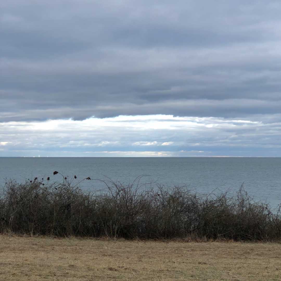
You have a nice view there. What part of the world is it? What is beyond the little hills on the horizon, any significant body of water?
George PreoteasaParticipant Hi everybody, long time no visit here and I see some new people and lots of beautiful things. I recently shot what I thought was a 22 degree halo, but then it struck me that it’s oval, so I did some looking up. Atoptics says it’s a circumscribed halo. Interesting how its shape varies with the height of the sun.George PreoteasaParticipant
Usually, the shape and the size of the elements will tell you the level. Also, how fast they move. Lower clouds, closer to you, appear to move faster in general.
George PreoteasaParticipantHi Alexxx, yes, those that look like fibers are cirrus. The small roundish ones are either cirrocumulus or altocumulus. It’s hard to tell from pictures because it’s not clear what the scale is. The rule is (if I remember correctly) if the pinky covers (or almost) the cloud element when the arm is fully extended, it’s cirrocumulus.
My guess from the picture is those are high altocumulus, but not quite cirrocumulus.
George PreoteasaParticipantOh, I see your previous post. It’s short exposure.
Identifying clouds at dawn or dusk can be rather difficult, but I will offer my guess. From what I see on the left side, I would say cirrus. And in the middle, those holes would indicate the lacunosus variety.
I wonder what others would say.
George PreoteasaParticipantWith what exposure time was the picture taken? I wonder if there is a bit of cloud movement in the picture.
George PreoteasaParticipantSteven, nice spotting. The basic type is stratocumulus. Because it’s wavy, you can say it’s stratocumulus undulatus. And the perspective effect makes them look like they radiate for some point away, so radiatus also applies. A mouthful. Also know as “cloud streets”.
George PreoteasaParticipantGeorge, I cannot confirm, that’s too strong a statement, but the fires have certainly increased the natural convection, which is the main mechanism of cloud formation, specifically for cumulonimbus. Also, there is additional water vapor generated by the fires, so you have all the ingredients to form a storm cloud.
George PreoteasaParticipantThanks Martin, good article. Yes, there is some business around rain making and hail prevention. The problem is proving cloud seeding effectiveness. Here is what the article says (translated from German by Google).
Evaluation of the applicability and effectiveness
Hail cloud with a characteristic greenish color
While an effect is theoretically conceivable and justifiable, in practice there are great problems with all the methods used in the actual introduction of silver iodide into suitable cloud layers at the right time because the local weather conditions fluctuate greatly. So far, there have been no scientific studies on measuring success, and no clear results could be derived from company investigations. [12] For the increased, targeted raining by means of cloud vaccination, an effect of only 10% change in the amount of precipitation could only be statistically proven. [13] Israeli studies question whether the method is more effective. [14]With larger storm clouds (approx. 3 km in diameter), even with careful estimates, at least 2 ⋅ 10 18 drops must be assumed, which can potentially form hail. Assuming the production of 2 ⋅ 10 13 condensation nuclei per gram of silver iodide used, even with the distribution of several hundred kilograms of the substance, it is hardly possible to assume sufficient nuclei to produce a greater effect. [15]Accordingly, attempts to bring certain rain clouds to rain down the water content ( artificial rain ) using such a technique frequently failed , in order to make certain major events rainproof, such as the May 9 parades in Moscow in 2005 and 2008 or the arrival of the Olympic Feuers in Peking 2008. The successes reported are controversial. [16] Russian meteorologists also announced that they wanted to prevent rain at the G8 summit in St. Petersburg 2006 using silver iodide, but during the conference there were cloudbursts. [17]
George PreoteasaParticipantHello everyone, I’d like to move this thread to the top of the Forum with this post of a link to an absolutely fantastic moon halo++. It was posted on Twitter. I don’t think Twitter requires you to sign up to see postings (like FB).
https://twitter.com/BrentMckean501/status/1228106368718008322/photo/1
@Hans – I think you will love it.George PreoteasaParticipantHa, this is my old domain. One on my college thesis (that was VERY long ago) was on this subject. The focus was hail prevention, but the theory is the same, The freezing nuclei are needed to get the precipitation going. For hail prevention in particular, the idea is that while there are freezing nuclei, there are too few, so a few crystals get to grow to huge sizes and come down as hail. If you provide a lot of nuclei, there will be some more even distribution.
Later on, when I was working at the Meteorological Institute in Romania, we had a program where we would watch on the radar for clouds that can potentially carry hail and would send an alert to a couple of clients (vineyards, whose crops are the most affected by hail) who would launch small rockets dispersing silver iodide.
The problem with both rain making and hail prevention is that it’s very difficult to prove it works (or not). I remember some studies where two very similar areas were selected and one or the other was seeded at random. It was inconclusive.
I found this article that seems to say the technique works. At a 5-15% increase in precipitation, I am not convinced it’s not just normal variability.
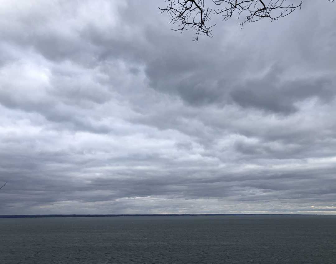
George PreoteasaParticipantHappy new year everyone! It was cloudy and windy in New York in the morning. Stratocumulus clouds (as seen below over the Long Island Sound) slowly started opening up in the afternoon and eventually created conditions for a very nice sunset (which unfortunately I could not capture because I was driving).
George PreoteasaParticipantVery nice, Hans, Keelin and Greg. I am trying to keep up with you.
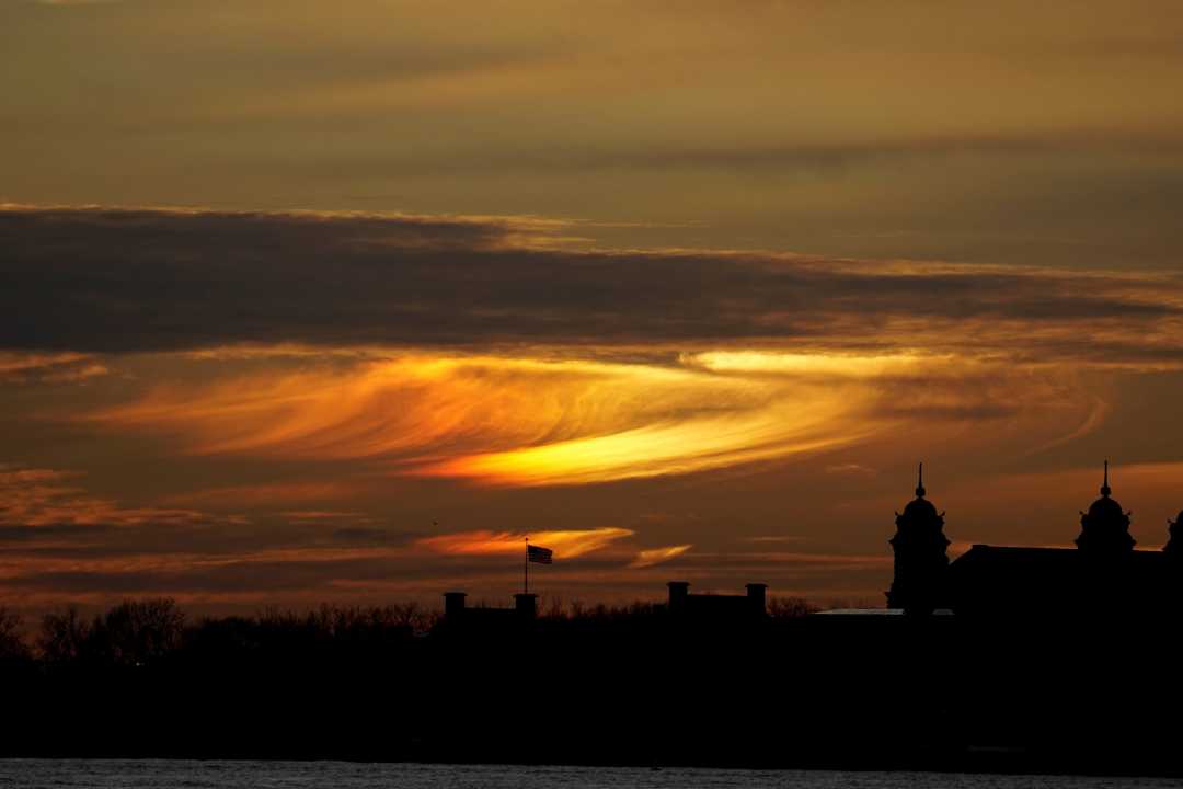
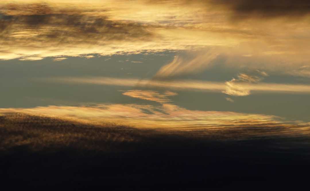
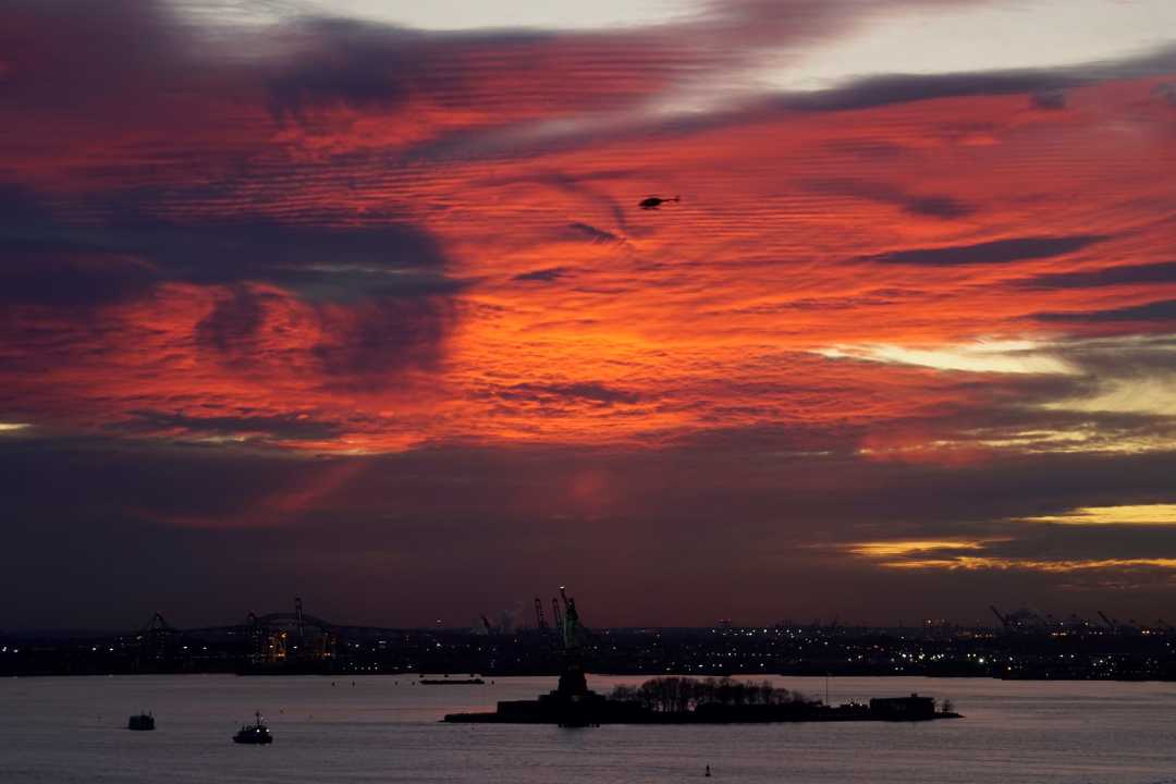
This is the time of year when from Battery Park in NY you can see the sun setting behind the Liberty Statue. This is near where I work, so I went to catch it. Well, clouds got in the way of the actual sunset, but I captured some very interesting side effects. First, an incredibly bright and colorful sundog over Ellis Island. (I had to reduce the exposure so that the colors are not overexposed.) Then some iridescence appeared on very thin undulatus. And in the end there was a red explosion above the spot where the sun was under the horizon.
A short timelapse video goes with this, shot from inside the building. (Copy and paste the link into the browser.)
vimeo.com/382524821
George PreoteasaParticipantGreg, in my experience, pano mode works in any direction. I took vertical pano’s, for example. Anyway, that is for future reference.
I asked about the location because in ski areas whee they make artificial snow it’s more likely to get complex halos and the like.
George PreoteasaParticipantWelcome, Gregory! This is very interesting. Where did you see it? Looking forward to seeing the video.
Not sure if you are using an iphone, but it has a “pano” mode. It’s been very useful for me for broad land/cloud scapes. I suppose other phone types have something similar.
-
AuthorPosts
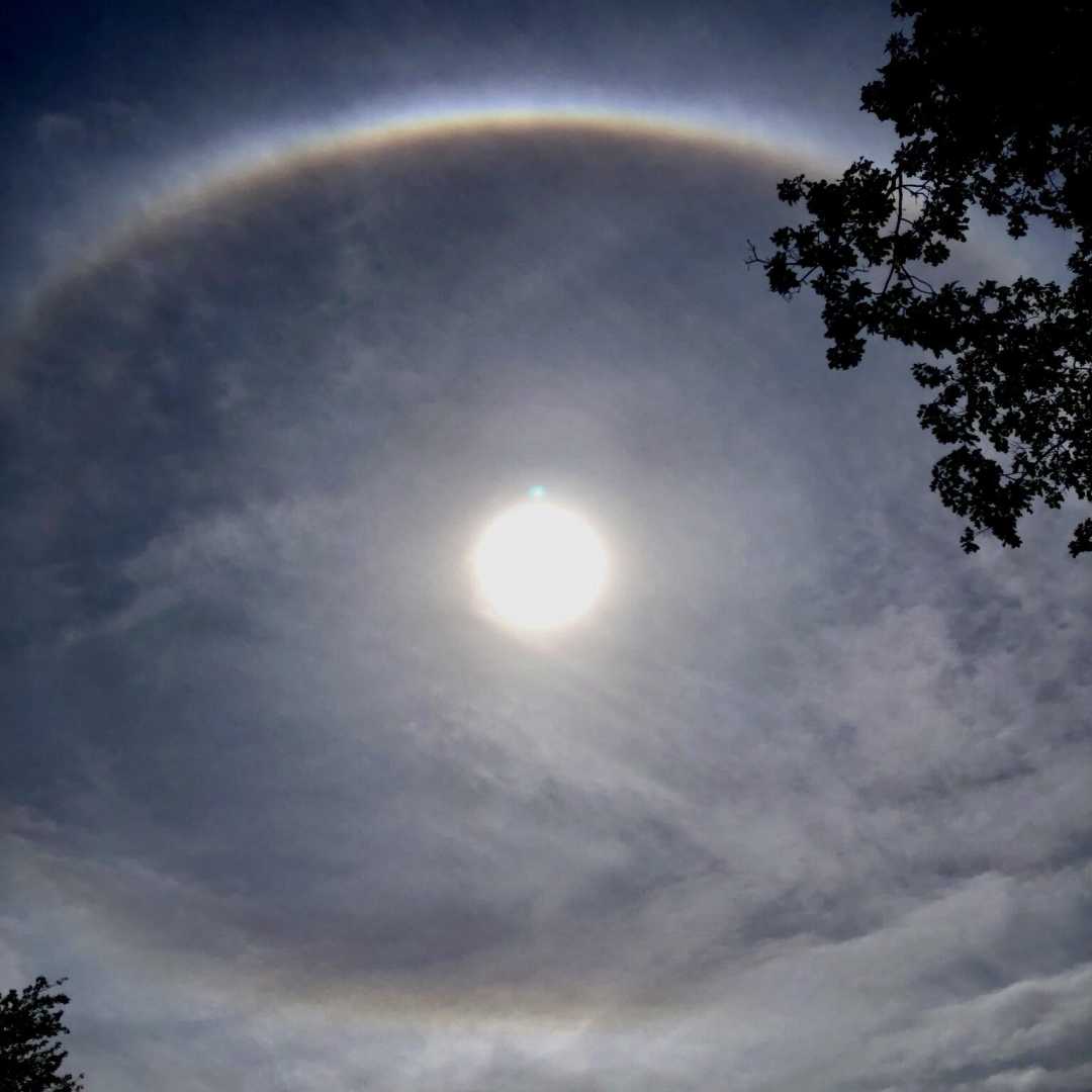 Hi everybody, long time no visit here and I see some new people and lots of beautiful things. I recently shot what I thought was a 22 degree halo, but then it struck me that it’s oval, so I did some looking up. Atoptics says it’s a circumscribed halo. Interesting how its shape varies with the height of the sun.