Forum Replies Created
-
AuthorPosts
-
January 24, 2019 at 11:42 am in reply to: Skywatchers await 'super blood wolf moon' – 20 – 21 January 2019 #327014
 George PreoteasaParticipant
Don, this is awesome!
January 24, 2019 at 2:46 am in reply to: Skywatchers await 'super blood wolf moon' – 20 – 21 January 2019 #326960George PreoteasaParticipantThank you Keelin
George PreoteasaParticipantA couple of things about eclipses. I got my eclipse dates and other information from this site:
Move your mouse over “Sun & Moon” and you will see all sorts of information including eclipses. There should be a place to specify your location. I got very detailed information about the eclipse specific to New York including phases of the eclipse and the azimuth and elevation of the moon at those points.
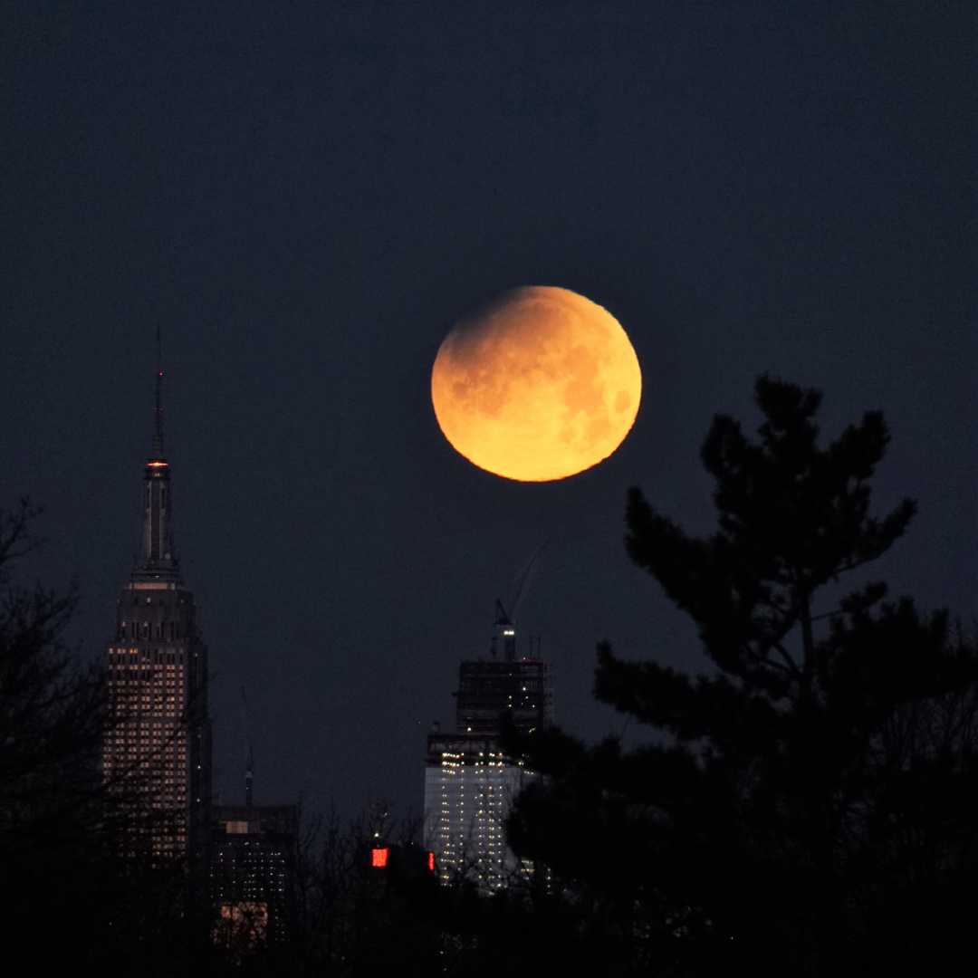
Now, speaking of elevation, Hans, I would have loved to put the eclipsed in some context, as you suggested, but it was difficult because the moon was very high as seen here, almost 70 degrees. I wanted to use a telephoto, so the moon is a bit bigger than a dot, but then the context needs to be at some proportional distance. For example, in the shot with the skyscrapers, they were at 11 km from me, so that ratio with the moon worked well. But if the moon is high up in the sky it’s a different story, cannot find a context at that distance. So the only thing I came up with was the combinations with the Gemini stars, which were really calling for it.
Incidentally, it was very cold, 7F/-14C, and very windy. Reminded me of Yellowknife.
January 21, 2019 at 4:07 pm in reply to: Skywatchers await 'super blood wolf moon' – 20 – 21 January 2019 #326579George PreoteasaParticipantThank you Hans.
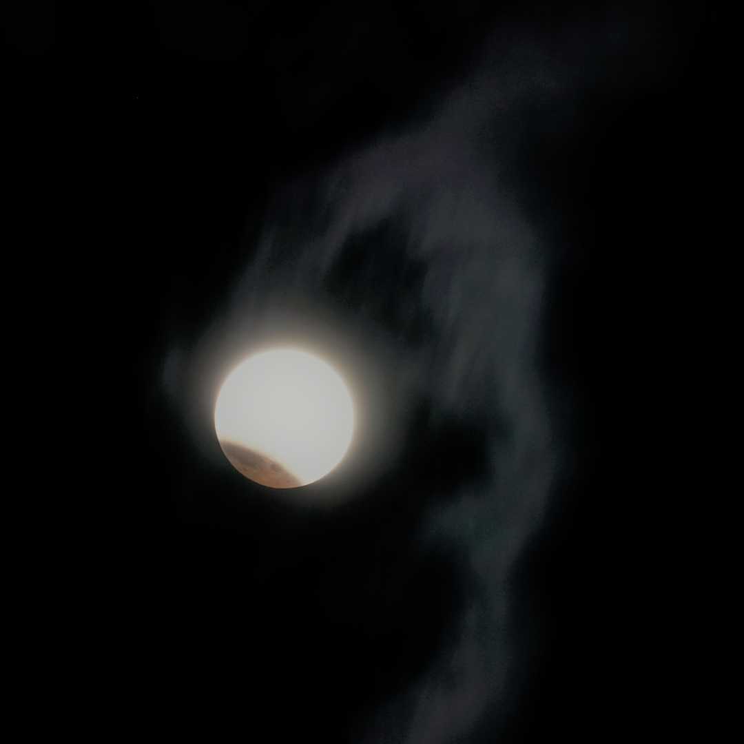
January 21, 2019 at 12:51 pm in reply to: Skywatchers await 'super blood wolf moon' – 20 – 21 January 2019 #326537George PreoteasaParticipantThere were some clouds early on, made more visible when the picture is enhanced.
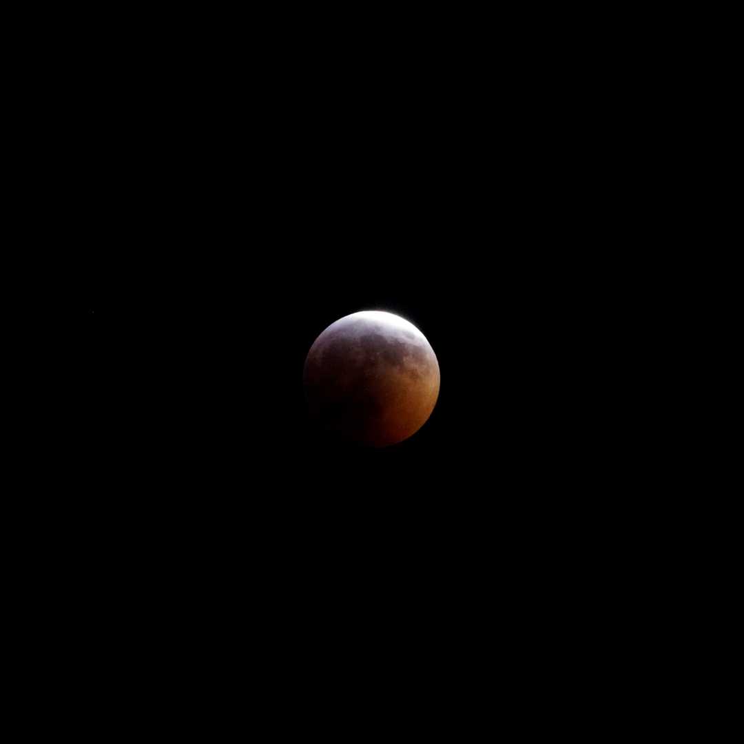
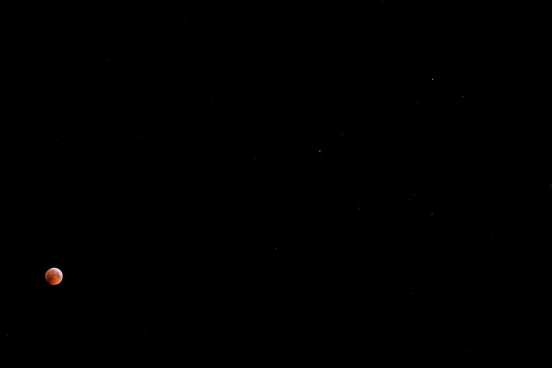
 January 21, 2019 at 12:34 pm in reply to: Skywatchers await 'super blood wolf moon' – 20 – 21 January 2019 #326531George PreoteasaParticipant
Here are my modest shots. Blood moon just before totality, blood moon just after totality (not very different) and blood moon with Pollux and Castor, the two brightest stars of Gemini (and a few other stars).
George PreoteasaParticipantA distrail is the opposite of a contrail, still I thought this is the best thread to post this. I was taking a time lapse of clouds passing in front of the moon, when this happened. The time lapse is too fast, so I had to create a slowed down version. That slowed down version is not much faster than real time. Interesting how quickly these things happen.
George PreoteasaParticipantThe little cumulus-like clouds produce precipitation in the form of ice crystals and strong air currents below drag those precipitations away. Very ice shot!
George PreoteasaParticipantRough fluctus. And a baby.
George PreoteasaParticipantOnly the surfer is missing.
George PreoteasaParticipantTwo very nice discrete dogs, Hans and Keelin.
George PreoteasaParticipantHi Laurence, this is an outstanding picture helped by the combination of circumstances. The sun is low, so no filter needed, therefore you can capture the landscape. Beautiful, thanks for sharing!
I am in a bit of a panic. We have a lunar eclipse coming in just over a week and I am still thinking what kind of shot(s) to take. The moon will be pretty high up, so if I am using a telephoto to get some moon details, it will be hard to get some landscape around it. Oh well, I still have time to think. (And it may even be snowing, who knows?)
Will the lunar eclipse be visible by you?
I caught on “film” a partial lunar eclipse in the early 2018. The moon set well before totality. But it looked great anyway.
January 10, 2019 at 2:49 am in reply to: Northern Lights – Aurora Borealis – Scotland – 4 November #324664George PreoteasaParticipantFolks, thank you all for your compliments and encouragements to show more. I am glad to do that. Here is a link to the trip album I created. Not just the Aurora, but also a few “frozen” moments. And a Bullock’s Bistro interior pano, maybe Don can see his signature :-)
January 9, 2019 at 3:28 am in reply to: Green cloud in thunderstorms – Sydney, Australia – battered by cauliflowers! #324487George PreoteasaParticipantFascinating, Laurence. Thanks for sharing. There are two accepted theories about how rain forms. One, applicable to CB clouds, is that it all starts as ice crystals that grow at first by direct deposit of water molecules onto them. At some point,they are heavy enough to start falling and they grow by accretion, the tiny droplets they hit freeze on them instantly. As they get lower, the temperature of the air increases above freezing and they begin to melt. If they are very big, some survive and hit the ground as hail.
How big can the hail balls be up in the clouds? Maybe 15 cm. The updrafts can be 50 m/s and will keep these big balls up. In fact they can go up and down more than once as they get picked up by different updrafts. Mind boggling what happens up there.
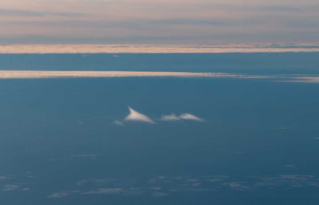
George PreoteasaParticipantI think it’s a fallstreak hole. The reason is that those “cirrus” clouds are below the altocumulus, You can see that on the right end of the gap.
-
AuthorPosts