
The Mother of All Cloud Features
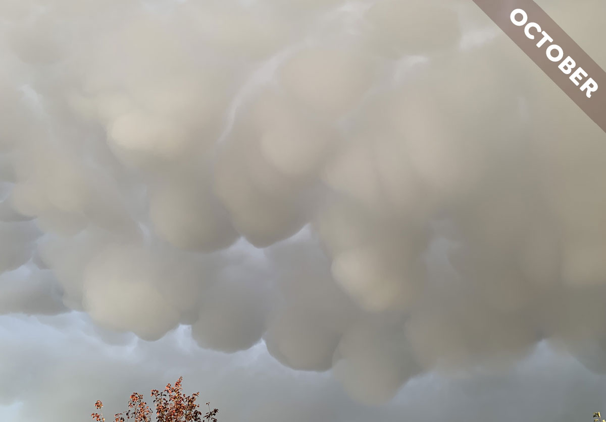
Of all of the rare and unusual clouds, mamma is probably the best known. These pouches of cloud look so distinctive as they hang from the underside of a cloud layer. These features can appear on six of the ten main cloud types. Mamma may not look particularly dramatic when they form on five of these, Stratocumulus, Altocumulus, Altostratus, Cirrocumulus, and Cirrus, but they often look spectacular when they develop on the powerful storm clouds known as Cumulonimbus – like these ones spotted over Bedford, England by Susan Allison (Member 13,586).
Mamma typically hang from the underside of a storm cloud’s incus, or anvil, which is the extended canopy of ice crystals that spreads out at its top. While they may be easy to spot and relatively common – at least, in regions where there are a lot of thunderstorms – the exact mechanism behind the formation of mamma is far from clear. One thing we do know is that they form when cold moist air within the cloud layer starts to rapidly sink. This is likely triggered by the air within the cloud cooling rapidly as water changes from one phase to another: perhaps melting from ice crystals into liquid droplets or maybe evaporating from liquid droplets into water vapour, the gas form of water. Either of these changes of state has the effect of cooling the surrounding air within the cloud, and if this happened rapidly enough it could result in the cool air sinking into the warmer less-dense air below, pulling down the cloud with it into rounded pouches. Such a method of formation makes mamma an outlier in the cloud world, since most clouds develop when warm moist air rises and forms droplets or ice crystals as it does so.
Mamma cloud features are often referred to as harbingers of severe weather, including tornadoes. But this is not necessarily the case. Mamma features tend to form to the rear of an advancing storm cloud, and so they can indicate that the storm is moving away from you. Indeed, when describing the mamma features here spotted, Susan confirmed that ‘within ten minutes, there wasn’t a cloud in the sky’. You can think of mamma as storm-forecasting cloud features similar to the low ridge of cloud, arcus, that forms at the front base of a storm and suggests showers are about to arrive. Mamma, on the other hand, indicate that the storm is likely heading away from you. Phew! But don’t forget to look over your shoulder – there could well be another storm cloud coming up behind.
Mamma on the underside of a Cumulonimbus spotted over Bedford, England by Susan Allison (Member 13,586). View this image in the photo gallery.
