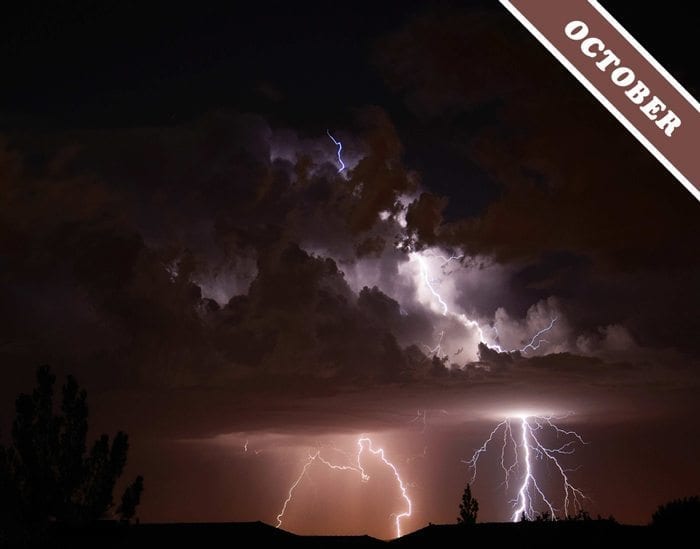
A Storm over Utah
Lightning can take many different paths as the enormous electrical charges that build up within Cumulonimbus storm clouds suddenly redistribute themselves. Sometimes, the bolt travels from the cloud to the ground. At other times, it goes within the cloud from one charged region to another. Lightning can also strike between two clouds and even upwards from the top of a cloud into the atmosphere above. The dramatic Cumulonimbus that we have chosen as Cloud of the Month for October, and which was photographed over Utah, US, by Geoff Horner, seems to be letting rip in all directions at once.
© Photograph Geoff Horner.


My partner and I stumbled over here coming from a different web page and thought I should check
things out. I like what I see so i am just following you.
Look forward to looking at your web page again.
Stunning!
Purrrrrrrrrrfect, AHHHHHH SCARY CLOUDS!!!!
Shane, it was just one image, maybe 15-30sec. As I recall, it does contain 2 separate lightning strikes. Our summer monsoon storms can often produce several strikes in that short time frame. They’re also pretty isolated, so I can shoot a killer storm that’s 25 miles (or more) away, and it’s dead calm where I am (why the trees didn’t blur). Thanks all for the comments, and please visit my Facebook page Geoff Horner PhotoArt to see more of my work!
Nice to look at.. I am curious though if these were multiple exposures comped to make the one image? I would like to believe this is shot perfectly timed as the trees dont have blur which is a good indication of a long time exposure.. Nevertheless a dramatic image :)
Admirável e terrivelmente belo. Além disso, há que referir a arte de fotografar…
Very impressive! A picture worthy of praise.
The political statement to end all such. Congrats.