
Cloud Identification Help
Forums › Cloud Identification Help › Cloud Identification Help
Tagged: Cloud Identification?
- This topic has 61 replies, 14 voices, and was last updated 5 years, 7 months ago by
 Heather Milligan.
-
AuthorPosts
-
-
March 31, 2020 at 4:44 pm #426846
 Steven strickModerator
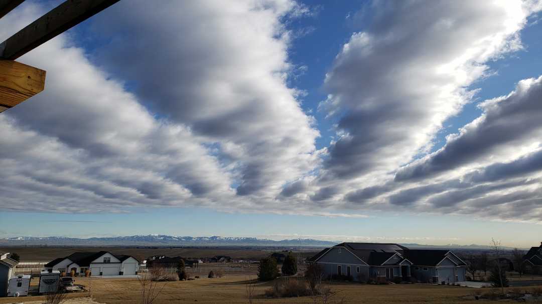
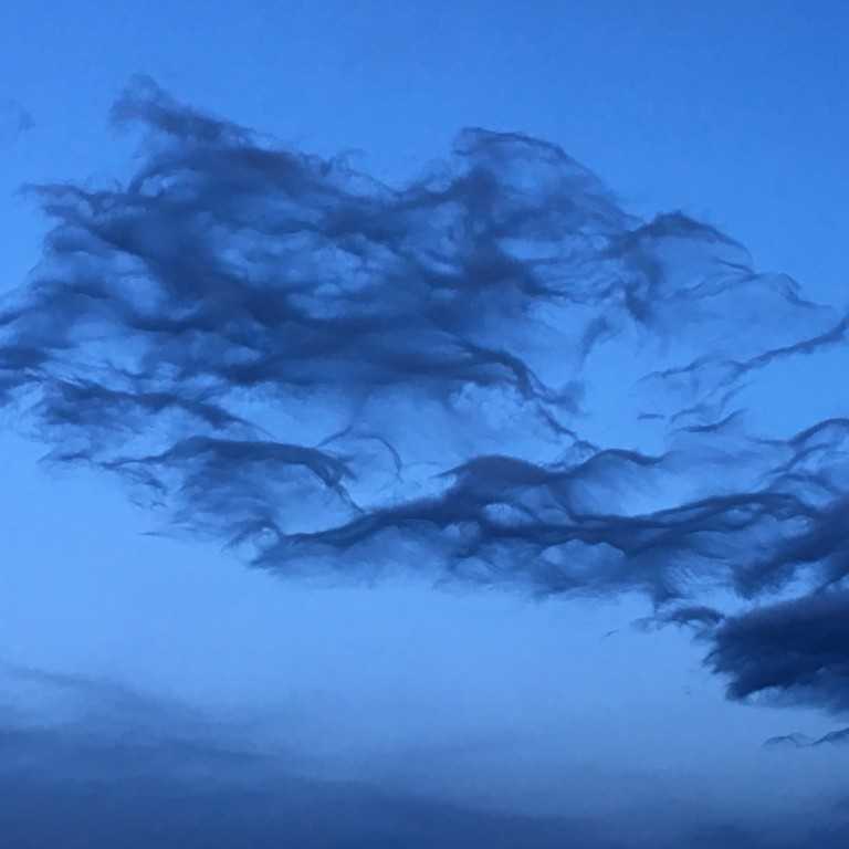
New Forum Topic: This can be a place for cloudspotters to get advice on their identifications. I’ll start it off with this one that I, as a beginner, am having trouble identifying and will ask any help from members to provide cloudspotting assistance. As you run across your clouds that you are not quite sure of, please post them so members can jump in to aid.
This is one outside of Boise, Idaho that is so dramatic but I’m not sure what I’m looking at.

-
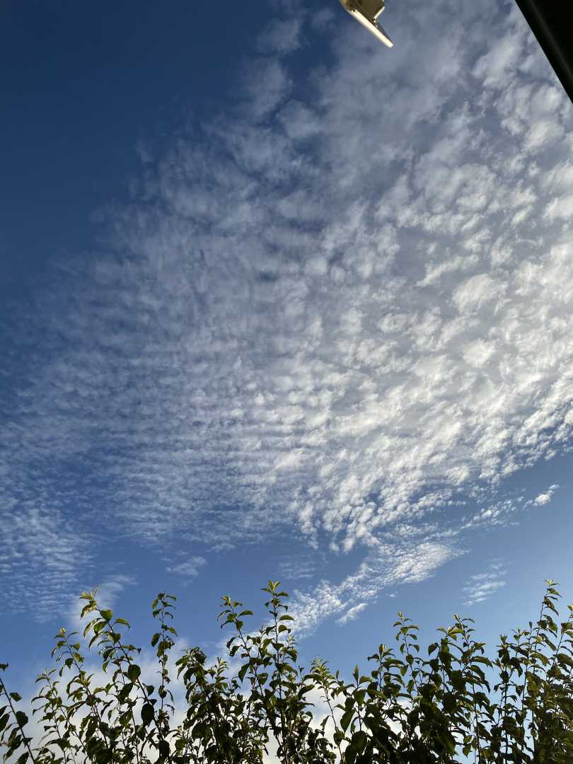
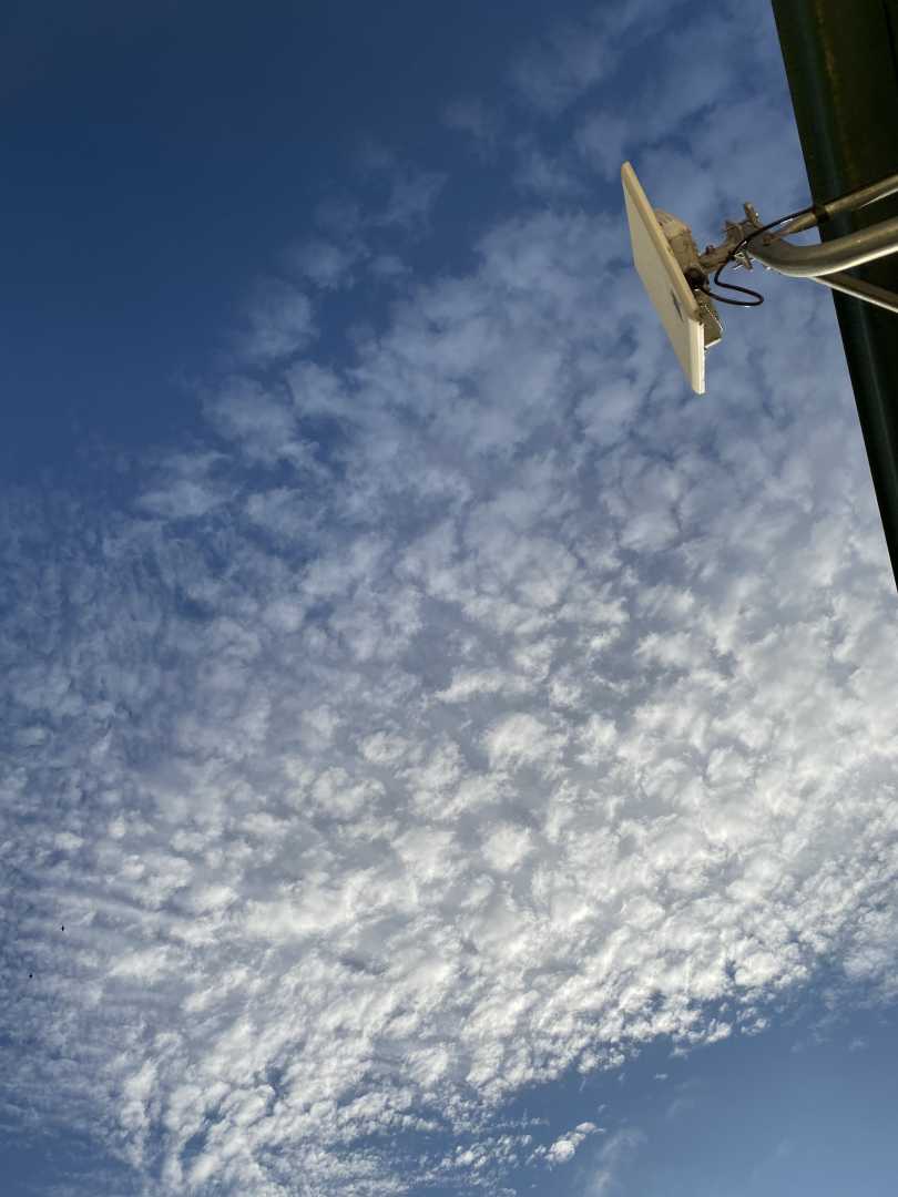
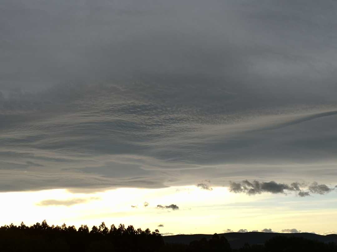
March 31, 2020 at 5:03 pm #426848Karin WarrenParticipant
Hi Steven! I love the International Cloud Atlas for cloud ID. Your photo looks to me like stratocumulus undulatus. https://cloudatlas.wmo.int/varieties-stratocumulus-undulatus-sc-un.html
-
March 31, 2020 at 5:18 pm #426849Wilhelm von ZitzewitzParticipant
Hi Steven! In Gavin´s “A Cloud A Day” this Cloud-Formation is discribed as “Stratocumulus undulatus radiatus” on page 183. Kind regards, Wilhelm
-
March 31, 2020 at 9:42 pm #426887Steven strickModerator
Kwarren and Dr. Zitzewitz….
Thank you both !! I’ve been looking all over for the ID. Now, I can enter that into my life list.
steve
-
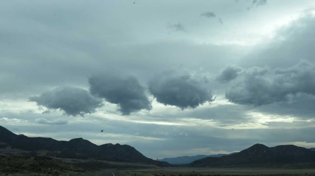
April 2, 2020 at 1:50 am #427210Steven strickModerator
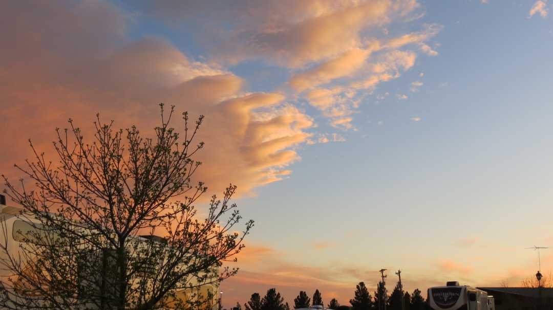
Here’s one looking SW from Carlsbad, New Mexico. I guess these are cumulus but they look like long fingers. Little by little, they started protruding like this. Very interesting. Are these just Cumulus?
-
April 2, 2020 at 5:07 pm #427305Don HatfieldParticipant
Perhaps Cumulus Fractus. Did they continue to disperse, dissipate ?
-
April 2, 2020 at 5:28 pm #427309Hans StockerParticipant
I rather think altocumulus Don. Coloring well at sunset by the way.
-
April 2, 2020 at 7:42 pm #427327Steven strickModerator
There were two formations, one above and one below. Here’s what happened to the one above. The “below” one did the same…just formed up again.
-
April 3, 2020 at 12:45 am #427362Don HatfieldParticipant
The coloring didn’t throw me off, but the solid cloud in the picture did. I usually think of altocumulus as :
-
April 3, 2020 at 3:29 pm #427426Steven strickModerator
This is Cumulus Fractus, isn’t it?
-
April 6, 2020 at 10:32 pm #427818Hans StockerParticipant
I also think this is cumulus fractus Steven.
Don you posted some nice classical altocumulus, but be sure there are many appearances of altocumulus. The ones Steven posted “looking SW from Carlsbad, New Mexico” before and after look most to the picture that can be found in the ICA when you look for Altocumulus duplicatus. Key is that the cloud must be at mid level. Any other opinion on this?
Today we had a small front passing by (Haarlem, Netherlands) and it was looking like a solid blanket with a very distinct edge in front. Sorry no picture.
-
April 7, 2020 at 7:01 am #427825Michael LerchParticipant
I think that is a shot of cumulus humilis..base is broader than it is tall. imho, they are not “broken up” to be fractus.
The Carlsbad sunset shots look like stratus that, at that edge, show undulatus which indicate differing air currents and that maybe why a segment of the stratus has torn away from the main body. At that area, air currents are tearing apart the stratus.
-
April 7, 2020 at 9:15 am #427836Hans StockerParticipant
Good food for thought Michael. About the cumulus I had the same considerations, but nevertheless I found some similar examples and it made me confirm the question of Steven. The ICA did not help really much in this case. I am still in doubt although your considerations can’t be denied.
For me it was surprising to think the Carlsbad sunset might be stratus. I did not look at it that way for it appeared to me at first glance too solid to be stratus and I had the impression it is at mid level. Nevertheless it is possible that it is stratus indeed. What do you think, is the argument of breaking up of the cloud also applicable for the hypothesis of altocumulus? For me here was the resemblance with the ac duplicatus in the ICA what made me choose altocumulus although the duplicatus is more difficult to judge from the pictures.
Anyway a nice discussion. I really like that. There are such large gray areas in cloud classification and different point of views are always surprising. The black and whites can only be found in the B&W threads.
-
April 7, 2020 at 6:25 pm #427906Don HatfieldParticipant
Hans, Michael – What is the difference in wind shear, or direction, or speed (or whatever) that might cause undulatus in one instance and altocumulus in another instance? Or perhaps the predecessor(?) cloud is different in thickness or in some other characteristic. I hope the question is clear.
-
April 8, 2020 at 11:00 am #428013Hans StockerParticipant
Don, undulatus is what the wind causes in a patch of cloud (except for the cumulus and cirrus) like the way ripples in the sand originate on the beach when the tide runs back for instance.
Whether altocumulus appears or not is a matter of the right conditions, being a flow of cold air at mid level. Just check the cloudspotters guide for a better explanation of the conditions needed to form altocumulus (e.o.). Of course the winds cause air to flow (or the other way around?) and form clouds depending on temperatures, moist etc. but undulatus is caused by the wind when the cloud is already there.
By the way: undulatus always shows its pattern perpendicular to the wind while cirrus fibratus has its streaks in the direction of the wind.
On my turn I hope this answer helps?
-
April 8, 2020 at 4:31 pm #428075Don HatfieldParticipant
Hans – Yes that helps a lot. I’ll check out the Cloudspotters Guide a bit more closely.
-
April 8, 2020 at 6:44 pm #428088Daniel MitchellParticipant
This forum is awesome– I’ve been unknowingly cloud-spotting for all my life, much more seriously on the photography front since 2008. So blessed to have stumbled across the CAS a couple of years back and then to come back for a revisit and find these forums.
I’m eating up the lingo now, seems like I’m learning new stuff every day- and it’s expanded my enjoyment of cloud-spotting so much— you are a fantastic community- so open, so kind and considerate with this wonderful atmosphere of learning together and sharing knowledge— very rare on the Internet!
Cheers— I hope and pray you all are safe, healthy and even… I dare say… happy!
-
April 12, 2020 at 8:10 pm #428617Hans StockerParticipant
I hope you are safe and happy too Daniel. And everybody else of course. It is so great to read you enjoy the discussions. To be continued as far as I am concerned.
-
April 13, 2020 at 4:13 pm #428688Steven strickModerator
Daniel…welcome! Those dog gone clouds can be tricky….at least for me!
steve
-
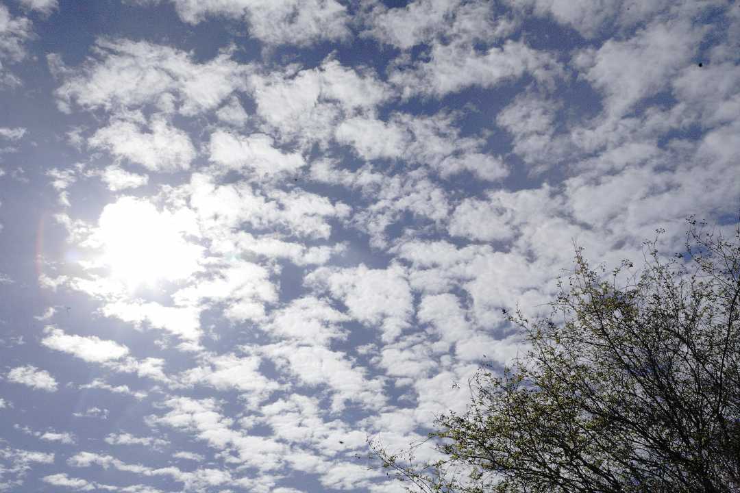
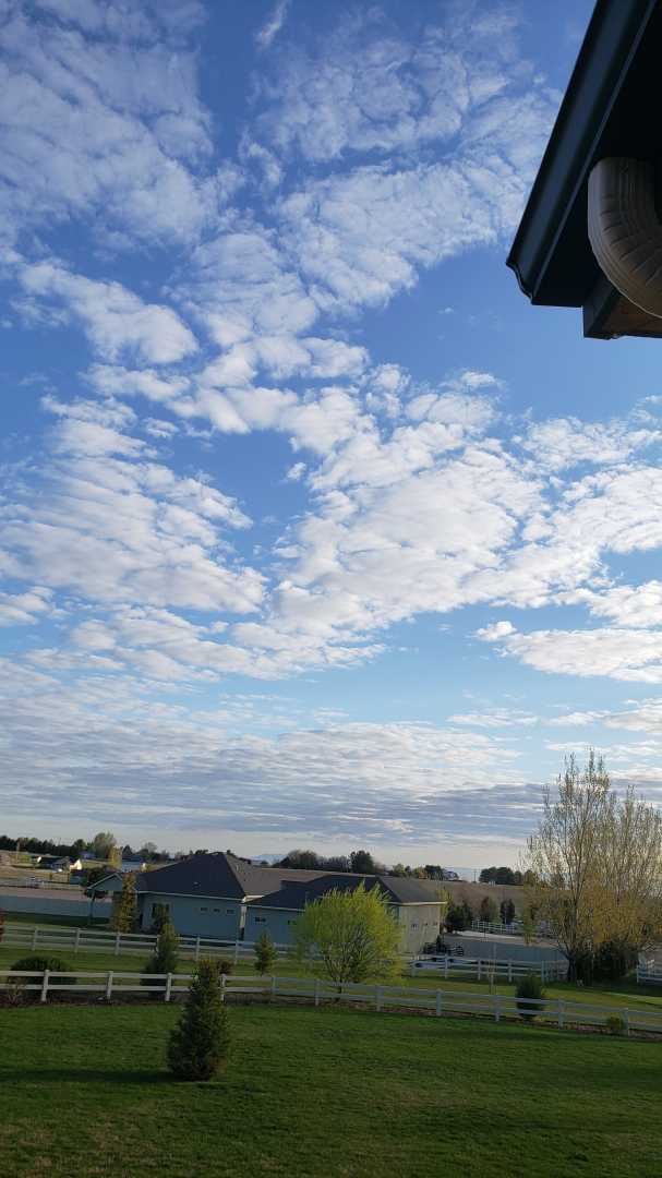
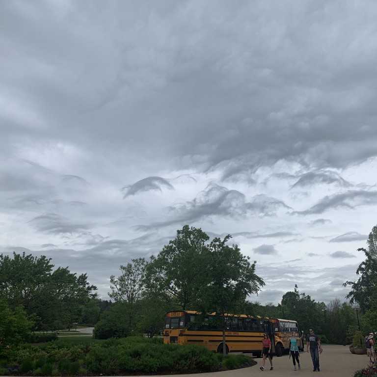
April 20, 2020 at 3:17 pm #429411Steven strickModerator
Morning in Idaho. I’m thinking Altocumulus?
-
April 21, 2020 at 3:43 am #429496Michael LerchParticipant
Steve ..yes…altocumulus (6500 ft to 18000ft high)..stratiformis( clouds over a large area)..perlucidus( gaps or spaces between clouds)
-
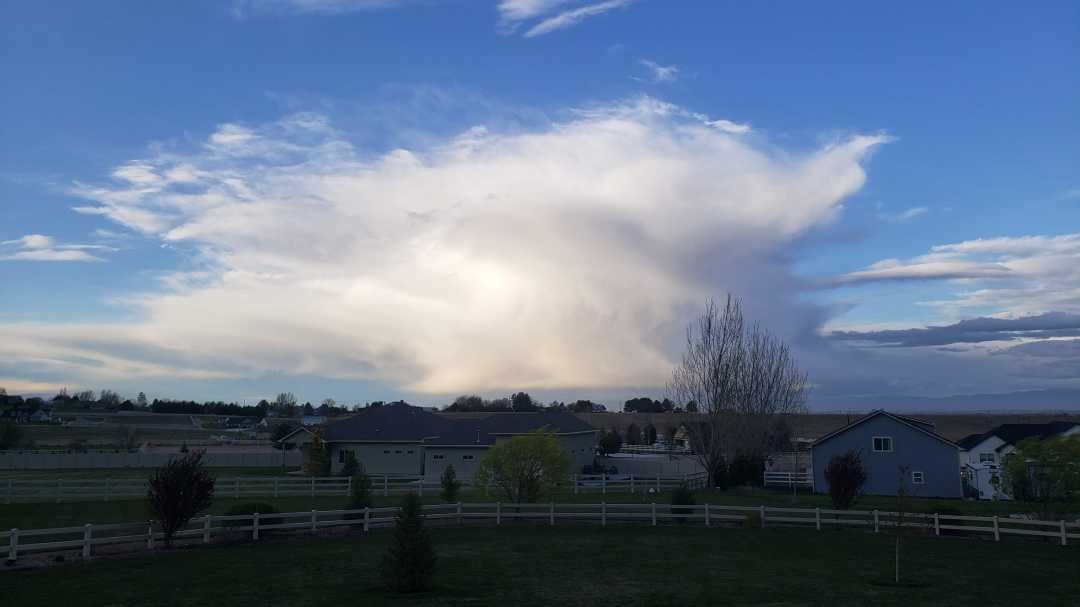
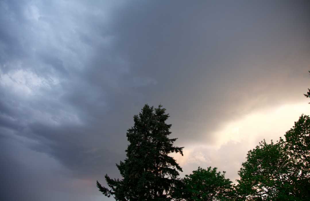
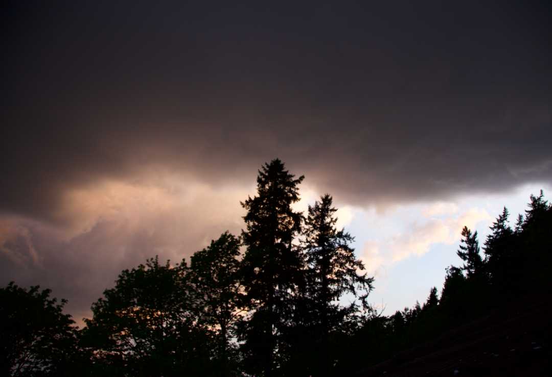
April 22, 2020 at 2:38 pm #429700Steven strickModerator
Great. Thank you! How ’bout this one? Seen in the morning during some local rain.
-
April 22, 2020 at 6:00 pm #429725Don HatfieldParticipant
holy moley, Michael. I never even knew such names existed. I had to look it up. (BTW I found a decent website : www. namesofcloud.com ).
I was taught that : You look pretty much straight up, straighten your arm & hold out you fingers like you’re pointing at the clouds. If the puffs are about 1 finger wide then they’re stratocumulus. If the puffs are bigger – two or three fingers wide – then they’re altocumulus.
-
April 22, 2020 at 8:25 pm #429735Hans StockerParticipant
Don, Michael is very accurate in his classification. When you want to be surprised even more just check the cloud identification table of the ICA (International Cloud Atlas) and check for each of the ten main cloud types (genera) the possible species, varieties, supplementary features and accessory clouds: Cloud Classification Summary
It is fun to check all kind of combinations together with pictures of good examples (mostly). I always check this table in case of doubt for which are always reasons to have (unfortunately).
And Steven: you spotted a nice cumulonimbus with species capillatus.
-
April 26, 2020 at 5:02 am #430066Jocelyn NortheyParticipant
I have just joined this group to learn more about clouds. I love the fat that some of us are learning together. Your image is amazing.
-
April 27, 2020 at 2:46 am #430128Michael LerchParticipant
I highly suggest THE book authored by this website’s founder, Gavin Pretor-Pinney: “The Cloudspotter’s Guide”. Its a fun read all the while being educational and inspiring. Buy it thru this website.
-
May 2, 2020 at 12:43 pm #430801Jocelyn NortheyParticipant
Thank you Michael. I have already bought that one, it is in the mail! I also spend hours looking at the ICA and and seem to understand. But then I walk out to a confused grey sky, that doesn’t look like any of the photographs. Slowly I am learning and it is good to know Hans also checks his images. Knowing that the experts also have moments of doubt, helps push me onward.
Joss, Tasmania
-
May 2, 2020 at 4:51 pm #430826Don HatfieldParticipant
Like Jocelyn Northey, I have a bit of trouble translating from ICA or Cloudspotter.
But I think I’m learning.
I believe this is Cumulus Mediocritis.
-
May 2, 2020 at 4:54 pm #430827Don HatfieldParticipant
Hans, Michael – I heard mention of (if I caught it correctly) ‘eyebrow clouds’ . I couldn’t find any reference to it, though. Can either of you you help?
-
May 2, 2020 at 5:32 pm #430832Hans StockerParticipant
Hello Don, it was nice to see you live in a Zoom meeting recently! It is no wonder you can’t find anything about an eyebbrow cloud. I know the eyebrow cloud is not an offically accepted classification (yet?). Maybe it is a new challenge for Gavin to get it recognized by the WMO and made part of the ICA. Gavin collects examples of them and he has already a Latin name for this cloud : superciliaris, which is Latin for eyebrow. So eyebrow clouds. I will try to find an example later. As a moderator for the cloudspotter app I have seen some examples going by. There are some similarities with asperitas imo.
An example taken in France by me in 2014 by me.
An example from the moderator app. I love this one. It is in my opinion a perfect example.
Another one from the cloudspotter app.
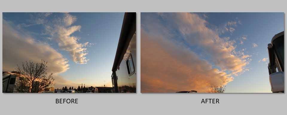
By the way: very nice inversion. It is fun to experiment with image processing.
I am sure Michael will come up with some of his own examples?
-
May 2, 2020 at 9:01 pm #430848Don HatfieldParticipant
Hans – Thanks for your kind comments. It was nice to see you in other than your avatar, too.
Regarding the inversion – Yes that was fun. After inverting it, I changed the white balance point, and added a bit of contrast. A little fun with Photoshop.
Regarding the eyebrows – Your France 2014 photo, and the second Cloudspotter app : I absolutely agree. In the blue, moderator app photo I also see eyebrows where the darkness comes together. It looks a bit like a dark, dense liquid being slowly poured into a less dense, lighter coloured one (yeah – I know that’s a description that can be used to describe clouds). More than that, this one reminds me of the (pulling from my vague memory again) of the fractal looking cloud that sometimes (?) comes through mountain passes. Doesn’t take away from the sheer beauty of the photo; I hope it soon joins the Cloud-A-Day gallery.
I’ll have to keep a look-out for them, try to send some in. Due to the wild rainstorms we get here in Dallas, we regularly get skies very much like the Cloudspotter app photo.
Regarding WMO – I saw an article somewhere (there goes my memory again) about the new, stronger influence of the so-called citizen-scientist. I hope Gavin wins out again!
-
May 2, 2020 at 9:03 pm #430849Don HatfieldParticipant
Almost forgot – Did I get the Cumulus Mediocritis right?
-
May 2, 2020 at 9:53 pm #430852Hans StockerParticipant
Ah, yes Don. A cumulus mediocris inverted, mirrored and as it is as well :)
-
May 4, 2020 at 3:31 am #430963Steven strickModerator
Jocelyn, Welcome….this is a great place to post your clouds and get answers!
-
May 7, 2020 at 2:38 am #431318Alvar Jolin-LombardiniParticipant
Hello,
I took this picture yesterday during the Seattle thunderstorm.
I am not sure what type this is, as I am a beginner, but my best guess is that it is a Volutus? Or maybe a Cumulus?
Thank you!
-
May 7, 2020 at 10:53 pm #431434Hans StockerParticipant
Hello Donnatello. Knowing this is a thunder storm this might be arcus. Very impressing in my opinion such a thunderstorm like this. Any other opinions?
-
May 8, 2020 at 3:26 am #431453Steven strickModerator
…found an interesting article on cloud “gazing”. Not bad.
-
May 11, 2020 at 5:42 am #431803Jocelyn NortheyParticipant
I took this image this morning. I was trying to capture undulatus for CloudSpotter but forgot I had to click on the button on the app instead of the phone.
However when I looked at the image it looked different to what I saw with the naked eye. The main section of the cloud looks like a reverse nettingn -
May 11, 2020 at 5:44 am #431804Jocelyn NortheyParticipant
<p style=”text-align: right;”>
Another view of it</p> -
May 13, 2020 at 12:13 pm #432100Aurora Nea Julia RunolinnaParticipant
Hi! A friend send this photo to me asking the type of the cloud. Picture is taken 13.5. about at 8am (UTC+3) in the coast of Bothnian Bay.
Browsing through everything I know and I can’t figure out this.. I know that I’ve seen this formation before, not by my own eyes, but somewhere in social media.
Any guesses?
-
May 13, 2020 at 12:27 pm #432106Jocelyn NortheyParticipant
To me they look like eyebrow clouds. This is not a learned response, as I am rather new to this site. However Hans Stocker added one a few replies ago. To view scroll up. CAS would like to call this cloud formation supersciliaris.
but then again it might just be something else. Good like in your endeavours to find out more about these intriquing clouds. I shall be watching with interest.
-
May 13, 2020 at 12:45 pm #432113Aurora Nea Julia RunolinnaParticipant
Found something on CAS- page Cloud of the month – September 2019
and this quote from Weird clouds – videoSociety founder, Gavin Pretor-Pinney, told us that he’s always called them ‘eyebrow clouds’ as they do rather have that appearance. He says they are caused by turbulence as the wind blows over raised ground such as a mountain peak, which fits with the Lake District location.
It got very interesting on the “over raised ground” part, cause in my knowledge the picture I got isn’t near to anything of great heights… Can’t wait to know the name of this individual!
-
May 14, 2020 at 8:43 am #432213Hans StockerParticipant
Hello Cloudlady
I like your picture of the so-called eyebrows. I agree with Jocelyn on that classification all be it an unofficial one. Nice video you found about the phenomenon. All examples here are lenticularis shaped and in my opinion they also seem to have the outlines of what asperitas looks like. About the heights that are assumed to be near I think waves in the air can be further away from heights than you might think. And waves of air are needed for lenticularis to form in the right conditions.
Unfortunately there is no official name yet for these eyebrows. Maybe Gavin Pretor Pinney succeeds also in getting this one officially accepted by the WMO?
-
May 19, 2020 at 6:15 pm #432805Alvar Jolin-LombardiniParticipant
Hello!
I shot this picture in Iceland (In July), and I think it’s a Pileus, however, I am not sure.
Is this a Pileus or something else?
Thank You!
-
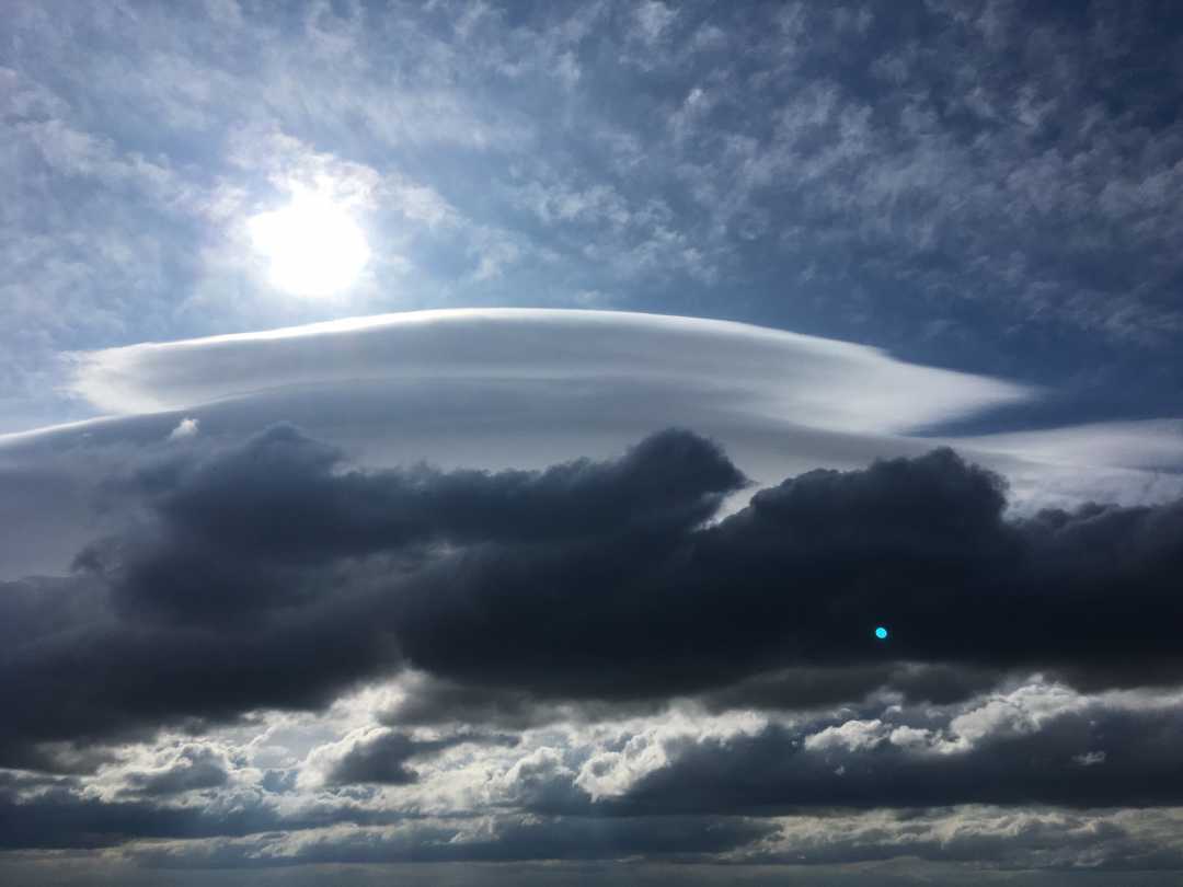
May 20, 2020 at 12:18 pm #432864Hans StockerParticipant
Hello Donnatella, I think you spotted a lenticularis above the stratocumulus. Pileus is a so-called accessory cloud that is only found attached to another cloud, for example a cumulus. On this picture they don’t seem to be attached, so in my opinion it is a lenticularis “on its own”. Any other opinions?
-
May 20, 2020 at 4:32 pm #432901Steven strickModerator
I sure looks like a lenticularis to me also. Too disjointed from the clouds below to be a pileus. Gorgeous photo!
-
May 21, 2020 at 1:26 am #432960Michael LerchParticipant
Donnatella,,Yes wind is the tell on the identity of the cloud phenomena you photographed. The lower dark clouds show being shaped and pushed by the wind. So is the lenticular cloud formed by wind. Pileus is the product of a cloud, generally a fast rising cumulonimbus or convectus , compressing the moisture out of the atmosphere above. So winds tend not to make pileus as much as fast and furious rising columns . Winds actually destroy the delicate veil like mist created by compression.
-
May 21, 2020 at 2:15 am #432962Alvar Jolin-LombardiniParticipant
Thank you so much to everyone who identified it!
-
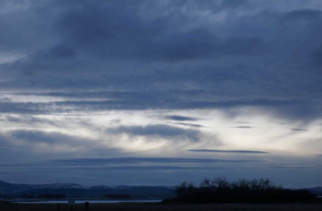
May 21, 2020 at 10:41 pm #433079Ruth QuistParticipantThis was taken on a February evening this year. Time was late evening over some ponds.
-
May 23, 2020 at 4:33 pm #433327Hans StockerParticipant
Nice to see that the cloud identification help has got a special place on the Forum in a way that in this category also new topics can be created. That way they will all be easy to find I suppose.
I will give your sunset a try Ruth. I see mainly altocumulus with in the middle against the light backgroud virga falling down from it. Beneath and above is altocumulus lenticularis visible. On top Of the picture the low hanging dark clouds might be stratocumulus. Any other opinions?
-
May 25, 2020 at 8:48 pm #433532Ruth QuistParticipant
Hans, thanks so much for your assistance with this cloud grouping. I will enjoy looking up those formations. Months ago I would take photos of what I thought were interesting shapes, sizes, and colors. Now there is so much more that can influence a good picture. I look forward to sharing more on the way fun forums.
-
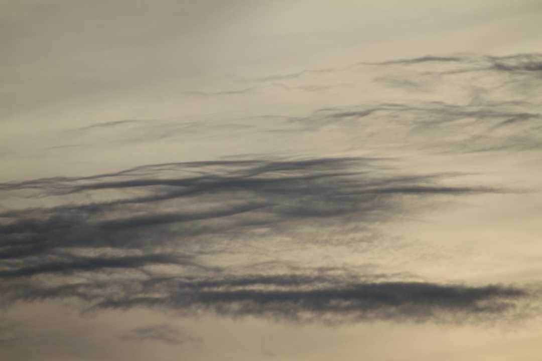
June 8, 2020 at 8:48 pm #435057Don HatfieldParticipant
Having a little trouble with this cirrus. I don’t think fibratus applies, nor do I think radiatus applies. It also looks too thick (wide? heavy?) to be a contrail being blown by the wind.
And yes, I agree that “help” should have it’s own place in the Forum.
-
June 12, 2020 at 11:36 pm #435919Hans StockerParticipant
Hello Don, it is Cirrus for sure you spotted and a bit of Altocumulus on the lower half of the picture. Indeed no fibratus nor radiatus. “Just” Cirrus. It must be a coincidence but I check The Cloudspotter’s Guide (by Gavin Pretor-Pinney himself) on a rather regular basis and a few days ago I read this text underneath a picture of cirrus: ‘” Cloud genera don’t have to be defined as one of the species. These are just Cirrus.” On p. 175 when you want to look it up. Quite applicable here I think. When you don’t have the Guide yet it is certainly recommended for its omnipresent humor and great information on clouds. My copy is well-thumbed yet I can say.
-
June 15, 2020 at 12:35 pm #436202Wilhelm von ZitzewitzParticipant
For German-speakers: “The Cloudspotter´s Guide”- German edition is “Wolkengucken” (published 2006) and “These are just Cirrus” can be found on page 187. I bought the book in early 2006 and applied for membership 2 weeks later (Nr. 6178).
Today I am with great pleasure the community manager for the Cloudspotter Group “Upper Austria and Salzburg, Austria”
High-cloud mixture above the “Pöstlingberg-Basilica, Linz-Austria (daily check from the kitchen window of my home).
-
November 1, 2020 at 8:52 pm #451178Heather MilliganParticipant
Mini Mammatus within this cloud? Dipton, New Zealand. 27 October 2020 sunset
-
November 1, 2020 at 9:23 pm #451187Hans StockerParticipant
It certainly looks like it Heather. Very peculiar spotting in my opinion. Love it.
-
November 26, 2020 at 3:14 pm #454543Gregory VenarskyParticipant
Very interesting Heather, I don’t quite know exactly what those are, but I have to agree on tiny mammatus. Very interesting indeed.
-
November 27, 2020 at 10:57 pm #454748George PreoteasaParticipant
Aside from the mini mammas, don’t folks think these are asperitas?
-
November 30, 2020 at 8:56 pm #455280Hans StockerParticipant
George, you are right it also looks like asperitas. Very peculiar with these mini mammas.
-
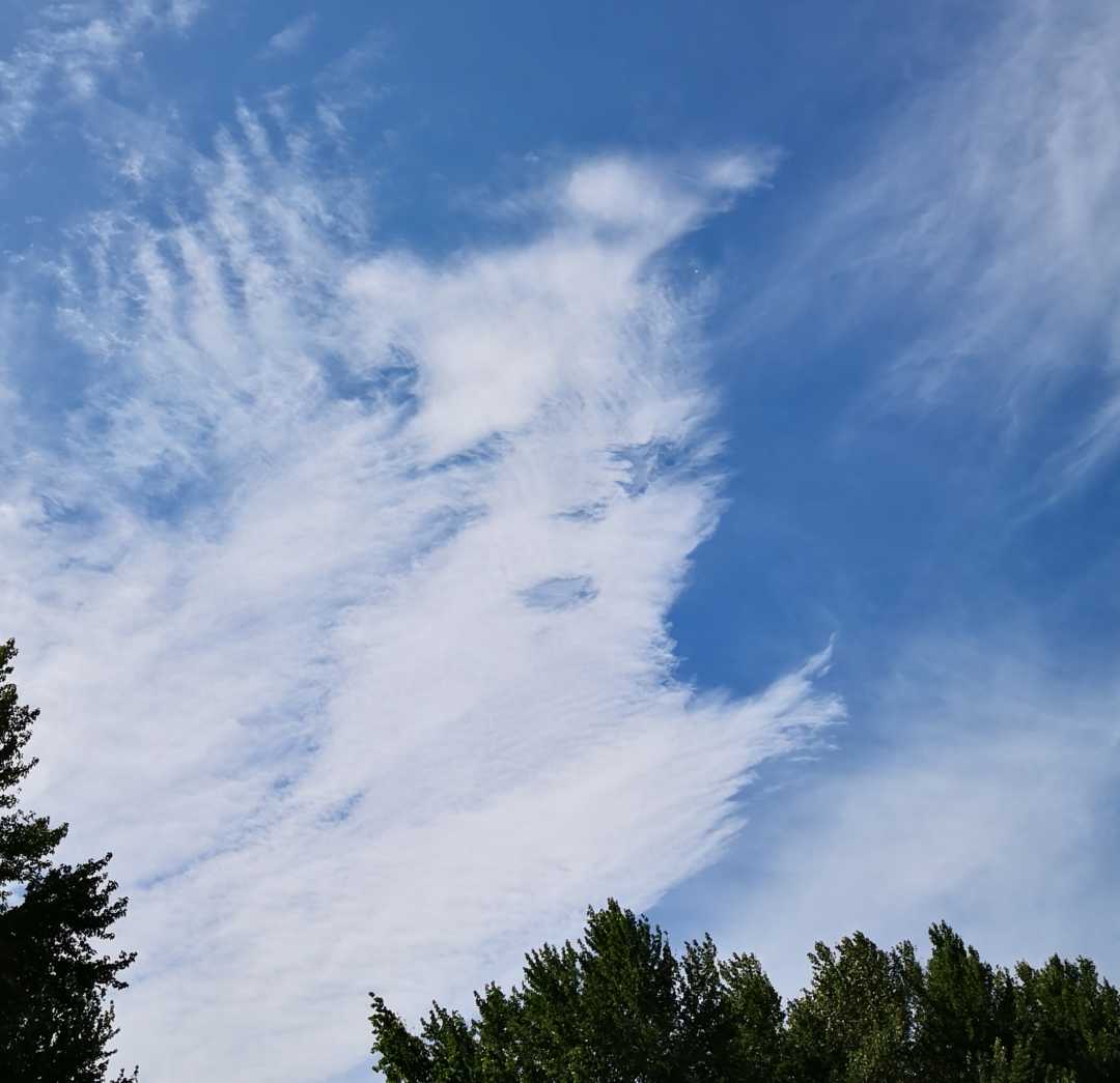
December 8, 2020 at 12:20 am #456614Heather MilliganParticipant Is it a mini fallstreak hole? Dipton, New Zealand.
-
December 10, 2020 at 1:12 am #457049Gregory VenarskyParticipant
Hello Heather! Pertaining to your question, I don’t believe so. You have the right idea, however, a fallstreak hole usually constitutes a clearly defined hole, as well as the fallstreaks themselves. You seem to have captured a beautiful image of two different layers of a denser cirrus down below, and a wispier layer up above. Here is a solid example(not mine) of a fallstreak hole. Hope this helps!
http://www.abc.net.au/news/2014-11-03/fallstreak-hole-cloud-formation-in-victoria/5863564
-
December 10, 2020 at 6:09 am #457070Heather MilliganParticipant
Thank you so much Gregory for your informative answer. I will keep scanning the skies here in New Zealand.
-
-
AuthorPosts

 Another view of it</p>
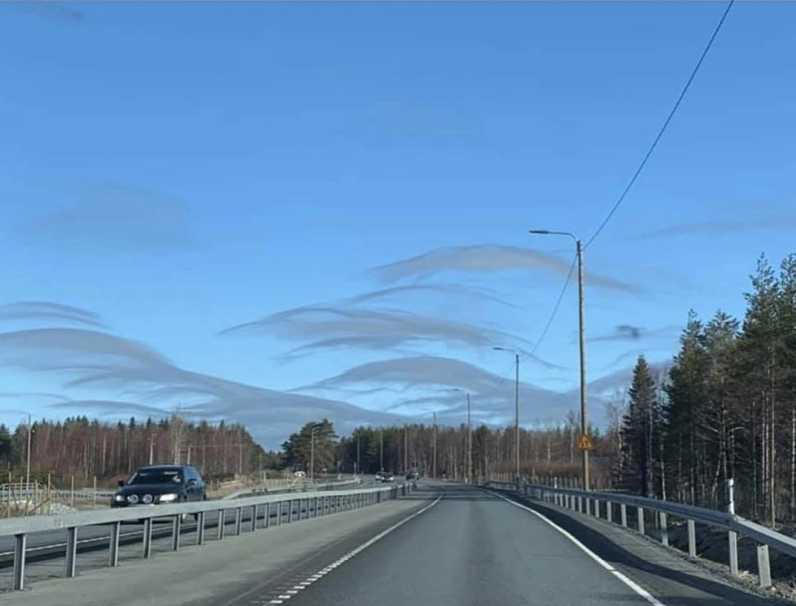
 This was taken on a February evening this year. Time was late evening over some ponds.
 Is it a mini fallstreak hole? Dipton, New Zealand.
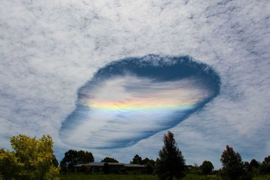
- You must be logged in to reply to this topic.
