
Arcus – The Ten-Minute Warning of the Cloud World
The heavy downpours that fall from a Cumulonimbus storm cloud (or a very large Cumulus congestus) can cause a dramatic ridge-like feature to form along the front base of the cloud. This is the cloud feature known an arcus, or shelf cloud, and it’s your ten-minute warning of the weather in store.
Heavy precipitation drags cool air down with it, pulling the air from up within the cloud down to the surface below. This downdraft of cool air in the heavy showers is what leads to an arcus forming and is why the appearance of the cloud feature foretells the showers’ imminent arrival.
The air of the downdraft is cool because it was pulled down from the chilly upper reaches of the storm cloud and also, often, because it is cooled by rain evaporating or ice melting within the shower. Upon reaching the ground or water surface below, the shower touches down, but the air in the downdraft can only splay outwards. Much of this cool outflow of air rushes forward, in the direction of the storms travel. There, it meets air down near the surface that is warmer and therefore less dense. The outflow of denser cool air burrows beneath the warmer air ahead of the storm, forcing it upwards, causing it to cool and condense into a cloudy ridge jutting out ahead of the shower region.
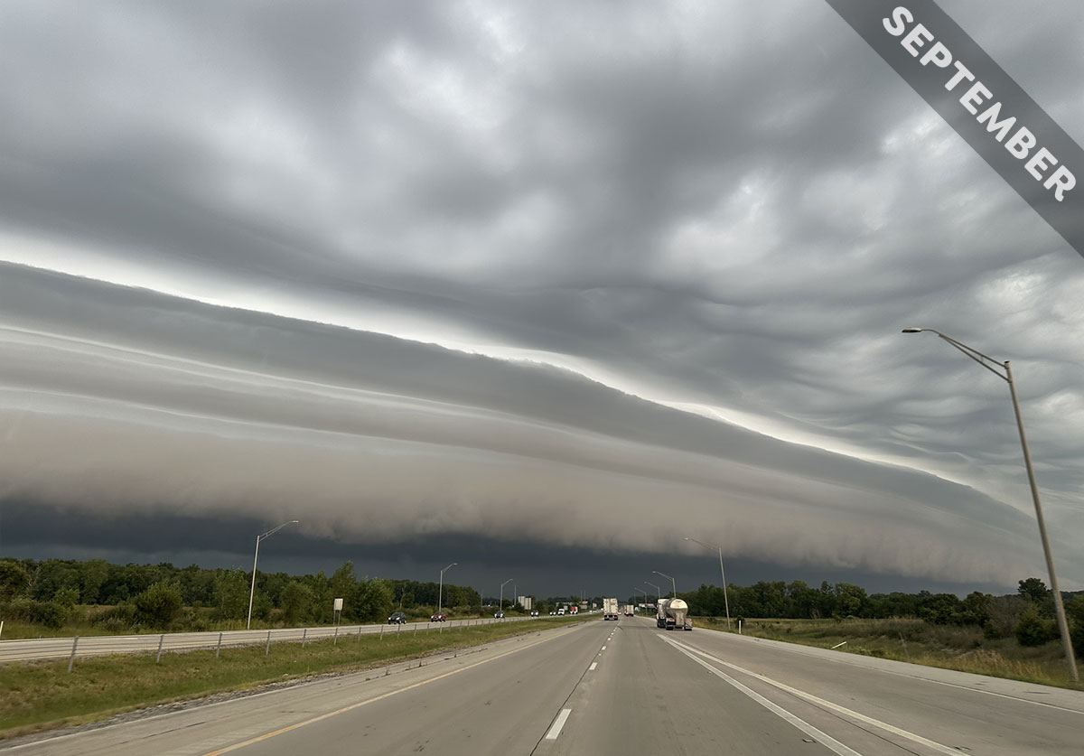
Arcus features can look ragged and turbulent, but sometimes they can have a smooth, laminar appearance, like the arcus spotted here over Fort Wayne, Indiana, US by Christina Erickson (Member 63,330). It has a layered structure, indicating moister and drier levels in the air out ahead of the storm.
Because the feature forms on the leading edge of the precipitation, on the side that is in the direction of the storm’s travel, an arcus is a reliable herald of incoming rain or hail and the gusty winds that accompany it. ‘I thoroughly enjoyed witnessing the majesty of this ominous skyscape on my way to work,’ Christina told us. And sure enough, she confirmed, ‘heavy rain pelted the landscape further along the drive.’
An arcus feature, or shelf cloud, appearing ahead of Cumulonimbus showers, spotted over Fort Wayne, Indiana, US by Christina Erickson (Member 63,330). View this in the photo gallery.
