Filter By:
Main Cloud Types
- Cumulus
- Stratus
- Stratocumulus
- Altocumulus
- Altostratus
- Cirrus
- Cirrocumulus
- Cirrostratus
- Nimbostratus
- Cumulonimbus
Other Clouds
- Arcus
- Asperitas
- Cap / banner clouds
- Capillatus
- Castellanus
- Cataractagenitus
- Cauda (Tail cloud)
- Cavum (Fallstreak hole)
- Congestus
- Contrail (homogenitus)
- Duplicatus
- Diamond dust
- Distrail
- Fibratus
- Flammagenitus (Pyrocumulus)
- Floccus
- Fluctus (Kelvin-Helmholtz)
- Fractus
- Homogenitus
- Horseshoe vortex
- Humilis
- Incus
- Intortus
- Lacunosus
- Lenticularis
- Mamma
- Morning Glory Cloud
- Murus (Wall cloud)
- Mediocris
- Nacreous
- Nebulosus
- Noctilucent
- Pannus
- Perlucidus
- Pileus
- Praecipitatio
- Radiatus
- Silvagenitus
- Spissatus
- Stratiformis
- 'Supercilium' (not official classification)
- Translucidus
- Tuba / Twister
- Uncinus
- Undulatus
- Velum
- Vertebratus
- Virga
- Volutus (Roll cloud)
Optical Effects
- 22° Halo
- 46° Halo
- Circumhorizon Arc
- Circumscribed halo
- Circumzenithal Arc
- Cloudbow / Fogbow
- Corona
- Crepuscular rays & shadows
- Diffuse arcs
- Green flash
- Glory
- Halos
- Helic arc
- Infralateral arc
- Iridescence
- Lower Sun Pillar
- Lower Tangent Arc
- Moonbow
- Moondogs
- Parhelic circle
- Parry antisolar arcs
- Parry arc
- Parry infralateral arc
- Parry supralateral arc
- Rainbow
- Sub parhelion
- Sub-sun
- Suncave parry arc
- Sun dog (Parhelion)
- Sun pillar
- Supernumerary bows
- Subparhelic circle
- Supralateral arc
- Upper tangent arc
- Wegener arc
October 12, 2024
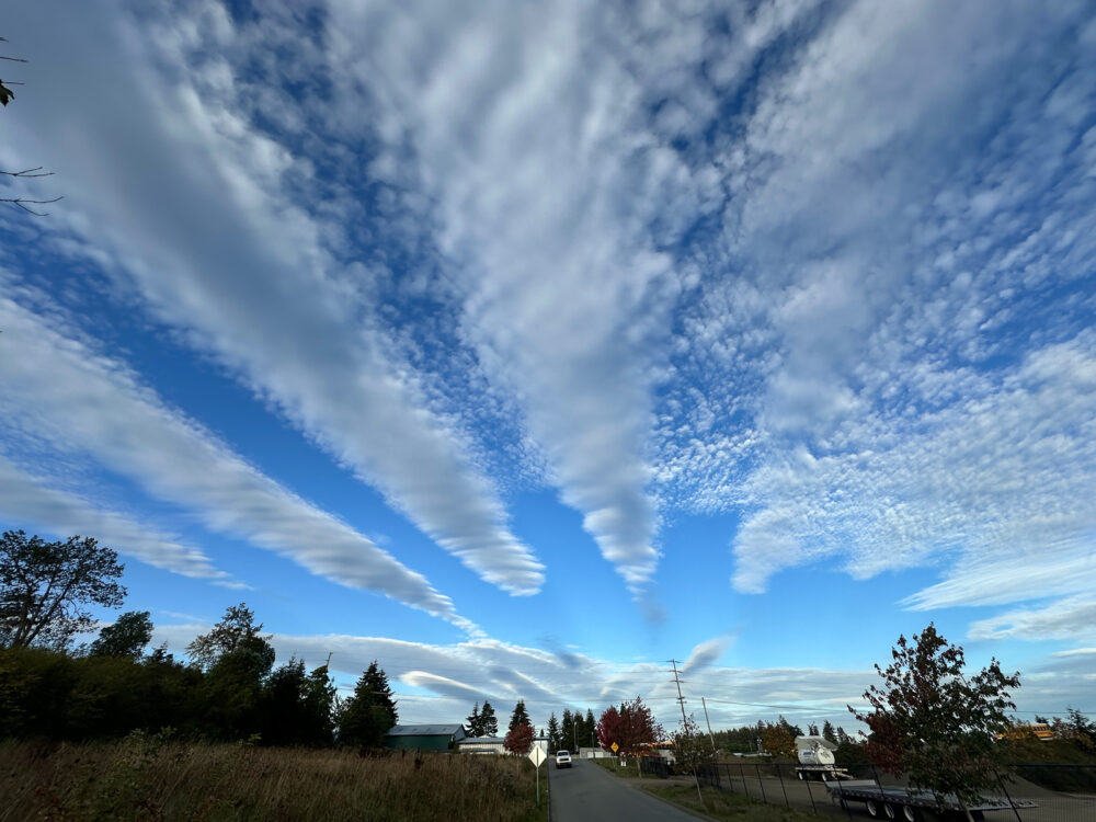
Altocumulus radiatus over Sequim, Washington, US
[social_share]
Leave a Reply Cancel reply
You must be logged in to post a comment.
This site uses Akismet to reduce spam. Learn how your comment data is processed.
April 20, 2016
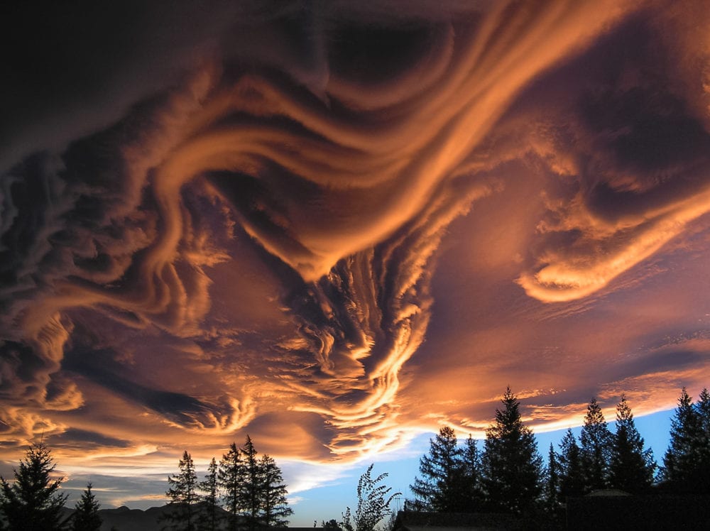
An extended lenticularis formation catches the evening light over Hanmer Springs, New Zealand,
[social_share]
5 thoughts on “An extended lenticularis formation catches the evening light over Hanmer Springs, New Zealand,”
Leave a Reply Cancel reply
You must be logged in to post a comment.
This site uses Akismet to reduce spam. Learn how your comment data is processed.


I agree with Lawrence Green – this photo needs to be in the 2017 CAS calendar, for sure!
This is probably one of the most impressive asperatas formations I’ve ever seen photographed.
Well done, Witta!
Lauren
Amazing formation
5th attempt to get a comment posted onto the new website. That said, I think this magnificent photo would grandly grace a page on the CAS 2017 calendar.
This photo first appeared on the NASA APOD website on 17th April with a brief, concise explanation about how this type of cloud formats.
Here is the text:-
Explanation: What kind of clouds are these? Although their cause is presently unknown, such unusual atmospheric structures, as menacing as they might seem, do not appear to be harbingers of meteorological doom. Known informally as Undulatus asperatus clouds, they can be stunning in appearance, unusual in occurrence, are relatively unstudied, and have even been suggested as a new type of cloud. Whereas most low cloud decks are flat bottomed, asperatus clouds appear to have significant vertical structure underneath. Speculation therefore holds that asperatus clouds might be related to lenticular clouds that form near mountains, or mammatus clouds associated with thunderstorms, or perhaps a foehn wind — a type of dry downward wind that flows off mountains. Such a wind called the Canterbury arch streams toward the east coast of New Zealand’s South Island. The featured image, taken above Hanmer Springs in Canterbury, New Zealand, in 2005, shows great detail partly because sunlight illuminates the undulating clouds from the side.
Laurence
Superb shot.
Somehow quite disturbing.
My imagination was working overtime.
Wow