
What are these clouds?
Forums › Cloud Identification Help › What are these clouds?
- This topic has 16 replies, 6 voices, and was last updated 5 years, 1 month ago by
 George Preoteasa.
-
AuthorPosts
-
-
June 27, 2020 at 7:22 pm #438194
 Alexandra BrowneParticipant
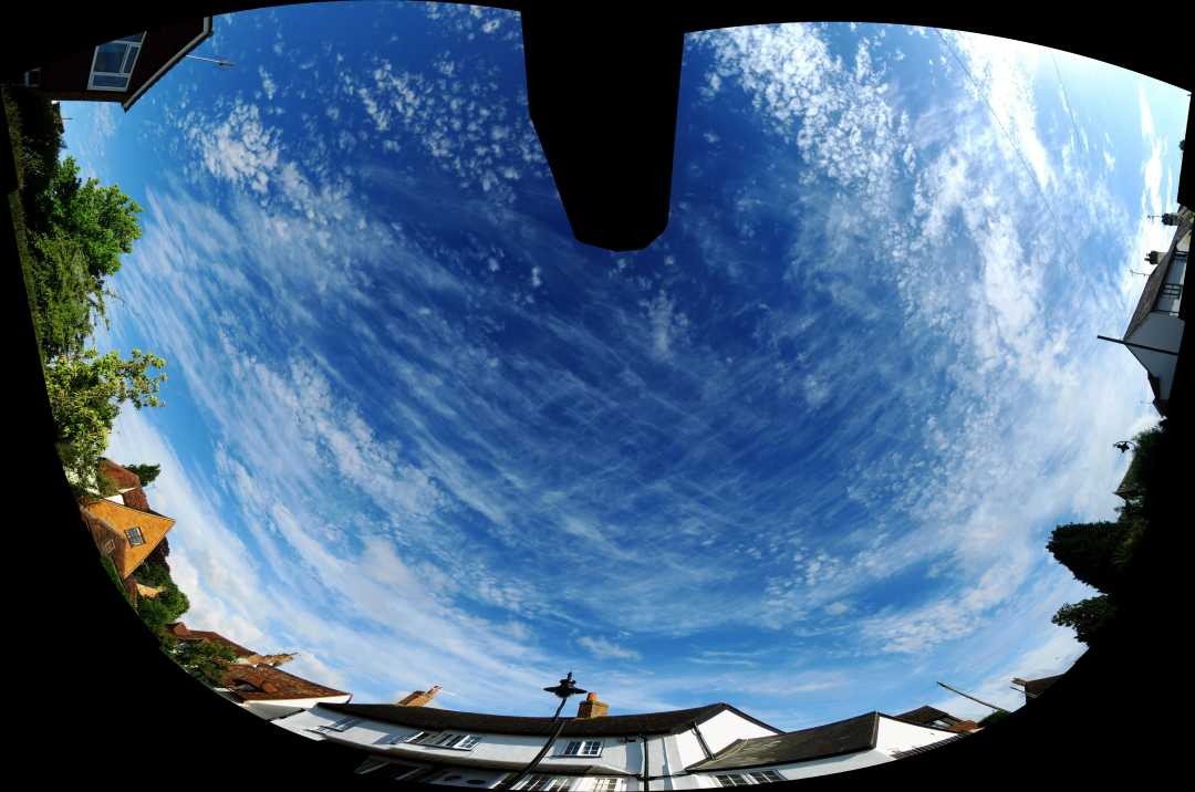
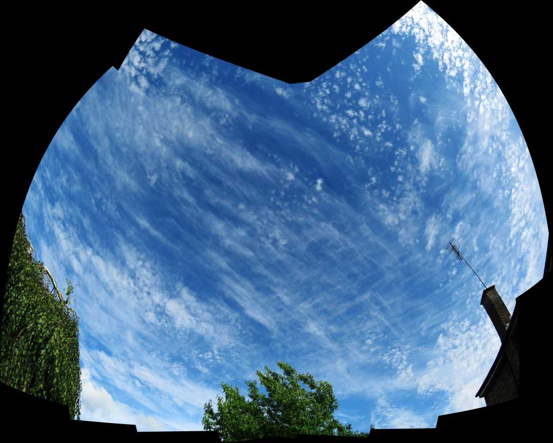
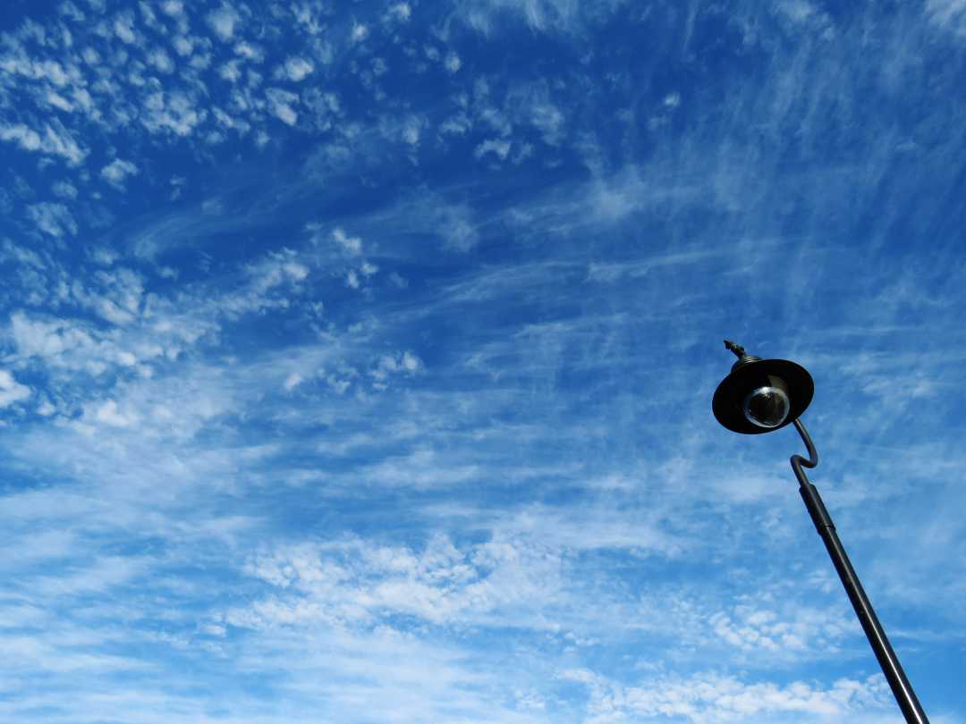
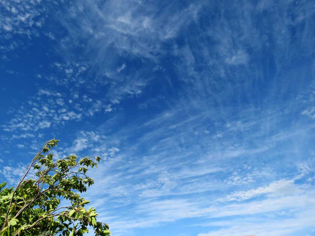
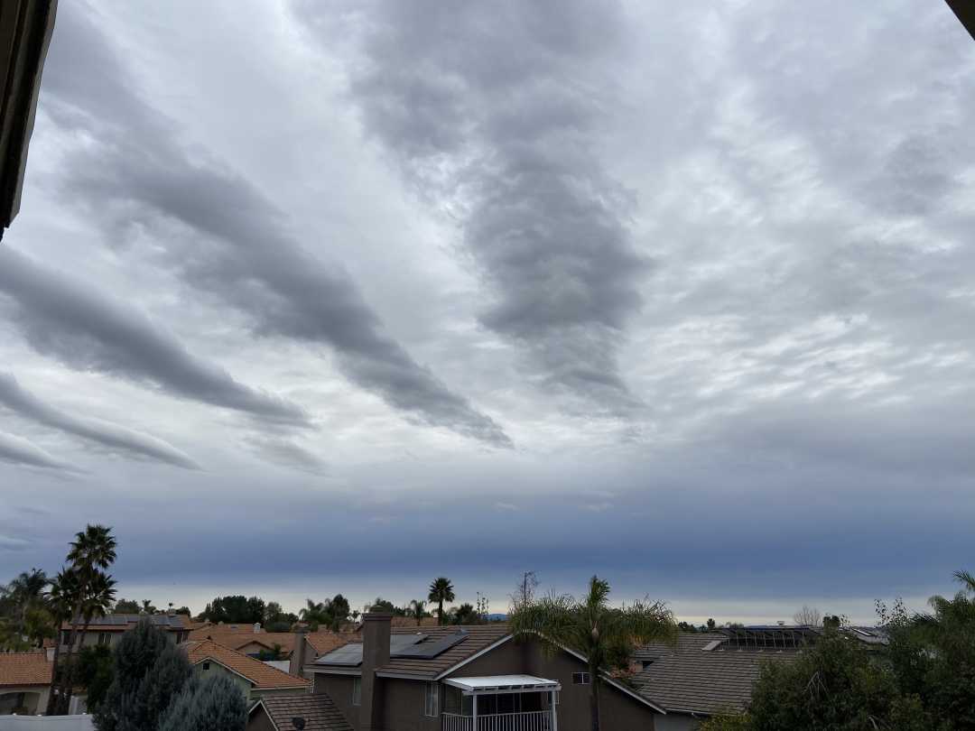
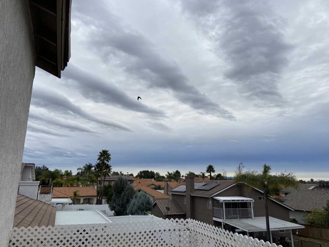
OK, this might be a bit of a challenge! I don’t know. Maybe even easy for you knowledgeable bunch. This was a glorious display tonight. Can you tell me what clouds they are? I recognise cirrus.
The weird photos are stitches of several shots.
Alexxx

-
June 27, 2020 at 10:08 pm #438203George PreoteasaParticipant
Hi Alexxx, yes, those that look like fibers are cirrus. The small roundish ones are either cirrocumulus or altocumulus. It’s hard to tell from pictures because it’s not clear what the scale is. The rule is (if I remember correctly) if the pinky covers (or almost) the cloud element when the arm is fully extended, it’s cirrocumulus.
My guess from the picture is those are high altocumulus, but not quite cirrocumulus.
-
June 28, 2020 at 3:48 pm #438266Don HatfieldParticipant
George has it pretty much correct, although I learned it as : When pointing at the clouds, if your index and first two or three fingers cover the clump, it’s altocumulus. Otherwise cirrocumulus.
But you have to look at clouds that are more-or-less overhead. The rule doessn’t work for clouds on the horizon.
In the photos, I personally had a hard time interpreting the super-wide angle shots. However, in the last two, it appears that the cumulus clouds are lower down than the cirrus. So, like George, I would guess altocumulus for the ‘clumpy’ ones.
Clearly cirrus, as George says, for the others.
-
June 29, 2020 at 10:28 am #438351Alexandra BrowneParticipant
Thank you!
-
July 18, 2020 at 3:04 am #440602Rob ThompsonParticipant
It looks like there are three layers with the wind in different directions.
The lower layer with alto-cumulus and not much wind.
And the two upper layers with cirrus, fairly windy with the wind direction nearly at right angles.
Rob
-
February 2, 2021 at 2:57 pm #469733Julia LongParticipantWhat are these fabulous rows of clouds?
-
February 2, 2021 at 9:49 pm #469863Rob ThompsonParticipant
It could be a wave system which was triggered downstream of a mountain range but it looks more like an air-mass wave system which develops when different layers in the atmosphere have very different wind speeds and directions….same physics as wind over the ocean.
Were the clouds (which indicate the wave crests) moving or stationary?
If you can give us the location, direction the camera was pointing as well as the time and date, it may be possible to work out from the weather archives what was happening.
Rob
-
February 23, 2021 at 11:27 pm #473083George PreoteasaParticipant
Jumping in a little late … The wavy clouds on February 2 are stratocumulus undulatus. But what makes them so cool is that above them you have a layer of altostratus of a different shade of gray.
The “tornado” is indeed, like Greg says, a contrail twisted out of shape by winds with different directions and speeds a different altitudes and even within the same layer.
-
-
February 3, 2021 at 4:53 am #469937Gregory VenarskyParticipant
Hello Julia!
I believe it may be an example of undulatus or possibly cloud streets caused by oscillations in the atmosphere. Lovely catch by the way!
Greg
-
February 4, 2021 at 6:34 am #470198Julia LongParticipant
Thanks Rob & Greg!
Location: Wildomar, CA
Direction: SSE
Date: 2/1
Time: 7:47 am
-
February 8, 2021 at 12:03 am #470675Rob ThompsonParticipant
Is that 2nd Feb or 1st Jan?
We do dates in Australia with the day first…
Rob
-
February 12, 2021 at 4:17 pm #471394Julia LongParticipant
Holy tornado! What is this beauty, looking like a funnel cloud…?
-
February 12, 2021 at 4:19 pm #471395Julia LongParticipant
Rob – February 2nd, 2021
😃
-
February 12, 2021 at 4:25 pm #471396Julia LongParticipant
Rob, Where in Australia? My moms best friend is from Bunbury.
-
February 12, 2021 at 8:05 pm #471439Gregory VenarskyParticipant
Ha! I can see the funnel shape quite clearly! However it does not happen to be a tornado, instead, it seems to be a manmade airplane contrail cloud.
Greg
-
February 12, 2021 at 10:25 pm #471453Julia LongParticipant
Thanks Greg!
We get a lot of air traffic of varying types, we are just over the mountain from Camp Pendleton Marine Base.
~Julia -
February 13, 2021 at 5:34 am #471482Rob ThompsonParticipant
I am in the Blue Mountains to the west of Sydney. Bunbury would be about as far as New York is from you!
The synoptic chart for the 2nd of Feb is at https://www.wpc.ncep.noaa.gov/archives/web_pages/sfc/sfc_archive_maps.php?arcdate=02/02/2021&selmap=2021020215&maptype=print_us
There doesn’t seem to be any weather data for Wildomar but a flick around the nearby weather stations shows the wind at ground level to be all over the place… https://www.wunderground.com/history
The synoptic chart is certainly conducive to winds that change with altitude which could trigger air mass wave systems. But you are also surrounded heaps of mountains which could trigger mountain wave systems.
The wonderful thing about the weather is that no matter how much left brain might you throw at it sometimes you just have to say “Who knows” and switch over to the right brain and enjoy the photo!
Interesting day!
Rob
-
-
AuthorPosts
 What are these fabulous rows of clouds?
- You must be logged in to reply to this topic.
