
Sky and cloud questions?
Forums › The Cloud Forum › Sky and cloud questions?
- This topic has 32 replies, 5 voices, and was last updated 7 years, 10 months ago by
 Hans Stocker.
-
AuthorPosts
-
-
July 28, 2018 at 9:11 pm #287545
 Ramona EdwardsParticipant
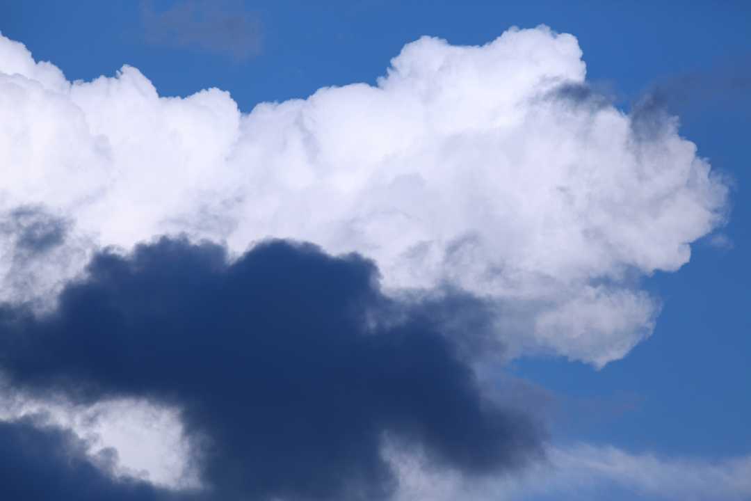
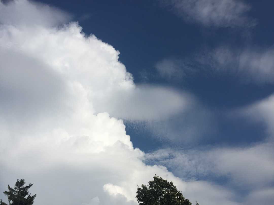
I was wondering if it is okay to start a “question” thread? I have SO many questions about the clouds that I see and am not confident enough of my own identification skills to post photos with labels on them! I will post one and if this isn’t a good subject I will try to delete it later. I have been wondering about these very dark clouds that appear alongside “regular” white cumulus clouds. I read this in today’s “cloud of the day” text and am wondering if that is the case here?
Thanks!
RamonaLow clouds, like these sunset Cumulus spotted by Jim Miller (Member 45,129) over Great Ayton, Middlesborough, England tend to look dark and shaded on the side away from the Sun. This is because they consist of droplets that are very tiny and very plentiful. Compared with the more translucent high clouds consisting of larger, fewer ice crystals, these low Cumulus appear more ‘optically dense’. The surfaces of their multitudinous little droplets scatter the sunlight more effectively. Less light passes through, and so their shaded sides appear darker.

-
July 28, 2018 at 9:23 pm #287547Ramona EdwardsParticipant
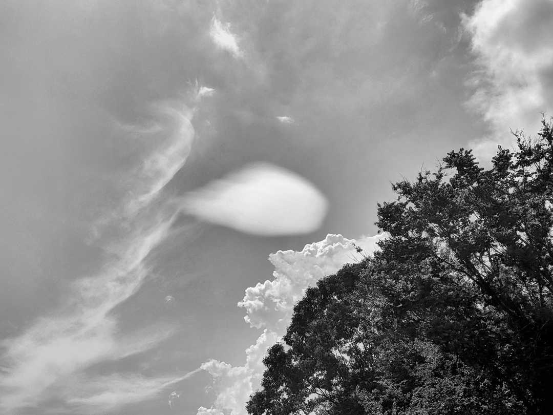
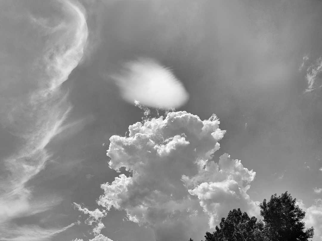
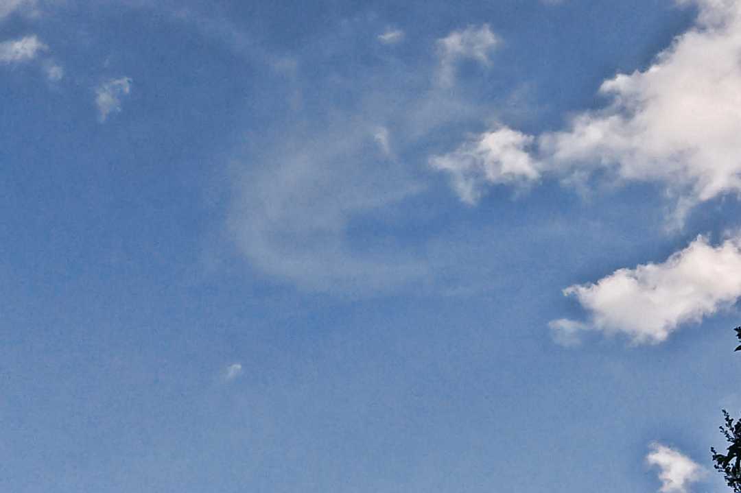
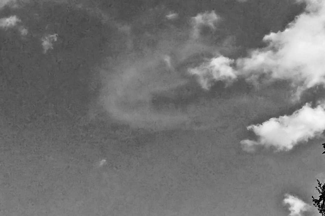
One more question if I may? I saw this odd little cloud while on a road trip, and I watched it transform over a few minute’s time. It started off as just a smallish “blob”, but then had a bit of striation around the edges at the end. I like to make clouds in black and white for more definitions, so maybe that will help. I am wondering if this is a “lens or almond shaped” lenticularis cloud?
Thanks!
Ramona
-
July 28, 2018 at 10:22 pm #287559Hans StockerParticipant
Hello Ramona, that is some time ago? Nice to read something from you again.
For the first picture I agree with your thought that t is a matter of shadowing like explained in the Cloud a Day.
The second one seems to be lenticular cirrocumulus to me. Anyone correct me when I am wrong?
Hans
-
July 31, 2018 at 5:22 pm #288030Ramona EdwardsParticipant
Thank you for your help, Hans! It is good to know when I am at least close with my cloud identification! Yes, I have been off the forum for quite some time, due to a death in the family and the ensuing challenges. Thanks for your help!
Ramona
-
-
July 28, 2018 at 11:50 pm #287579Howard BrownParticipant
Hallo again, Ramona. In answer to your question, of course it is OK for you to start a thread. I think you have good skills and observations to offer, for our appreciation and discussion.
I agree your lonely cloud could be lenticularis species (and not pileus on the near looking Cu). But it looks too low and too large a cloudlet for cirrocumulus. So looking at the Cloud Classification it would have to be Altocumulus. But you have the keys
– was your lonely cloud wandering or hovering
– is there raised ground upwind
See The Cloud Collector’s Handbook pp 104/105 and 29.
-
August 8, 2018 at 3:00 pm #289463Ramona EdwardsParticipant
Hello Hygge! I have my handbook now, but I am wondering if I have a different version than yours? In my book pages 104/105 are a photograph of cloud iridescence and 29 is about Nimbostratus? However, having looked on page 29, I noticed that the next page was about Cumulonimbus and the photograph looks like something I saw last night! I had not seen it before and this one is much smaller, but it has the “hairy” look of the larger cloud in the book.
-
-
July 29, 2018 at 1:20 am #287592George PreoteasaParticipant
Great idea, Ramona, I love to answer questions when I can, offer guesses otherwise, and ask my own questions. In fact, this is how I started posting to the forum. And even more coincidental, it was about a sort of lenticularis. I’ll include it at the end.
Regarding your questions, it’s true that the dark color in a cloud denotes higher water content. But it would not be the whole cloud, but rather the “belly”. So, agreeing with Hans, that dark cloud is really in the shadow on the big white one. It would probably look pretty bright white if it were not there.
Your other shots show a lenticularis, no doubt. I am not sure if it’s at the cirrus level of alto level. There is one indication, I think, which is the small undulatus fringes, which are rellay tiny, so that would indicate high altitude, thus cirrocumulus, again agreeing with Hans.
Now, your shot seems to also show other clouds and I seem to see some cumulonimbus features in them. There is similarity to that in the picture I posted. I think the disturbances created by cumulonimbus updrafts interferes with the horizontal air flow, just like a mountain or hill would, and this creates conditions for lenticularis clouds. Now, that’s just a guess.
Finally, I think BW can be really nice and useful in making features stand out, but did you try using a red filter? I recently bought one and it makes a difference. (I put the camera in BW mode too and increase the exposure. But you’re a photographer, if I remember, to whom am I giving advice :-)
-
July 31, 2018 at 5:27 pm #288034Ramona EdwardsParticipant
Thank you, Hygge! Is that an actual book you are talking about (the handbook) or is it an online resource? If it is a book, I would love to have one.
This little cloud was hovering around the same place and I took a series of photographs of it as it slowly changed shape/appearance. I am not sure if there was raised ground or not, as we were traveling and I don’t remember where exactly this was taken. I do know that it was a rather turbulent day, but a wonderful one to have your head in the clouds! There was a lot of rain about and ever changing skies/clouds.
RamonaEdited to add: Sorry, but this reply went with the wrong message!
-
July 31, 2018 at 5:34 pm #288037Ramona EdwardsParticipant
Wow, thanks for all of this great information, George! Yes, it was quite a turbulent day and lots to keep me occupied as we traveled! Thanks for the suggestion on the red filter – I can do that in editing and will see what effect that has. And yes, your little cloud looks a lot like mine!!
I am so glad to have you guys as resources to help me understand more and more about clouds!
Yes, the undulatus fringes on this little cloud were very small – I only noticed them on the photo after I looked at it on the computer! It was just such an odd little cloud, all by itself among the “big guys”!
And thanks for the encouragement on starting this thread! I will do my research first and then ask questions, in order to not waste anyone’s time with just throwing all of my (MANY) questions out there!
Ramona
-
July 31, 2018 at 5:38 pm #288038Ramona EdwardsParticipant
I found the handbook on Amazon, Hygge! Will order it now! Thanks for the heads up!
Ramona
-
-
July 31, 2018 at 7:41 pm #288049Hans StockerParticipant
Why not use the shop on this site. You can let the cloud collector’s handbook signed with a message from Gavin, the writer himself. I can recommend it. It is fun reading it.
-
July 31, 2018 at 7:53 pm #288053Ramona EdwardsParticipant
Oh, what a wonderful idea, Hans! I ordered one from Amazon, but I know a friend who would love a copy, too, so I can give the first one to him. Do I just go ahead and order it from the shop or do you need to do something special to get it signed?
Thanks!
Ramona
-
-
July 31, 2018 at 9:42 pm #288063Hans StockerParticipant
The shopping process will show the choices to make Ramona. Have fun with it!
-
August 6, 2018 at 10:18 pm #289125Ramona EdwardsParticipant
I got my handbook!! What fun reading it is! I sit each evening and watch the clouds move across one part of our sky. These clouds move over a river and I am wondering if that affects the wind patterns. I know there is very little chance of this, but I was reading about the horseshoe vortex clouds and wondering about the formations I watch over and over again. Here is an example of them – the higher cloud is in kind of a horseshoe shape, but it’s way to large and probably not the correct type of cloud, right? I will post a black and white version of it, too, so the contrast can be seen more clearly. I am loving the book!!
-
August 6, 2018 at 10:19 pm #289126Ramona EdwardsParticipant
-
August 6, 2018 at 10:50 pm #289135George PreoteasaParticipant
Hmm … interesting but I think it’s a coincidence. Can you describe a bit its evolution? Did you see it form, how long did it last?
-
August 8, 2018 at 2:41 pm #289458Ramona EdwardsParticipant
I can’t remember exactly how long this one was there, but I think it was a few minutes rather than seconds, like the KH clouds are. I suspect it was just a coincidence, too, as this doesn’t seem like the right type of cloud or the right situation. I will keep an eye on the sky and look for others, though!!
Thanks for the help!!
Ramona
-
-
August 8, 2018 at 2:46 pm #289460Ramona EdwardsParticipant
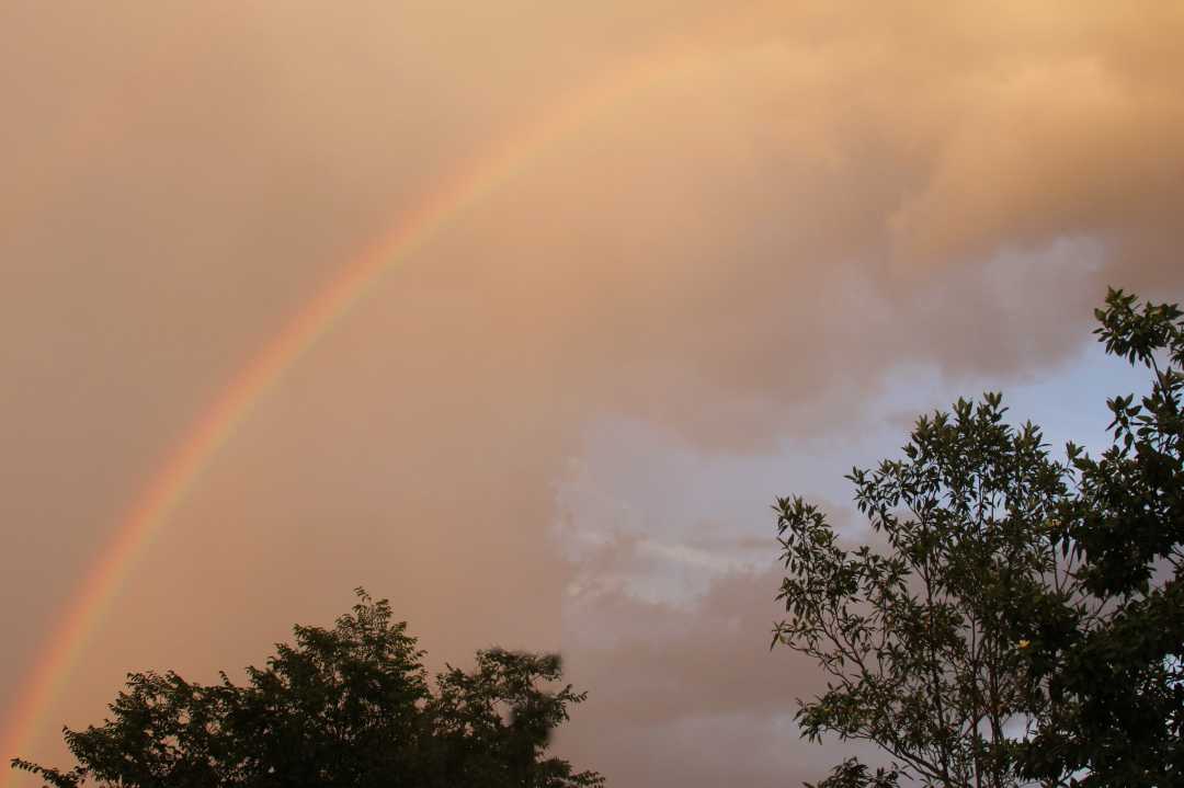
When I read the Cloud of the Day description today it brought to mind this rainbow and clouds that I photographed last week. It was quite a strange situation. I was inside and I suddenly felt like “it was yellow outside – very yellow”. I don’t know how to explain it, as it was quite an odd feeling, but I figured I would check it out. Things did indeed look very yellow outside and I saw one of the most vibrant rainbows that I have ever seen! I suspect it had something to do with the sun going down and the water droplets in the clouds? Am I on the right track? The description in the cloud of the day email was talking more about greenish clouds, but I am wondering if this would have a similar explanation? Here is what was in the email:
. The very smallest among the distribution of droplet sizes will scatter more blue light than red. This might be expected to give the clouds a bluish tinge, since this end of the spectrum would be scattered rather than absorbed by the cloud. Why then the green colour? This might relate to the time of day. Thunderclouds tend to reach maturity towards the end of the day, when the light striking their upper reaches has the warm hues of sunset. With the blue light already scattered out by the evening sunlight’s long passage through the dense, low atmosphere, a thunderstorm that might normally appear a dark bluish grey could end up appearing faintly green, especially towards the horizon.
-
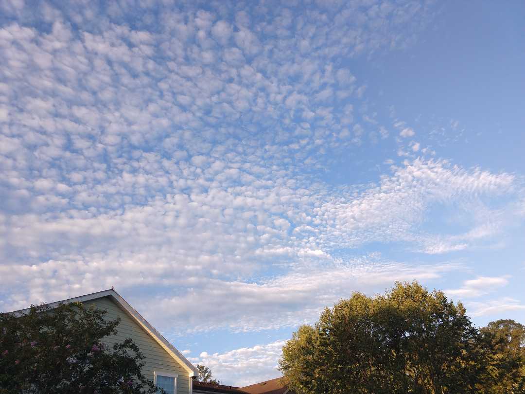
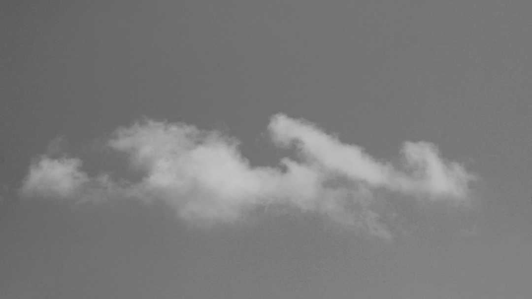
August 8, 2018 at 4:19 pm #289472Ramona EdwardsParticipantI have searched quite a bit for these and as near as I can tell they are Cirrocumulus? If they were Altocumulus they would have shadows on the bottom of them? And why do these get you 40 points in the “collection”? Just curious, LOL!!
Corrections always welcome!
Thanks again!
Ramona-
August 10, 2018 at 12:28 am #289720Howard BrownParticipant
It’s often a tricky one, Ramona. I personally have trouble spotting those shadows. Your opinion is key because you were there!
I agree your clouds are high though I would have gone for Ac. They don’t look ‘tiny’ like grains of rice, possibly wider than the single finger test?
Since you like checking things out, you are aware of the ICA link in the first, permanent thread of the Forum –
https://cloudatlas.wmo.int/definitions-of-clouds.html
https://cloudatlas.wmo.int/clouds-genera-altocumulus.html
Cc get 40 points because they are rare and fleeting I guess.
-
August 11, 2018 at 10:35 pm #290054Ramona EdwardsParticipant
Thanks, Hydde! There is so much to learn! I am trying to take it slow, but there are some clouds that just intrigue me and I skip ahead to try to identify them. I am going to post one that I have looked for throughout the ICA and I THINK I have identified it.
Ramona
-
-
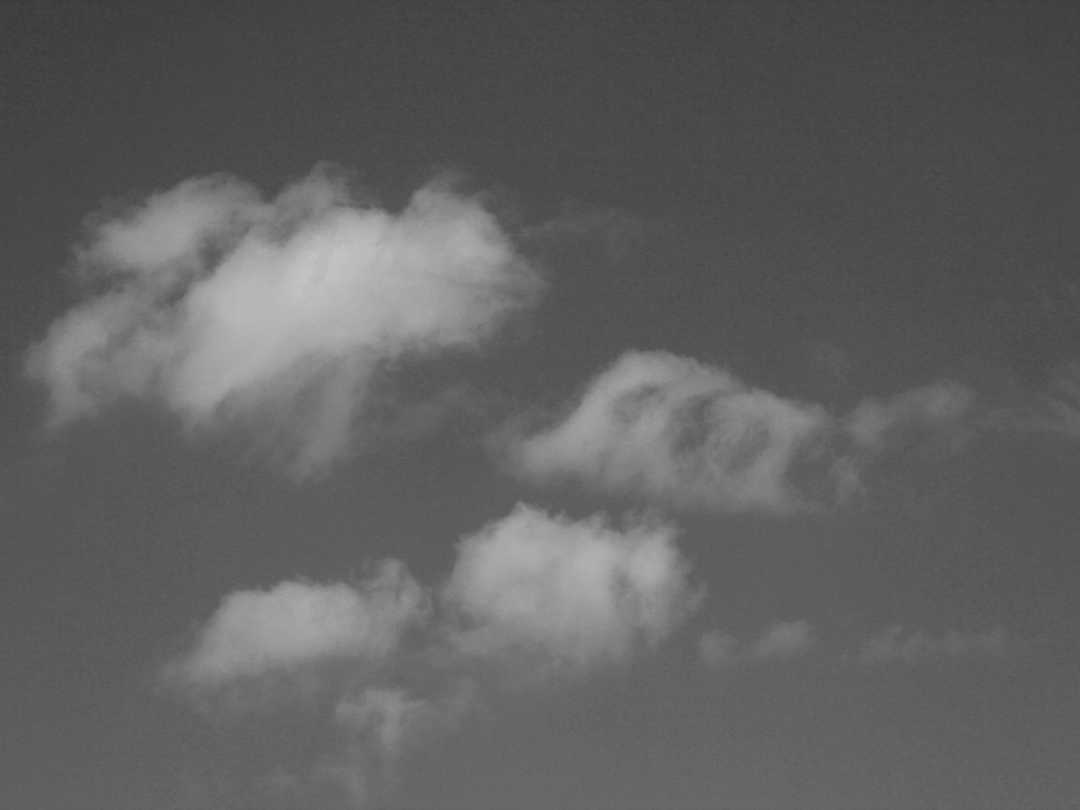
August 11, 2018 at 10:42 pm #290055Ramona EdwardsParticipantI am posting this in both color and black and white. It has quite intrigued me. I believe it is an Altocumulus lacunosus? Is that correct?
Thanks!
Ramona
-
August 12, 2018 at 3:41 am #290085Michael LerchParticipant
Hello Ramona, Nice capture with the camera, but no, imho, what you’ve photographed isn’t AltCum lacunosus. I believe you caught deteriorating altostratus or even a lower stratus. My understanding of the difference between lacunosus and deteriorating stratus is,,lacunosus is formed when colder air drops in altitude..the key might be..” forms”. When stratus deteriorates,,it is coming apart, evaporating back to gaseous state when warmer atmosphere rises through the stratus. Lacunosus condenses out of the atmosphere, forms. What I’ve seen is usually a uniform altitude, or sheet of lacunosus. Deteriorating stratus or even deteriorating lenticular is pushed and rounded as the cloud evaporates from rising thermals. The gallery has examples of lacunosus. My experience has been that lacunosus has no real herald, nothing hinting at its entrance. It just happens. Only a few times has it been literally out of a clear blue sky. Most of the time lacunosus has been part of a hurly burly mix of a system sweeping though. Most of my observations have been of small to medium patches of sky especially at alto altitudes. Tip of little finger to tip of thumb of an outstretched hand ( or less) is a small patch of cloud to me. That distance is also roughly 20degrees a way to measure halos distance from sun, and for star gazing at night. When you see Lacunosus you will know it. Look for a uniform horizontal sheet of it, maybe even under a thin asperitas event. Have fun!
-
August 15, 2018 at 11:44 pm #290681Howard BrownParticipant
A masterful explanation, Michael. Thank you.
-
August 19, 2018 at 7:55 pm #291257Ramona EdwardsParticipant
Thanks so much, Michael!! That is a lot of information to study!! I am not getting notifications when there is a post here, and I often forget to check unless I do get those notifications, so I am late in replying! Clouds are so incredibly complex, but fascinating! I can see how it is very helpful to know how they develop and what the air conditions are when they are seen.
Thanks again! I am adding a new image and I will try to remember to check back on this one!Ramona
-
August 24, 2018 at 11:57 pm #292125Howard BrownParticipant
Ramona, there is a box you can tick:
‘Notify me of follow-up replies via email’
following your post and before you ‘Submit’. I have not used it so do not know the ins and outs but it sounds like it may solve a problem for you.
-
August 21, 2018 at 10:32 am #291513Hans StockerParticipant
Great explanation Michael. Many thanks for pointing this out. I would easily have classified it as lacunosus myself, but you must be right. The difficulty is that not only the appearance needs to comply with the classification but also the process by which it is formed and unfortunately the process itself is not visible, just the result of it. There is a lot of experience involved imho.
The resemblance to a B&W in thread X called ‘Ragged’ is striking btw. Now I know what it is!
And I suppose also a later one in the same thread with the name ‘Drifting’.
-
-
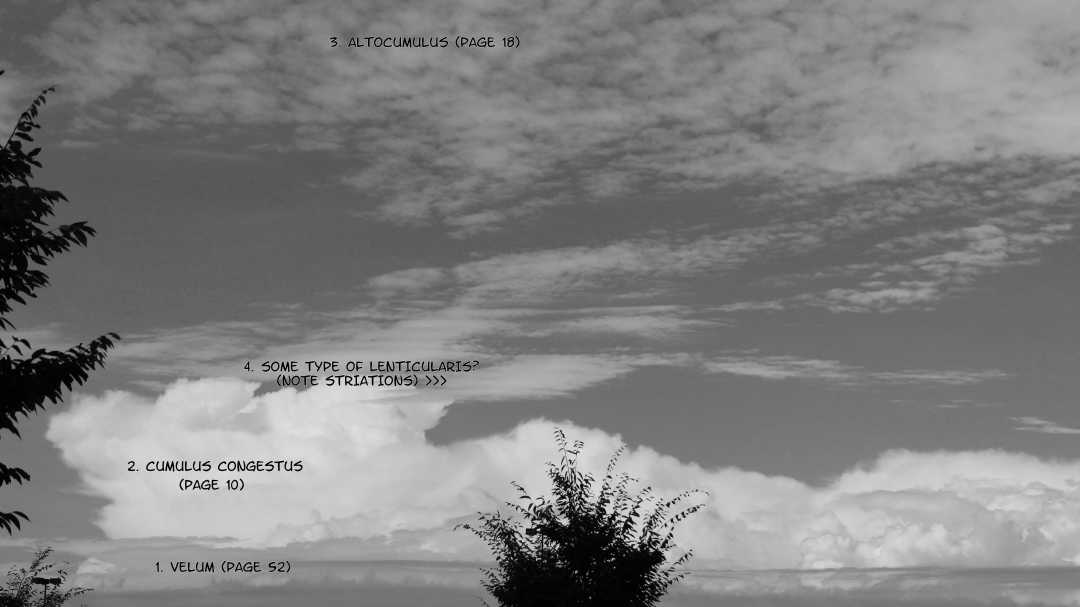
August 19, 2018 at 7:57 pm #291258Ramona EdwardsParticipant
This was what looked like a diverse sky and I wanted to try to name all of the various clouds. I am hoping I got just one right, LOL!! I wrote on each cloud what I THINK they are and the page in the handbook that I found it. Input and corrections very welcome! The clouds were pretty far in the distance, so the height of the trees may be misleading.
Ramona
-
August 25, 2018 at 10:55 am #292195Hans StockerParticipant
Hello Ramona, Hygge explained how to get notice of response on this thread. About the classifications I would say that I agree with the first three. The fourth seems to me part of the same layer of atocumulus as seen above in he picture. Due to perspective the lenticular-like patches seem to be at another level, but I think they are at the same level. The congestus builds up higher so the altocumulus shows in front of it. For what it is worth…… Any other opinion is welcome.
-
August 31, 2018 at 5:29 pm #293247Ramona EdwardsParticipant
There is some type of phenomena that I see over and over again in our skies – and it is always fun to watch (and quickly fleeting)! Tips of clouds often start “rolling” in the direction that the cloud is moving, forming what looks like a KH cloud, but then going on to form a circle. It kind of rolls on from there and dissipates and another roll will start – or there can be more than one at a time. I have done short videos of this and they only last a few seconds. Here is a cloud that is forming kind of like that, with some tiny little curls, too. The second image was a bit more unusual with what looks like three circles in one cloud. The color versions of these would show a blue sky behind them, but it was a day with a lot of clouds moving rather quickly. I don’t think these were very high, so are they small cumulus clouds drifting in the wind? And when they form the hook first and then a circle is that just part of clouds changing or does it have a name. The first one looks like KH to me, but I know that true KH clouds are rare and I see these on a regular basis. Thanks for the help!
-
September 1, 2018 at 9:11 pm #293422Hans StockerParticipant
Hello Ramona, KH is possible in cumulus. You can find an example in the ICA, although to me this example seems not very convincing. Neither your two examples ae convincing to me, but on a fair weather day with a lot of separate drifting cumulus clouds I have the same experience like you that the typical KH crests appear on top of cumulus.
-
-
August 31, 2018 at 5:41 pm #293249Ramona EdwardsParticipant
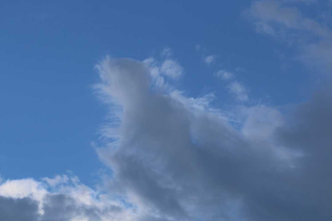
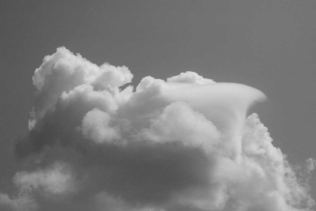
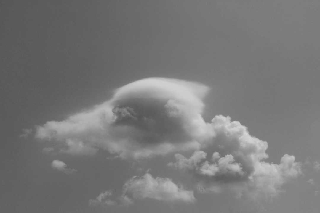
OK, next question. The day I took these photos was an amazing sky day!! Such diversity and SO many Pileus clouds forming and then dissipating! Spotting Pileus clouds is one of my favorite sky watching thing to do! This second cloud – I think is a Stratocumulus, due to the stormy nature of it. I watched what seemed to be a Pileus cloud on top of it turn into something MUCH larger – and then it became almost wedge-shaped, in the direction the wind was blowing it (top photo – they loaded in the opposite order I though they would). I actually have a video of this formation but I am sure it is too large to post here.
-
September 1, 2018 at 9:15 pm #293424Hans StockerParticipant
Hello Ramona, It is not clear to me what your question is in this case, but you surely captured some nice pileus. Especially the wedge-shaped one is indeed strange, but beautiful. Love it.
-
-
AuthorPosts
 I have searched quite a bit for these and as near as I can tell they are Cirrocumulus? If they were Altocumulus they would have shadows on the bottom of them? And why do these get you 40 points in the “collection”? Just curious, LOL!!
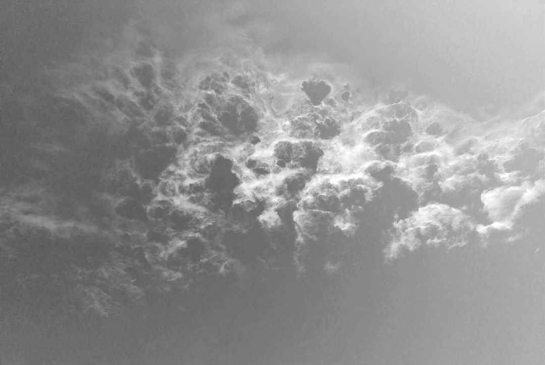 I am posting this in both color and black and white. It has quite intrigued me. I believe it is an Altocumulus lacunosus? Is that correct?
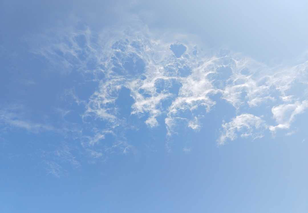
- You must be logged in to reply to this topic.
