Altitude: Mid/High

Distrail

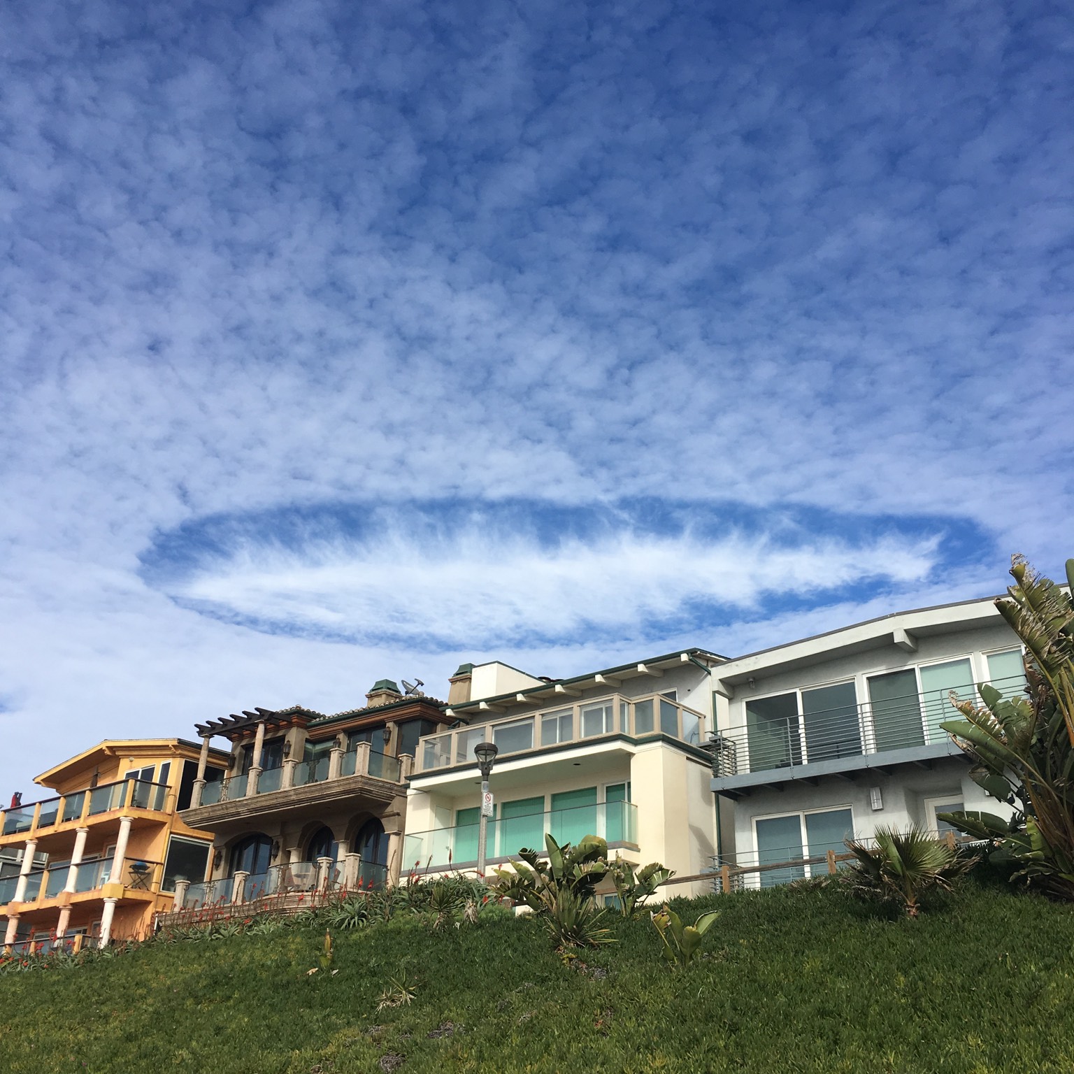
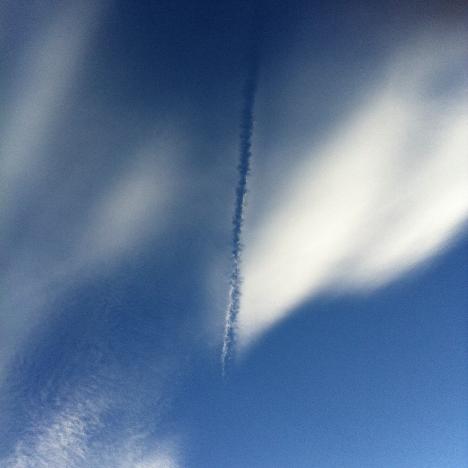
An aircraft dissipation trail, or distrail, is a specific example of the cloud hole known as a cavum, or fallstreak hole. In the case of a distrail, the cloud hole is formed by the passage of an aircraft through the cloud layer, and so it shaped more like a line than a circular hole.

As with a regular cavum, a distrail forms when very cold droplets in a cloud layer start to freeze in one region and fall below as ice crystals. If these dissipate away in warmer, drier air below the cloud, all that is left is a hole – or in this case, a line. An aircraft can trigger this freezing process by the cooling that happens within its wing vortices or by the tiny particles in its exhaust acting as ‘freezing nuclei’. Airborne particles, whether natural ones like dust, ash or plant material or ones introduced artificially like this, serve as the tiny seeds onto which cloud droplets can begin to freeze. Without them droplets can stay in ‘supercooled’ liquid state at temperatures as low as –40°C (–40°F).

Depending on whether or not the ice crystals evaporate in the air below, a distrail can appear as a completely clear line cut out of a cloud layer or one with a trail of ice falling crystals visible beneath it.

Floccus

THE floccus species is found in four of the ten cloud genera: Stratocumulus, Altocumulus, Cirrocumulus, and Cirrus. It is a hard formation to spot – not because it is rare or restricted to certain locations or times of year, but because its appearance is not especially distinctive, and so is easily confused with other forms of these clouds. But we all know cloudspotters love a challenge.

Whether you are considering low, mid-level, or high clouds, identifying floccus is about examining the tops and the bases of the cloudlets. A cloud of the floccus species will have soft-edged, rounded tops, like a blurred version of the tops of Cumulus clouds. The bases of its cloudlets will look diffuse and ragged. That’s because this is a cloud in transition, shifting from one state to another.

Clouds of the floccus species often have trails of ice crystals, known as virga, falling from their cloudlets. The droplets in the clouds are in the process of freezing into ice crystals – or in the case of Cirrus floccus have completely done so. The ice crystals give floccus softer-looking edges compared to clouds composed only of droplets and can soon grow large enough to start to fall from the cloud.

In short, floccus have rounded, bumpy tops with softened edges and ragged, indistinct bases often with trails of virga.

Cavum

They look bizarre, but cavum, also known as fallstreak holes, are not actually that rare. They are crisp gaps in mid- or high-level cloud layers, below which dangle trails of ice crystals.

To form a cavum, the cloud layer must consist of supercooled droplets – when its water is in liquid form despite temperatures at cloud level being well below 0˚C (32˚F). This is actually quite common, for pure water suspended as droplets in the air behaves very differently from tap water in the freezer. If there aren’t enough of the right sort of tiny particles in the atmosphere to act as icing nuclei, on to which they can start to freeze, droplets remain liquid until temperatures drop to around –40˚C (–40˚F). They ‘want’ to freeze, but can only do so when there are seeds on which the crystals can begin to grow.

The fallstreak hole forms when one region of the cloud finally starts to freeze and begins a chain reaction. All the moisture from the supercooled droplets in the area rushes to join the ice crystals, which quickly grow big enough to fall below. A form of virga, the trail of ice crystals doesn’t tend to reach the ground, but evaporates before getting that far.

What starts the freezing? Sometimes it’s ice crystals falling into the cloud’s droplets from a higher Cirrus cloud. Most often, it is caused by an aircraft climbing or descending through the cloud to form a ‘distrail’. Low pressure in the vortices around the plane’s wings can cool the air enough to set off the freezing.

Virga

When you look up to find jellyfish floating above, you are either diving or beneath the cloud known as virga.

In essence, this is just a cloud raining or snowing, but with one important difference: the precipitation never reaches the ground. If the droplets or ice crystals (or anything between the two) fall through air that is warm enough and/or dry enough, they can evaporate before ever landing.

The appearance of virga from the ground is of trails that hang down like tentacles from a clump or layer of cloud, waving not in the currents of the ocean, but in those of the atmosphere. When virga occur below low-level clouds, they are composed of water droplets, and appear grey. When they consist of ice crystals, having fallen from mid- or high-level clouds, they have a much paler appearance. But beware: this distinction is a tenuous one, because our eyes judge colour and tone relative to the brightness of the background. The same trail of virga can appear whiter or greyer depending on the sky behind. Fallstreak holes are specific cases of virga falling from a layer of supercooled droplets to leave a hole behind.

When a cloud’s precipitation can be seen to reach all the way to the ground, it is no longer called virga, but ‘praecipitatio’.