
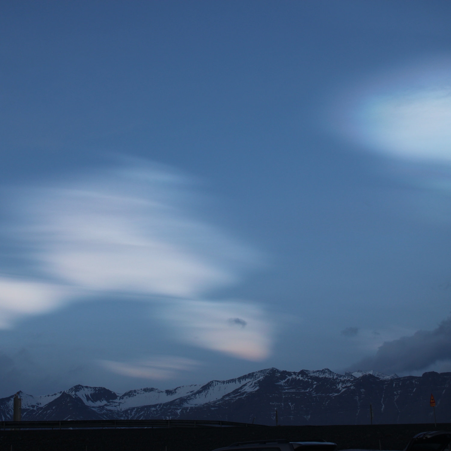
One January dawn in Iceland, Felix Diaz, grandson of Gene Diaz (Member 40,806), spotted these nacreous clouds above the Vatnajökull glacier. These clouds form up in the stratosphere, at altitudes of 10-20 miles (15-25 km), meaning they are some of the highest clouds in our atmosphere.
When the atmosphere is particularly stable, the rising and dipping flow of air as winds pass over mountains way below can have an effect all the way up in the stratosphere. The invisible wavelike flow of the air happens right the way up through the troposphere, the lower 8 miles (12 km) or so of the Earth’s atmosphere, where weather happens, and into the lower part of the stratosphere. While conditions are usually too dry for clouds to form up there, the crest of flowing air into this region can lift a little moisture with it. In the winter months, the temperatures can be low enough for even a small amount of moisture to freeze into the ice crystals we see as nacreous clouds.
They are so high in the atmosphere that they can catch the light even when the Sun’s below the horizon. This means they tend to remain visible when much of the rest of the sky is darkened. The tiny, consistently sized ice crystals of these clouds tend to diffract the sunlight to cause iridescent colours. The iridescence in Felix’s sky is subtle, but you might just be able to make out soft blue and purple hues in his nacreous cloud in the top right.
