
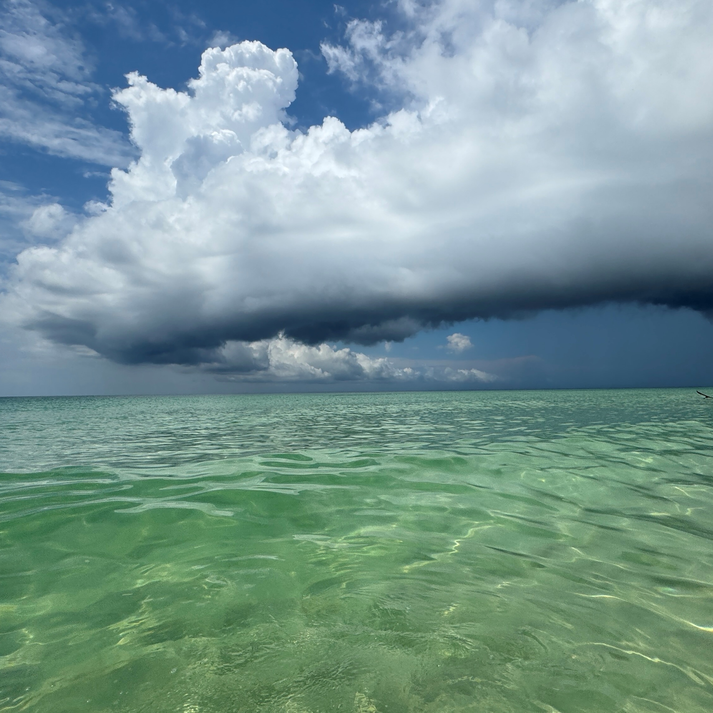
Nisa Dykstra, daughter of Linda Kimbrel (Member 24,116), spotted this arcus formation from Pensacola Beach, Florida, US. An arcus, also known as a shelf cloud, is a feature that can appear at the front base of a Cumulonimbus storm cloud or, more occasionally, a large Cumulus congestus.
The arcus feature is like the vanguard of a coming storm. See how the sky is darkened by heavy precipitation off to the right, just behind the low curve of the arcus. Heavy showers drag cold air down to the surface with them. Where this spreads out ahead of the storm’s movement, it burrows beneath the warmer, less-dense air up ahead. It lifts the warmer air, causing some of its moisture to condense into the distinctive shelf of the arcus.
When the air right near the surface is stable, an arcus appears smooth and laminar. When the air is more unstable, like it was when Nisa was at the beach, likely having been warmed by the water’s surface, arcus can sprout bumpy tops and appear more jagged. In fact, Nisa’s seems even to be sprouting towering clouds of its own. ‘She was struck by the dramatic color contrasts between the sunlit beach shallows, the gloomy rain, and the long arc of rapidly approaching clouds,’ Lisa said of her daughter. ‘It seemed an almost fair trade for the lack of sunshine they had on their vacation.’
