
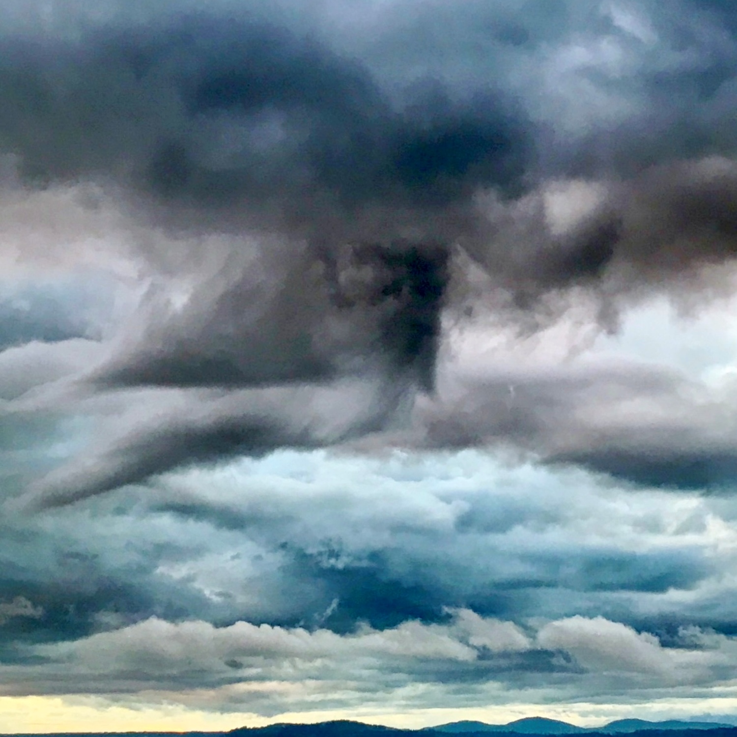
Adrienne Katz (Member 59,544) shared this patchwork sky from Seattle, US, asking if the dark cloud feature in the middle might be an example of a murus.
A murus, or wall cloud, is a localised block of low cloud that can appear extending down from the base of a Cumulonimbus storm cloud. It marks where air is being drawn up into the cloud to form a strong updraft that fuels the storm’s growth. Murus features are associated with very powerful storms. We can’t find clear evidence of a storm system here. This looks instead to be just an odd-shaped cloud fragment in a sky filled with Stratocumulus clouds as far as the eye can see.
Stratocumulus is the most common cloud formation worldwide. Highly variable, it comes in a whole range of different shapes and sizes – and sometimes it even comes in disguise.
