
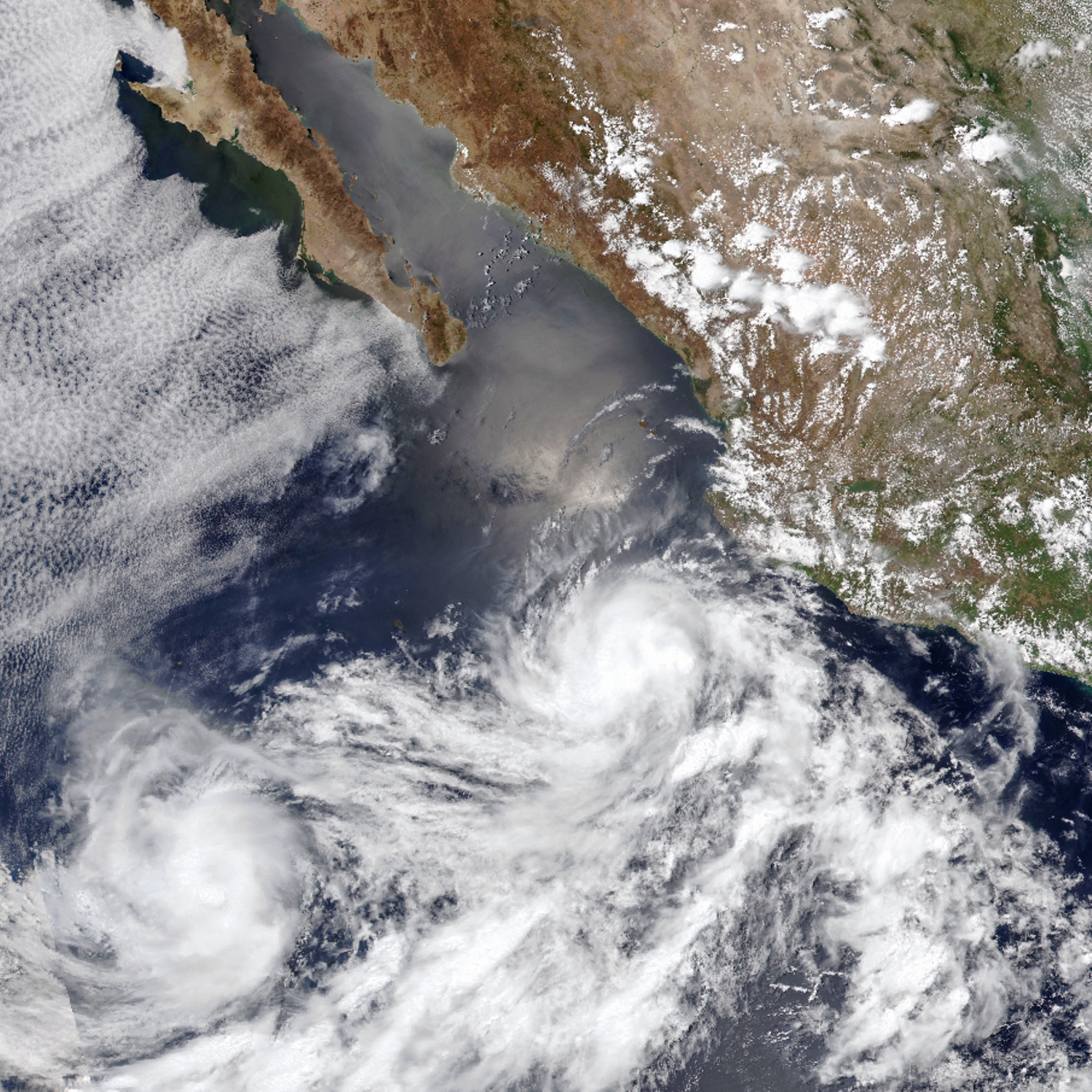
In early June 2025, twin tropical cyclones Barbara and Cosme developed near the start of the eastern Pacific hurricane season, swirling in tandem off Mexico’s coast. Barbara, captured on the right here on June 9 by the VIIRS (Visible Infrared Imaging Radiometer Suite) instrument on the NOAA-20 satellite, briefly reached Category 1 hurricane status with winds of 75 mph (120 km/h) before weakening to a tropical storm over cooler waters.
Twin cyclones like Barbara and Cosme are harder to forecast than individual ones due to the dynamic way they steer each other. In a process known as the Fujiwhara effect, they can begin orbiting a common midpoint. They may merge into a single stronger system or deflect each other, altering risk zones. In this case, Barbara’s influence on air currents caused Cosme, visible on the left here, to take a sharp turn to the north-east around her. With winds of 70 mph (110 km/h), Cosme remained a strong tropical storm but stayed offshore.
