
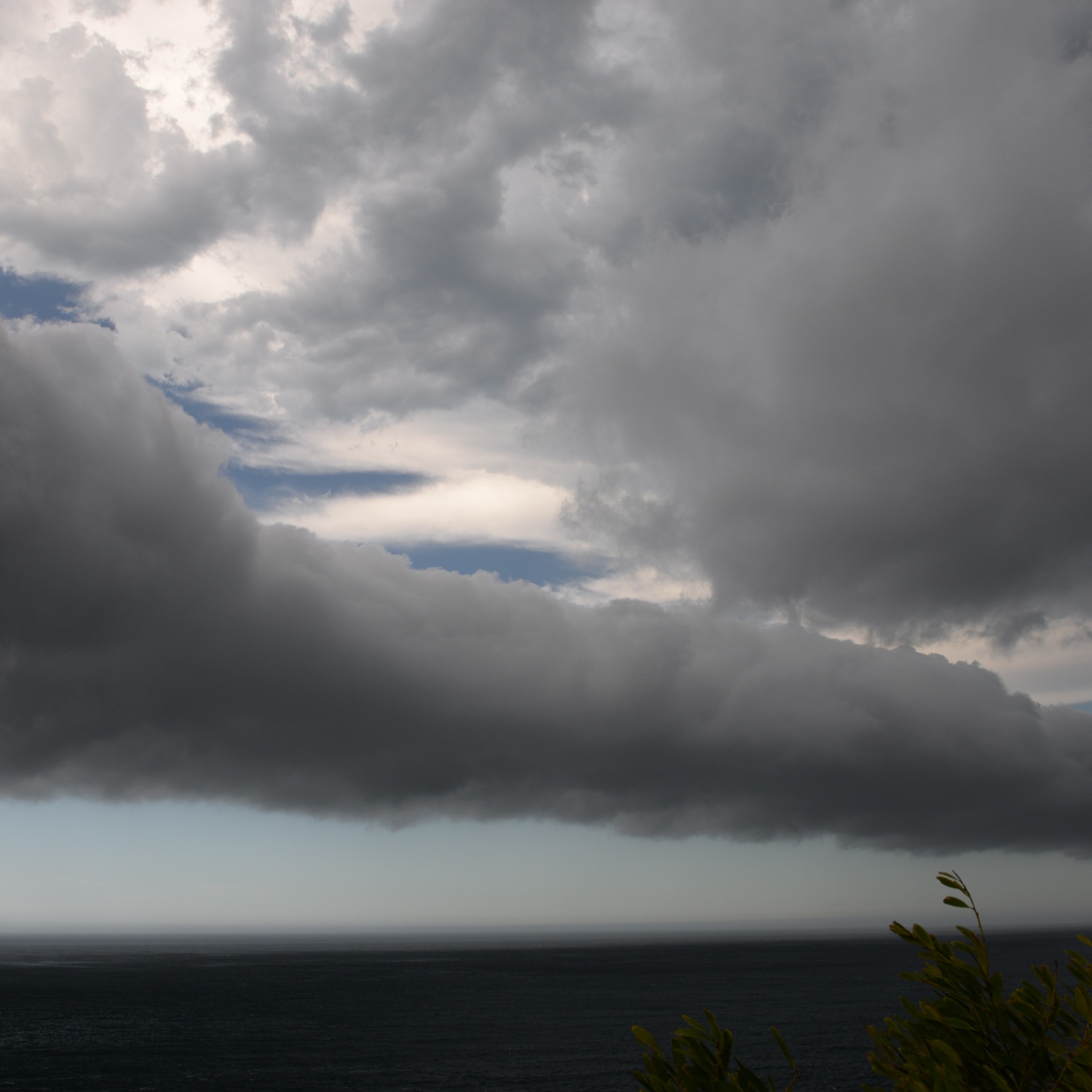
Michael Milenko (Member 35,154) felt a strong gust of wind and looked up to see this Stratocumulus volutus cloud ahead of a thunderstorm approaching Mona Vale, Sydney, Australia.
Stratocumulus volutus is also known as a roll cloud because it appears as a long, horizontal roll. It is caused by, but not attached to, the Cumulonimbus storm cloud that follows it. In the case of Michael’s volutus, the storm cloud was likely just behind and to the right of this view. Cold air dragged down by the heavy showers in the storm spreads out upon reaching the surface, forming what’s known as an outflow boundary as it burrows beneath the warmer air near the surface. If you’ve ever felt a sudden blast of cold wind a few minutes before an incoming storm, you’ve experienced an outflow boundary.
It is also known as a gust front. The gust of dense, cold air rushing out from the storm creates the horizontal roll of a volutus cloud by lifting the warmer, moister air into a rotating wave extending along its leading edge. Passing over a matter of minutes before the showers arrive, a volutus like this is nature’s way of warning that you’re about to get soaked.
