
Filter By:
Main Cloud Types
- Cumulus
- Stratus
- Stratocumulus
- Altocumulus
- Altostratus
- Cirrus
- Cirrocumulus
- Cirrostratus
- Nimbostratus
- Cumulonimbus
Other Clouds
- Arcus
- Asperitas
- Cap / banner clouds
- Capillatus
- Castellanus
- Cataractagenitus
- Cauda (Tail cloud)
- Cavum (Fallstreak hole)
- Congestus
- Contrail (homogenitus)
- Duplicatus
- Diamond dust
- Distrail
- Fibratus
- Flammagenitus (Pyrocumulus)
- Floccus
- Fluctus (Kelvin-Helmholtz)
- Fractus
- Homogenitus
- Horseshoe vortex
- Humilis
- Incus
- Intortus
- Lacunosus
- Lenticularis
- Mamma
- Morning Glory Cloud
- Murus (Wall cloud)
- Mediocris
- Nacreous
- Nebulosus
- Noctilucent
- Pannus
- Perlucidus
- Pileus
- Praecipitatio
- Radiatus
- Silvagenitus
- Spissatus
- Stratiformis
- 'Supercilium' (not official classification)
- Translucidus
- Tuba / Twister
- Uncinus
- Undulatus
- Velum
- Vertebratus
- Virga
- Volutus (Roll cloud)
Optical Effects
- 22° Halo
- 46° Halo
- Circumhorizon Arc
- Circumscribed halo
- Circumzenithal Arc
- Cloudbow / Fogbow
- Corona
- Crepuscular rays & shadows
- Diffuse arcs
- Green flash
- Glory
- Halos
- Helic arc
- Infralateral arc
- Iridescence
- Lower Sun Pillar
- Lower Tangent Arc
- Moonbow
- Moondogs
- Parhelic circle
- Parry antisolar arcs
- Parry arc
- Parry infralateral arc
- Parry supralateral arc
- Rainbow
- Sub parhelion
- Sub-sun
- Suncave parry arc
- Sun dog (Parhelion)
- Sun pillar
- Supernumerary bows
- Subparhelic circle
- Supralateral arc
- Upper tangent arc
- Wegener arc
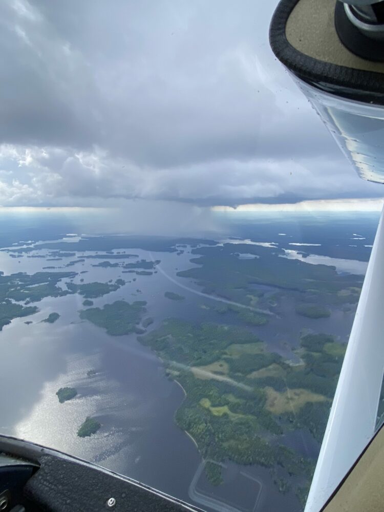
July 12, 2025
A view of the storm from a single engine Cessna at 4,500 feet above Lac du Flambeau, Wisconsin, US
[social_share]
Leave a Reply Cancel reply
You must be logged in to post a comment.
This site uses Akismet to reduce spam. Learn how your comment data is processed.
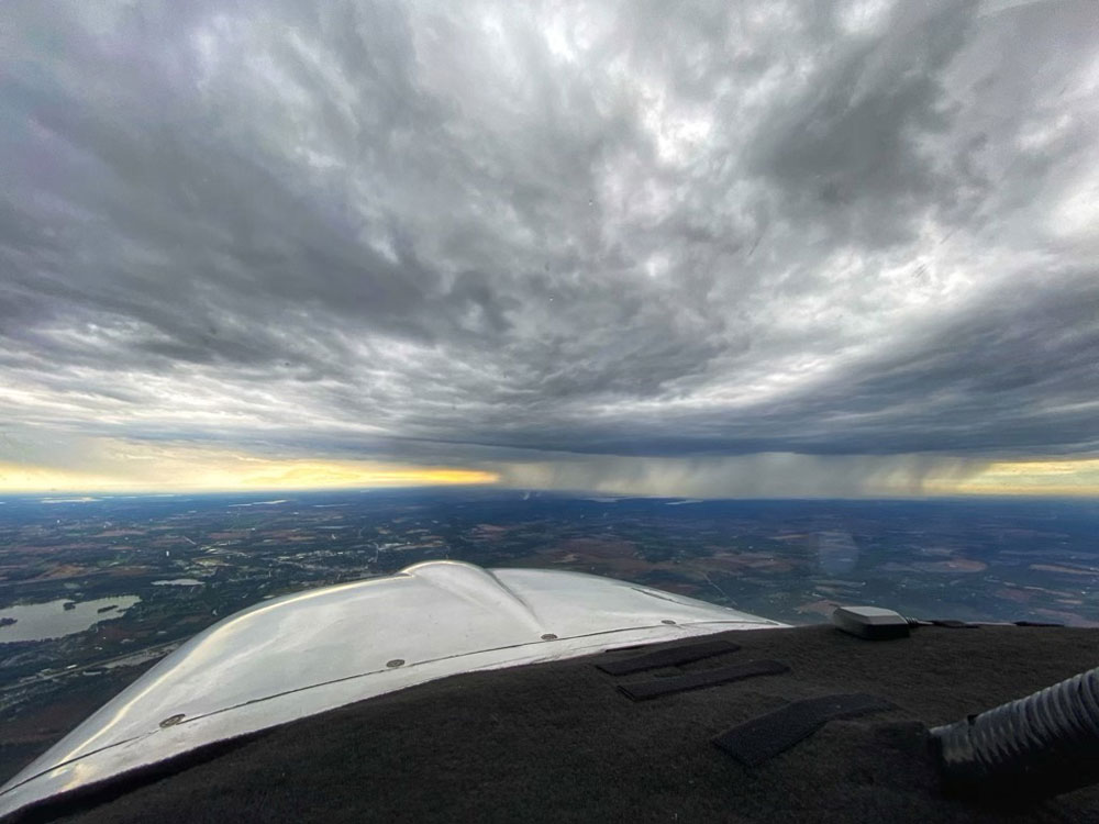
October 11, 2021
A precipitating storm system viewed from the flight deck over Southern Wisconsin, US.
[social_share]
Leave a Reply Cancel reply
You must be logged in to post a comment.
This site uses Akismet to reduce spam. Learn how your comment data is processed.

September 10, 2015
A storm cell over Illinois, US, spotted at 3,000 ft through the port window of a Piper Pawnee.
[social_share]
3 thoughts on “Michael Purpura”
Leave a Reply Cancel reply
You must be logged in to post a comment.
This site uses Akismet to reduce spam. Learn how your comment data is processed.

I watched that cell form over a period of 5 hours from a small cumulus cloud. The last glider I towed that day could be seen clearly against the grey wall of the storm cell, it’s 50′ white wings flashing as it worked the thermals outside of the cell. I wish I could have taken more photos.
Weather is fascinating and powerful.
Good point of observation. Near of the wild side of the weather!.
Hope you made it back to base safe and sound, Michael. Good shot!
Laurence