
Filter By:
Main Cloud Types
- Cumulus
- Stratus
- Stratocumulus
- Altocumulus
- Altostratus
- Cirrus
- Cirrocumulus
- Cirrostratus
- Nimbostratus
- Cumulonimbus
Other Clouds
- Arcus
- Asperitas
- Cap / banner clouds
- Capillatus
- Castellanus
- Cataractagenitus
- Cauda (Tail cloud)
- Cavum (Fallstreak hole)
- Congestus
- Contrail (homogenitus)
- Duplicatus
- Diamond dust
- Distrail
- Fibratus
- Flammagenitus (Pyrocumulus)
- Floccus
- Fluctus (Kelvin-Helmholtz)
- Fractus
- Homogenitus
- Horseshoe vortex
- Humilis
- Incus
- Intortus
- Lacunosus
- Lenticularis
- Mamma
- Morning Glory Cloud
- Murus (Wall cloud)
- Mediocris
- Nacreous
- Nebulosus
- Noctilucent
- Pannus
- Perlucidus
- Pileus
- Praecipitatio
- Radiatus
- Silvagenitus
- Spissatus
- Stratiformis
- 'Supercilium' (not official classification)
- Translucidus
- Tuba / Twister
- Uncinus
- Undulatus
- Velum
- Vertebratus
- Virga
- Volutus (Roll cloud)
Optical Effects
- 22° Halo
- 46° Halo
- Circumhorizon Arc
- Circumscribed halo
- Circumzenithal Arc
- Cloudbow / Fogbow
- Corona
- Crepuscular rays & shadows
- Diffuse arcs
- Green flash
- Glory
- Halos
- Helic arc
- Infralateral arc
- Iridescence
- Lower Sun Pillar
- Lower Tangent Arc
- Moonbow
- Moondogs
- Parhelic circle
- Parry antisolar arcs
- Parry arc
- Parry infralateral arc
- Parry supralateral arc
- Rainbow
- Sub parhelion
- Sub-sun
- Suncave parry arc
- Sun dog (Parhelion)
- Sun pillar
- Supernumerary bows
- Subparhelic circle
- Supralateral arc
- Upper tangent arc
- Wegener arc
A variety of Cumulus cloud formations over Kemerovo, Russia

Primary and secondary bows spotted near Mercogliano, Avellino, Italy
Leave a Reply Cancel reply
You must be logged in to post a comment.
This site uses Akismet to reduce spam. Learn how your comment data is processed.
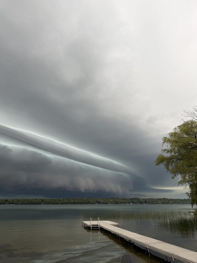
An arcus indicating the leading edge of a thunderstorm, spotted near Maple City, Michigan, US
Leave a Reply Cancel reply
You must be logged in to post a comment.
This site uses Akismet to reduce spam. Learn how your comment data is processed.

Signs of a large horseshoe vortex spotted after a hot and humid day in Penrith, Cumbria, England
Leave a Reply Cancel reply
You must be logged in to post a comment.
This site uses Akismet to reduce spam. Learn how your comment data is processed.

Mammatus (Mamma) spotted over Saeeda Al-Sawaleha, Saudi Arabia
Leave a Reply Cancel reply
You must be logged in to post a comment.
This site uses Akismet to reduce spam. Learn how your comment data is processed.

Altocumulus lenticularis duplicatus spotted by John's friend, Paddy Slattery, near Castlegregory, Co. Kerry, Ireland
Leave a Reply Cancel reply
You must be logged in to post a comment.
This site uses Akismet to reduce spam. Learn how your comment data is processed.

A whale in the sky, spotted over Fort Myers Beach, Florida, US
Leave a Reply Cancel reply
You must be logged in to post a comment.
This site uses Akismet to reduce spam. Learn how your comment data is processed.
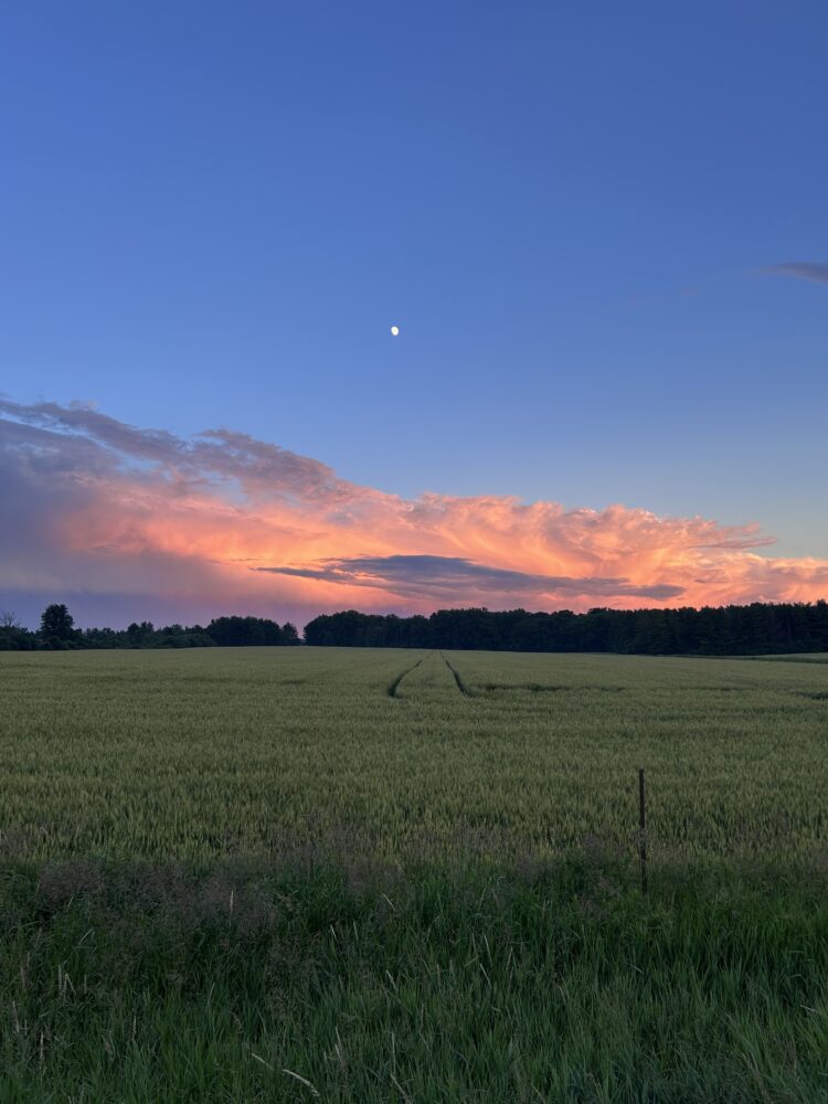
A notable storm in the distance, spotted at sunset, north of London, Ontario, Canada
Leave a Reply Cancel reply
You must be logged in to post a comment.
This site uses Akismet to reduce spam. Learn how your comment data is processed.

Altocumulus perlucidus spotted over Little Berkhampstead, East Hertfordshire, England
Leave a Reply Cancel reply
You must be logged in to post a comment.
This site uses Akismet to reduce spam. Learn how your comment data is processed.
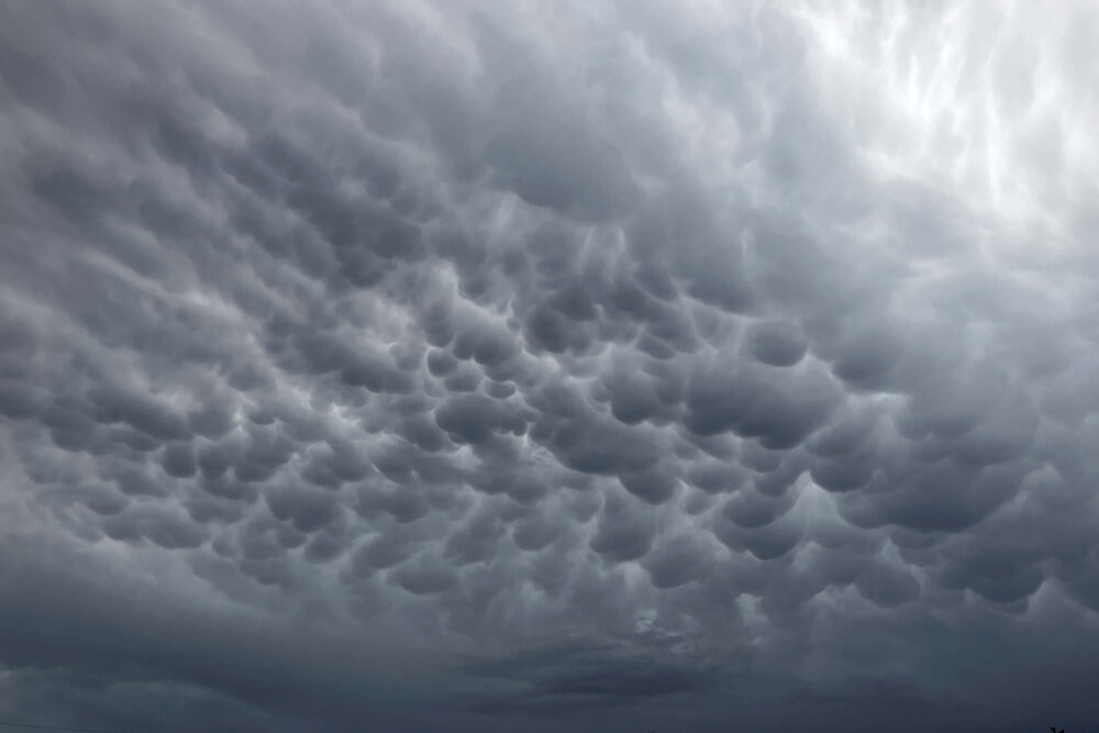
Mammatus (Mamma) spotted over Albuquerque, New Mexico, US
Leave a Reply Cancel reply
You must be logged in to post a comment.
This site uses Akismet to reduce spam. Learn how your comment data is processed.
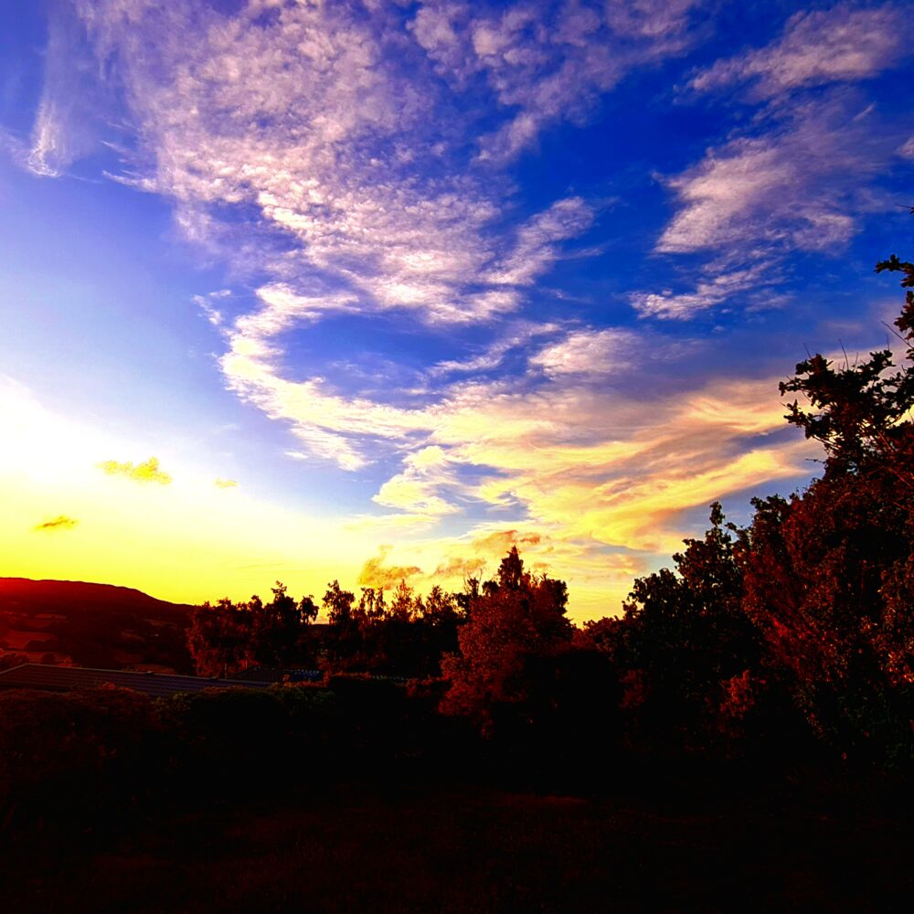
Sunset over Conwy, North Wales
Leave a Reply Cancel reply
You must be logged in to post a comment.
This site uses Akismet to reduce spam. Learn how your comment data is processed.
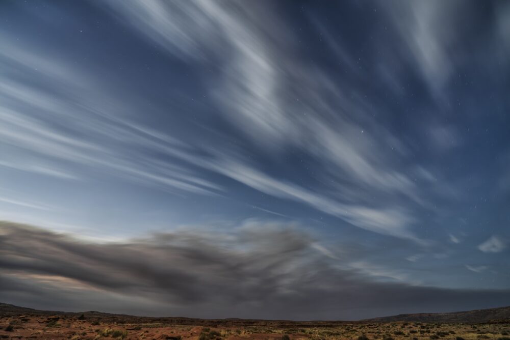
A mixture of clouds and wildfire smoke in this 90-second exposure photograph near Bluff, Utah, US
Leave a Reply Cancel reply
You must be logged in to post a comment.
This site uses Akismet to reduce spam. Learn how your comment data is processed.
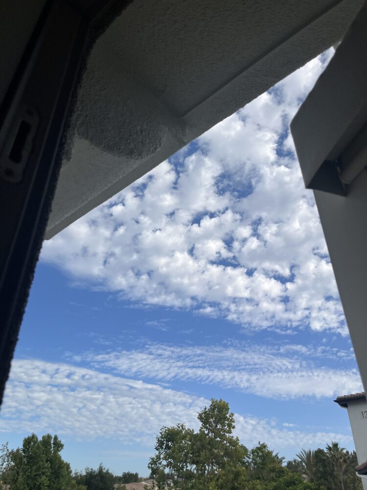
Altocumulus over Temecula, California, US
Leave a Reply Cancel reply
You must be logged in to post a comment.
This site uses Akismet to reduce spam. Learn how your comment data is processed.
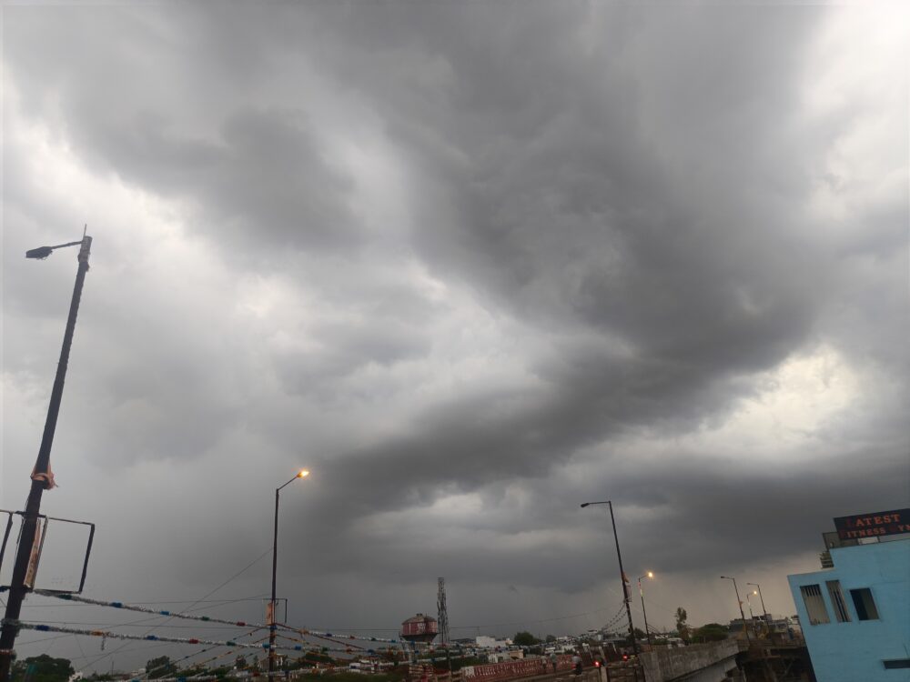
A storm system near Guna, Madhya Pradesh, India
Leave a Reply Cancel reply
You must be logged in to post a comment.
This site uses Akismet to reduce spam. Learn how your comment data is processed.
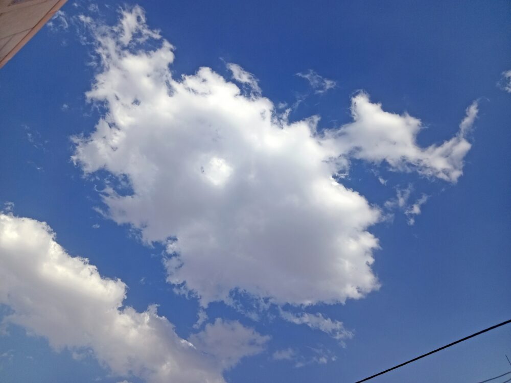
Cumulus spotted over Esfahan, Iran
Leave a Reply Cancel reply
You must be logged in to post a comment.
This site uses Akismet to reduce spam. Learn how your comment data is processed.
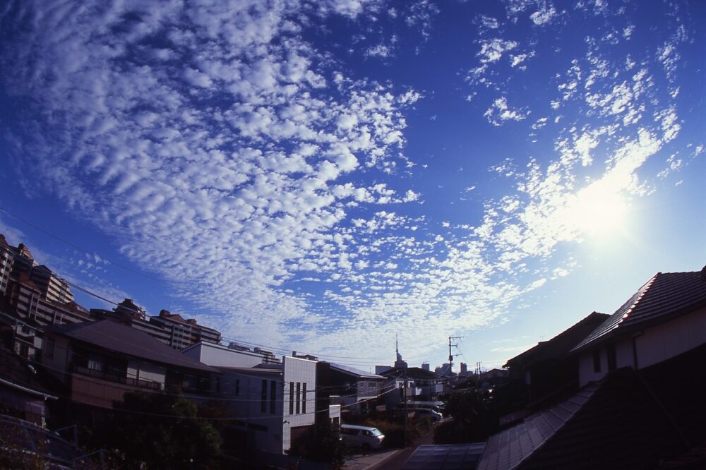
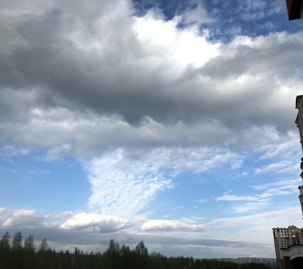
Altocumulus spotted shortly after sunrise over Toyohama, Fukuoka City, Japan
Leave a Reply Cancel reply
You must be logged in to post a comment.
This site uses Akismet to reduce spam. Learn how your comment data is processed.
