Mammatus
Forums › The Cloud Forum › Mammatus
Tagged: Mammatus
- This topic has 5 replies, 5 voices, and was last updated 8 years, 11 months ago by
 Hans Stocker.
-
AuthorPosts
-
-
March 11, 2017 at 11:16 am #199560
Samuel Stead
ParticipantToday I’ve got a story to tell. Last September, there was a really big storm where I live. Lots of rain and lightning. But the clouds were quite interesting, basically a really lumpy underside. I know my clouds, so I knew these were mammatus. Unfortunately, although I do know their association with tornadoes, I don’t know much about them. Anyone know any facts?
Note:I’m afraid I didn’t get a picture myself, but if I find one from that day, I’ll link it here.
-
March 12, 2017 at 4:47 am #199657
 Michael LerchParticipant
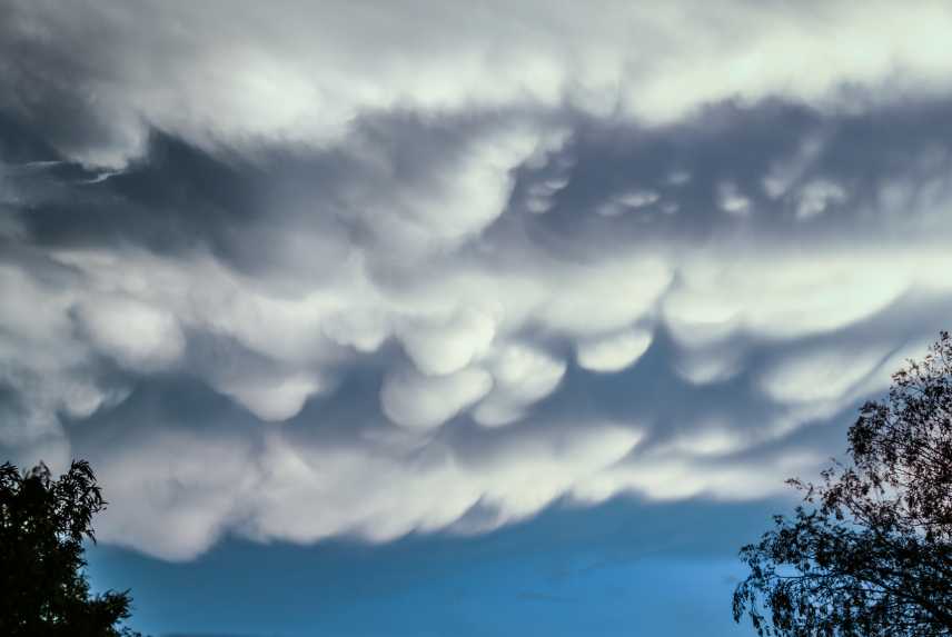
Samuel, I’ve read that even the experts aren’ t positive with whats going on with Mammatus..I’ve read that they proceed a storm then go outside and see them ahead of a storm. I see a lot of Mammatus in the Phoenix weather . Usually they are patchy, that is in a small area or as said at an end of a large system But I have photos showing a span of several miles of Mammatus. As far as relationship with tornadoes,,,,below is a shot of Mammatus I took from my backyard, while the local weather folks were sounding a Tornado Watch on the media. Thats as close as I want to be witnessing any relationship between Mammatus and Tornadoes. When I was in Kansas the same seemed to happen a lot. Tornado Watch was announced and Mammatus was in the sky. Both happen when a heavy duty system unleashes itself. But Mammatus doesn’t have to have a heavy duty cyclonic cell to happen .

-
March 12, 2017 at 1:03 pm #199690
 George PreoteasaParticipant
Samuel,
The general explanation is that mammatus are caused by sinking air. With the intense convection in a cumulonimbus cloud is, there has to be some downward air motion.
The page below says that the mammatus appear typically after the storm has passed. So if a tornado did not occur, you would be safe.
http://ww2010.atmos.uiuc.edu/(Gh)/guides/mtr/cld/cldtyp/oth/mm.rxml
But in the diagrams in this Wikipedia article, I see mammatus both ahead of the storm and behind:
https://en.wikipedia.org/wiki/Supercell
So there you have it :-)
-
March 20, 2017 at 2:54 am #200656
 Michael LerchParticipant
Recently I Caught This Progression. The 1st pic I took because it appeared the clouds had collided. The Cloud on the right is showing virga type trails streaming downward with hints of mammatus in the center of the pic, the point of collision. The 2nd shot was taken several minutes later, up to ten minutes later. Same cloud yet mammatus seems to weigh it down. There is still some virga visible on the opposite end.


-
March 24, 2017 at 4:42 pm #201600
David Worth
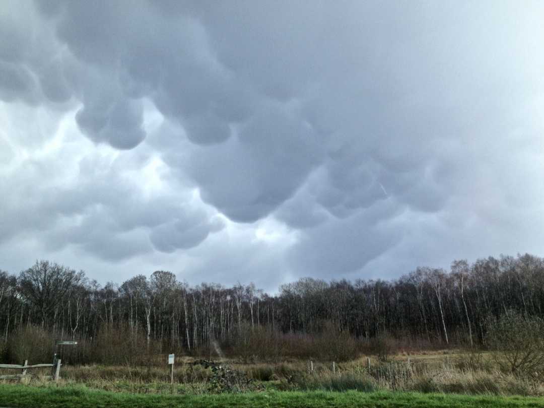
ParticipantI spotted this mammatus cloud formation after returning from Spain and landing at Gatwick, UK on a day when there was quite a lot of cumulous activity and sharp showers in the UK. The flight was a fairly bumpy ride back from Spain and we had to keep our seat belts fastened for much of the flight because of clear air turbulence.
The photo was snatched in a stationary traffic near Esher in Surrey. The mammatus was at the front edge of a cumulus cloud formation system which was moving quite fast. We don’t see a lot of such well defined mammatus in the UK, so I was quite pleased with this spot.

Littleworth Common, Esher, United Kingdom, 5 March 2017 12:47
-
March 28, 2017 at 9:46 am #202255
 Hans StockerParticipant
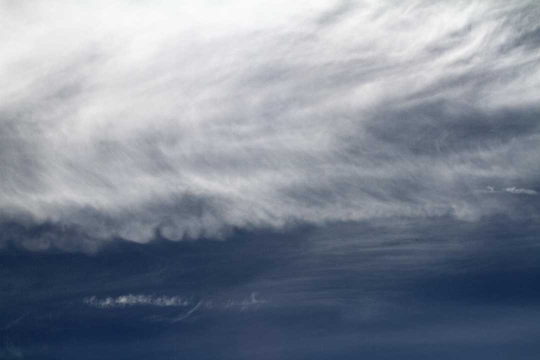
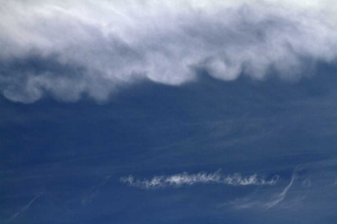
To all: nice spottings! It is interesting to read about the circumstances mamma develops. The sequence Michael posted is intriguing. Last weekend I spotted some mamma but in a rather unusual setting (I think). Only cirrus clouded the sky and a lot of contrail. It was mainly sunny and a spring-warm day due to a anticyclone that dominated the weather. Beside the frail cirrus structures also larger patches of Cirrus spissatus showed and to my surprise there was this mamma underneath.

close up

-
-
AuthorPosts
- You must be logged in to reply to this topic.


