

The low block of cloud that can appear at the highly turbulent inflow region of a large storm is known as a murus, or wall cloud. The feature develops at the back of an advancing storm, like its rear bumper, or fender, marking the region where no precipitation is falling but instead strong updrafts of warm, moist air near the ground are being sucked up into the storm, fuelling its growth. With such a rush of up-flowing air, a wall cloud is liable to sprout ‘tubas’, rotating fingers of cloud that descend from its base when the airflows develop spin. The murus feature at the storm’s rear is therefore, the breeding ground for landspouts, waterspouts and fully-fledged tornadoes. Tail-gating this particular cloud is not recommended.
Altitude: Low

When Stratus clouds or Cumulus clouds appear as broken fragments, they are known by the species fractus. And while all example of fractus clouds are united by their frayed, shred-like appearance, they can form in a number of quite different ways.
Cumulus fractus is the more straightforward. This is when a fair-weather Cumulus cloud is just beginning to form or is in the process of dissipating away. In both cases, the cloud lacks the crisp outlines and solid appearance of a fully-fledged Cumulus, looking instead rather more wispy and translucent. When viewing photographs, cloudspotter have been known to confuse Cumulus fractus with the high, wispy trails of ice crystals known as Cirrus.The distinction is clearer viewing the cloud in reality, since the fractus formation is much lower and soon changes either into Cumulus or just clear air.
The fractus form of Stratus tends to appear in two contexts. One is in the form of dark shreds beneath a raincloud. This form of Stratus fractus has the more specific name of pannus. The other appears as wisps of cloud snagging on hillsides, where they catch in the trees, forming as damp air gently ascends up the slopes.

Don’t get too excited about adding pannus to your cloud collection. When you do spot one, you’re likely to be rather underwhelmed, for they aren’t good-lookers. Loitering in the saturated atmosphere just below rain clouds, they resemble some sort of cloud version of hoodies, killing time outside McDonald’s on a Saturday night. These dark shreds of cloud, strictly classified as a type of Stratus fractus, give the sky a threatening air. The atmosphere below a precipitating cloud can become very humid, on account of all the moisture falling through it. Only the slightest rising gust can then cool the air enough for some of this moisture to condense into tiny droplets, which hang around as wisps of thin cloud.
If it is not raining or snowing when you notice dark shreds of pannus below a forbidding sky, you can be confident that it very soon will be. Pannus are the five-minute-precipitation warning of the cloud world.
As with the kids on the High Street, the sinister appearance of pannus clouds owes a lot to their surroundings. The shreds of cloud need only be thick enough to block a little light for our eyes to register them as darker than the thick, dark rain clouds above. Away from their precipitous context, pannus would be seen for the weedy wisps that they are. The same could be said of the prepubescent 14-year-olds, once stripped of their mates and hoods.
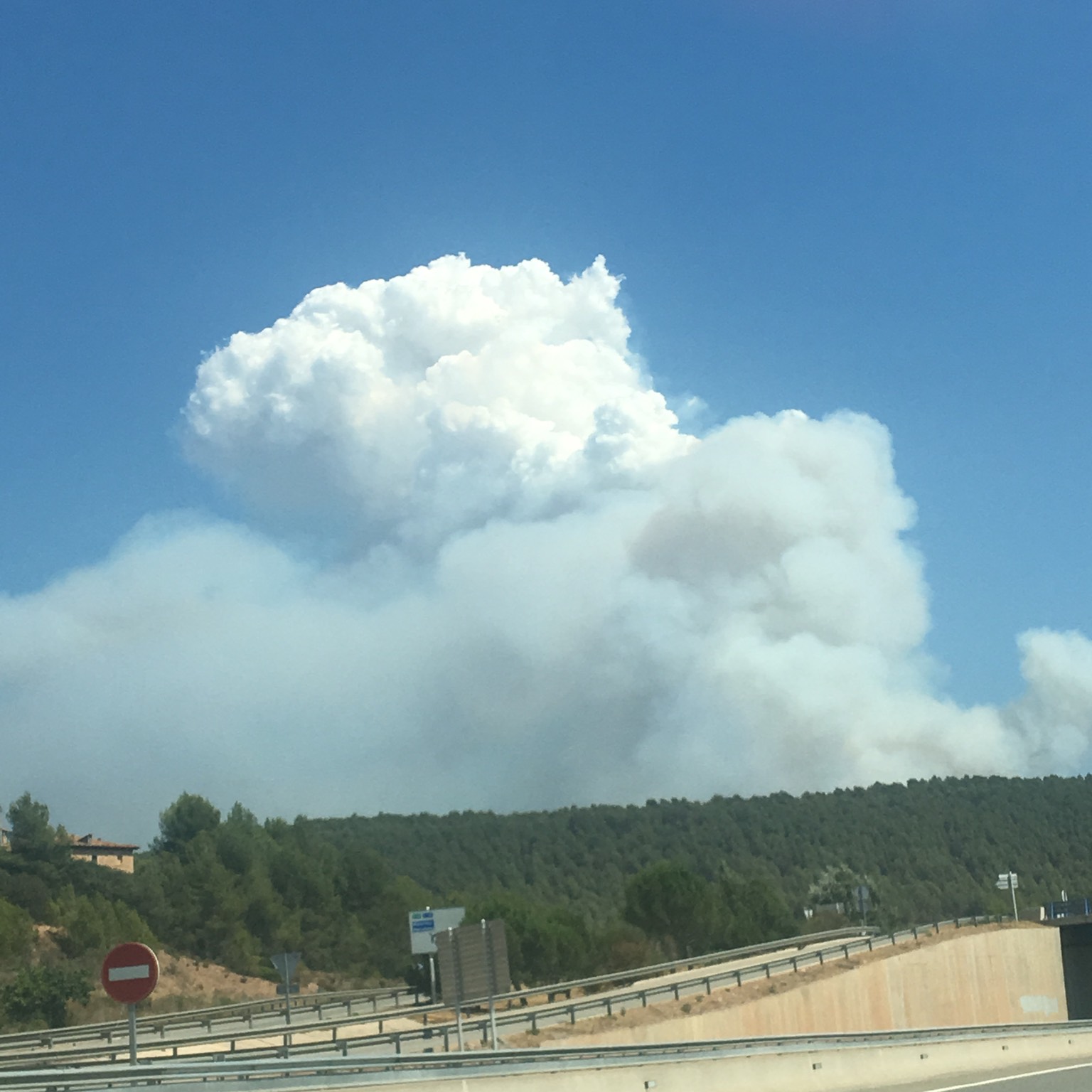
When clouds form in the columns of air above forest fires, they are known as pyrocumulus. Anything hot enough to produce strong convection currents can give rise to clouds so long as there is enough moisture around. Large volcanic eruptions can lead to pyrocumulus clouds too. Either way, pyrocumulus can sometimes grow large enough to produce thunder and lightning or tuba cloud features that can develop into landspouts or waterspouts. The more technical name for pyrocumulus clouds formed over wildfires or volcanoes would be Cumulus flammagenitus and, when they develop enough to produce precipitation and lightning, Cumulonimbus flammagenitus (which people sometimes describe as pyrocumulonimbus).
Pyrocumulus can also form over the cooling towers of power stations. These too produce heat and water vapour, which when the air is cool enough can condense into droplets of cloud. Technically speaking, you’d call these manmade ones Cumulus homogenitus.
Forest fires, volcanoes and power stations also introduce countless microscopic particles into the air. These act as condensation nuclei – tiny seeds onto which the water droplets start to condense. With such a plentiful supply of these condensation nuclei, pyrocumulus tend to consist of very plentiful and small droplets. This, along with all the larger particles of ash or smoke, gives the cloud a very dense, sometimes yellowish, appearance.

Asperitas is a rare formation that seems to form in the vicinity of Cumulonimbus storm systems. It can be thought of as an undulatus gone crazy. Asperitas differs from undulatus by the fact that its waves are more chaotic and disorderly, lacking any of the regularity and organisation typical of undulatus. The chaotic waves of asperitas have a more crisply defined base, which sometimes descends into pointed features, resembling upside-down peaks of meringue. When the waves cause varying thickness of the cloud layer, the sunlight passing through it can lead to dramatic patches of bright and dark.
This formation was only recognised as an official cloud classification in 2017, when the World Meteorological Organisation added it to the International Cloud Atlas, their official reference for cloud identification. It had first been proposed as a new cloud type by the Cloud Appreciation Society in 2008 and it acceptance as an official type was due largely to the examples submitted by members of the Cloud Appreciation Society.
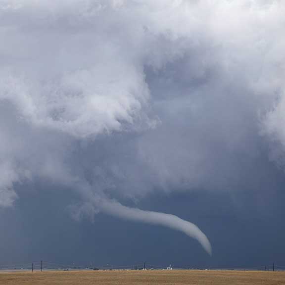
The air below a storm cloud is often a wild confusion of blustery, gusty and not-at-all-tranquil winds. But when the storm develops from a single Cumulonimbus cloud into a co-ordinated system, known as a multicell or supercell storm, the mêlée of air currents becomes much more organised. This is when a tuba can form.
Resembling a cloud finger descending from the storm’s base, the tuba forms in the air sucked upwards into the storm to feed its vigorous vertical growth. Like an upside-down version of bath water going down a plug hole, the rising air can start rotating in a vortex. In a big storm cell, the rapidly rising air expands and cools enough for some of its moisture to condense to form the walls of the tuba. Also known as a ‘funnel cloud’, it can be the birth of a tornado.
A tuba can also form when the air is not rising but sinking from the base of individual clouds, such as Cumulus congestus and Cumulonimbus. Dragged towards the ground by the cloud’s heavy showers, this sinking air can cause vortices to form. These are rarely as violent as the upward ones, so tubas are less pronounced. They herald not tornadoes, but the less ferocious landspouts or waterspouts.
Whatever a tuba is heralding, keep your distance when adding it to your cloud collection – just in case it has a mind to add a CloudSpotter to its own collection of flying debris.
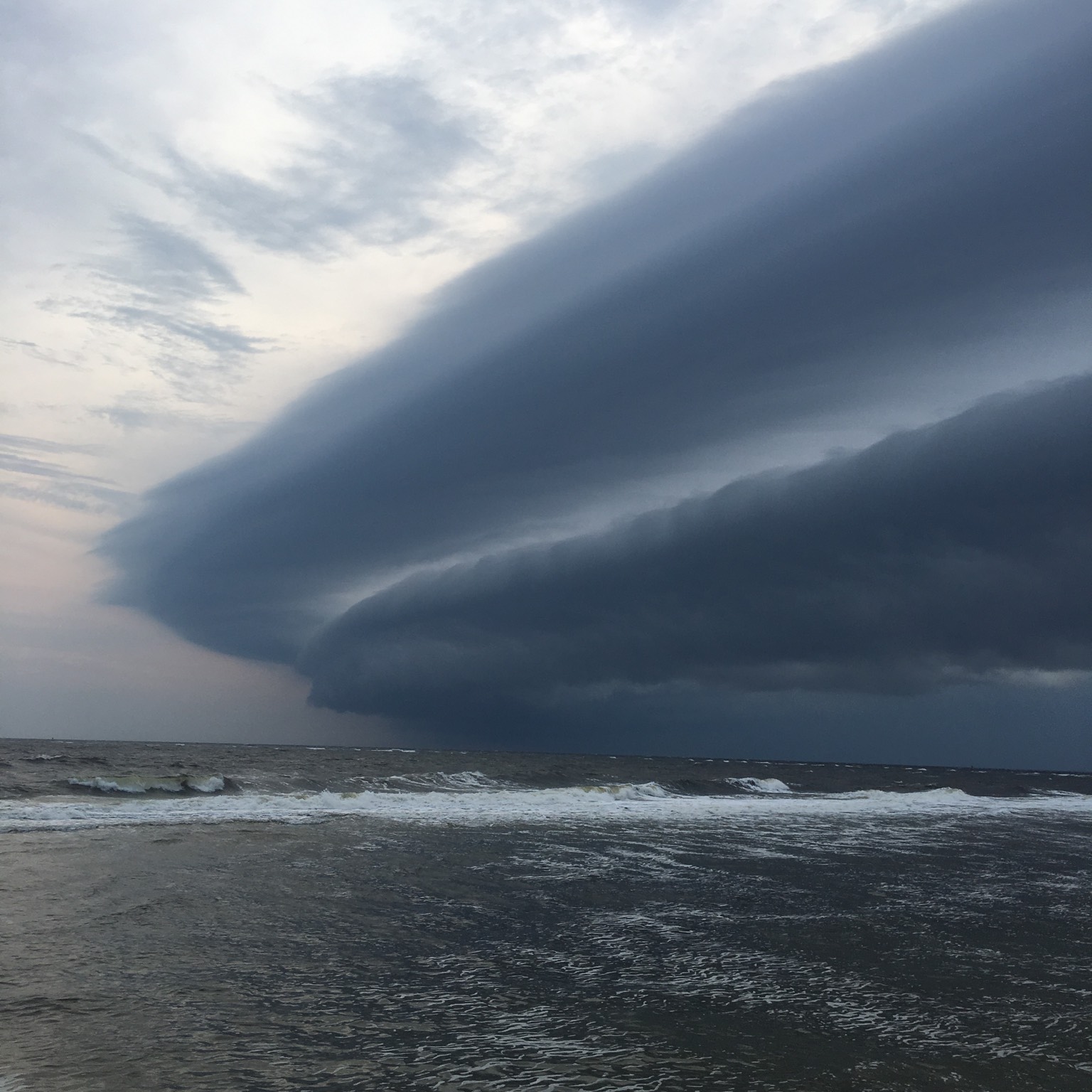
Storm chasers tend to have an abundance of arcus in their collections, for this formation, also known as a shelf cloud, is rather like the front bumper, or fender, of a storm cloud. It is a long, dark, horizontal roll or shelf running along the base of the storm cloud’s front edge (around the registration plate). So the shelf cloud is the first cloud feature to arrive as the storm runs you over.
Like those other brute-cloud groupies, tuba and incus, arcus hang out only in the company of hefty Cumulus congestus or Cumulonimbus clouds or those most brutish of all cloud systems, the fierce multicell and supercell storms. They form as the cold air that is dragged down by all the precipitation falling within the storm splays outwards upon reaching the ground. As it spreads around the storm, it burrows beneath the warmer, less-dense air at ground level. This is lifted most forcefully in the direction of the cloud’s movement, forming a ‘gust front’, in which the warmer air’s moisture can condense into water droplets that appear as the shelf of cloud.
More rarely, the lifting motion can cause a wave of rising and falling air that races ahead of the storm, causing a roll cloud, or volutus, which travels ahead of and separate from the storm.
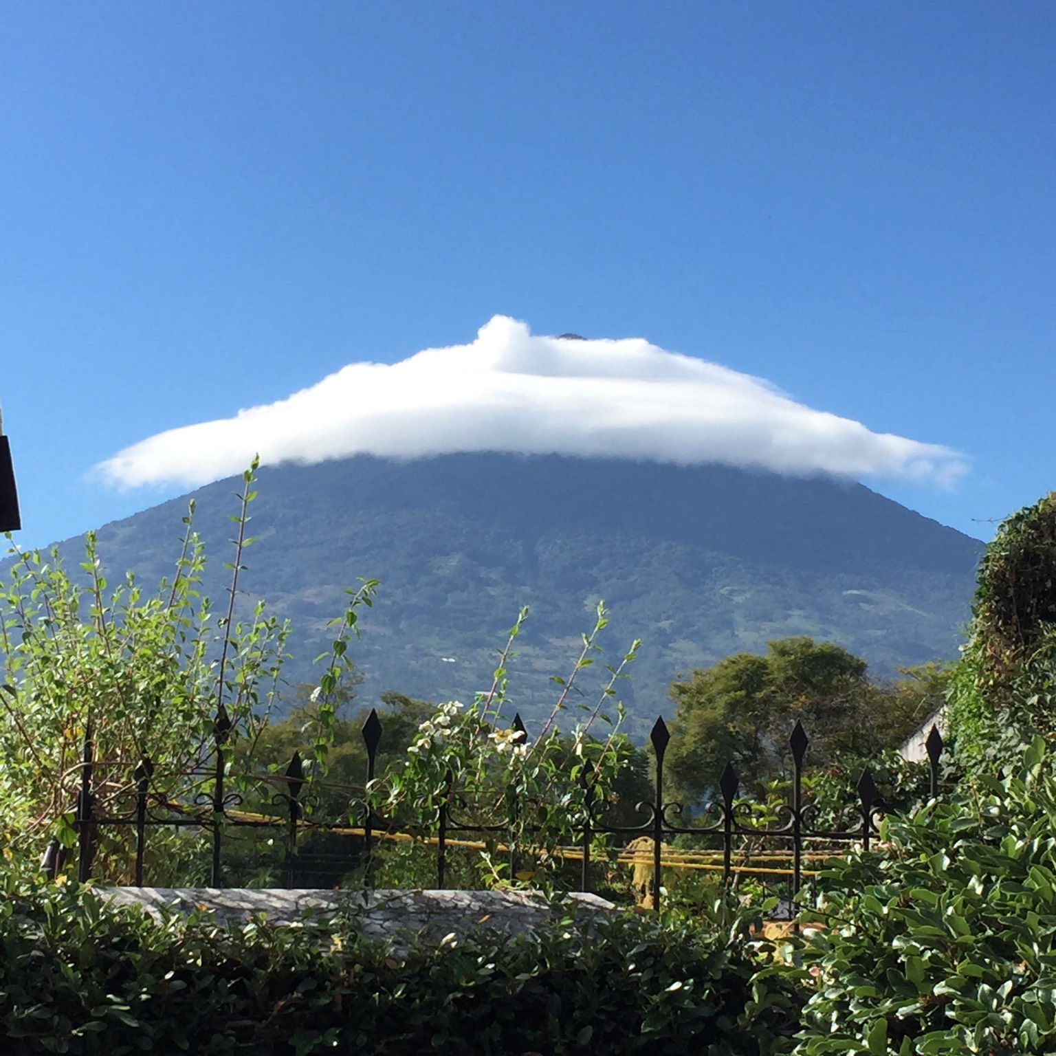
A cap cloud tends to look like an enormous hat, perched upon the mountain’s head. Sometimes it looks like a humble skullcap. Other times, it splays out in a full mother-in-law-at-a-wedding extravaganza. Occasionally, the mountain seems to be wearing one hat on top of another, which is surely a mountain fashion faux-pas. Whichever it is, a cap cloud forms as a stable airstream rises to pass over a peak, cooling as it does so. It is a particular example of a lenticularis cloud, in which the cloud lies over the mountaintop, rather than downwind from it.
CloudSpotters should be careful not to add the wrong cloud to their collections. Clouds such as Stratus or Stratocumulus clinging to mountaintops won’t do. Only a smooth, jaunty cloud hat will count.
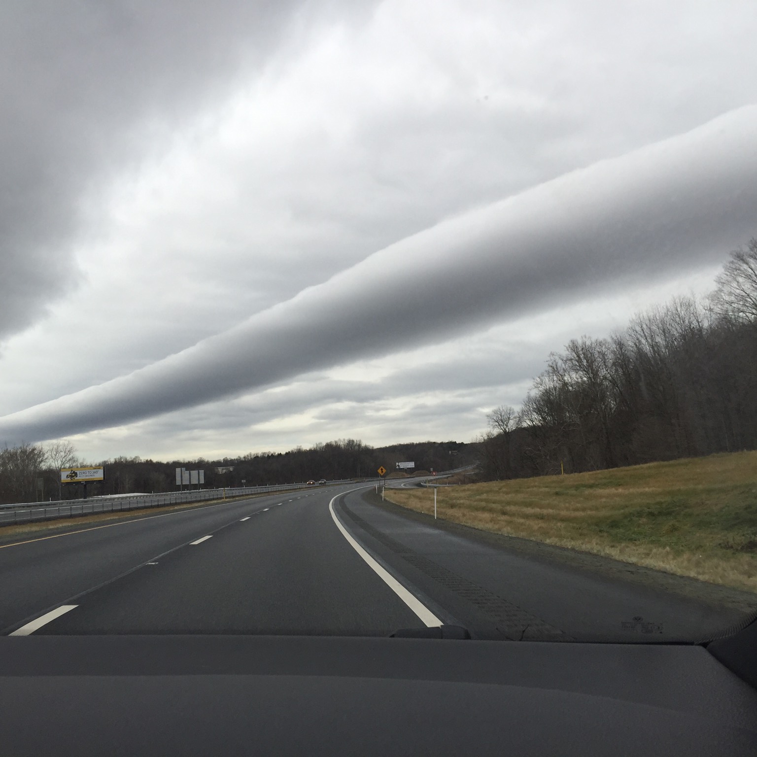
This is a long, low tube of cloud, which can appear to extend horizontally from horizon to horizon. Known more generally as a roll cloud, it often has a very smooth, silky surface. At other times, it can appear quite rough and bumpy. Volutus can move at speeds of up to 35mph (55km/h), with the roll appearing to rotate as it travels along. The direction of rotation is not as it would be for a solid tube rolling along the ground. In fact, the roll cloud rotates against its direction of travel – the cloud surface lifting at the front and dropping down at the back.
One famous volutus, the Morning Glory cloud, appears in Northern Queensland, Australia. This forms in a solitary wave of air and is caused by colliding sea breezes over the Cape York Peninsula. Volutus are often associated with sea breezes, and so they tend to be found in coastal waters. At other times, volutus are caused by storm systems. In this case they are rather like arcus, or shelf clouds, that have become detached from the storm system that produced them. As the storm dissipates, gusting winds of cold air can continue to spread out ahead of it, and form a roll of cloud that separates away from the rest of the storm.
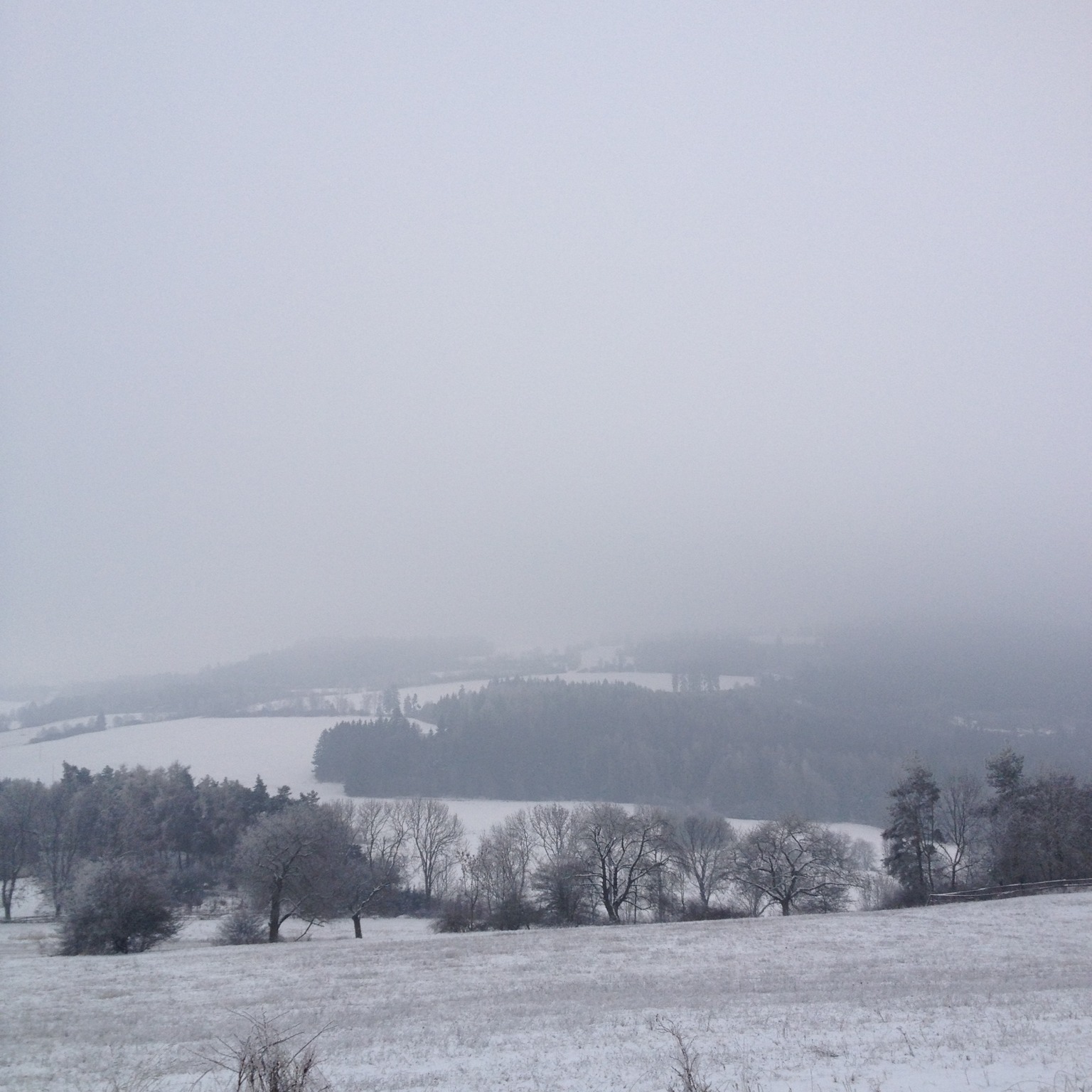
The lowest-forming of all the cloud types, Stratus can give you a strangely claustrophobic feeling, even though you’re outside. It is a featureless, grey overcast layer, which lurks around with its base generally no higher than 1,500ft from the ground. This is much lower than its equally charisma-free cousin, the Altostratus cloud. Stratus can sometimes obscure the tops of tall buildings. When a cloud like this forms so low that it is at ground level, it is known as fog or mist. Since fog can sometimes form in a different way from airborne Stratus, it has a page of its own.
One way that Stratus forms is when moist air cools as it blows over a relatively cold surface, such as a cold sea or land covered in thawing snow (‘advection fog’ is formed in the same way when winds are gentler). Another is when air cools as it rises. This might be as it blows up the lower slopes of a mountainside or as warmer air slowly rides up over a region of colder (denser) air. Finally, Stratus can appear when fog, which has formed overnight, lifts from the ground as it is stirred by a freshening wind.
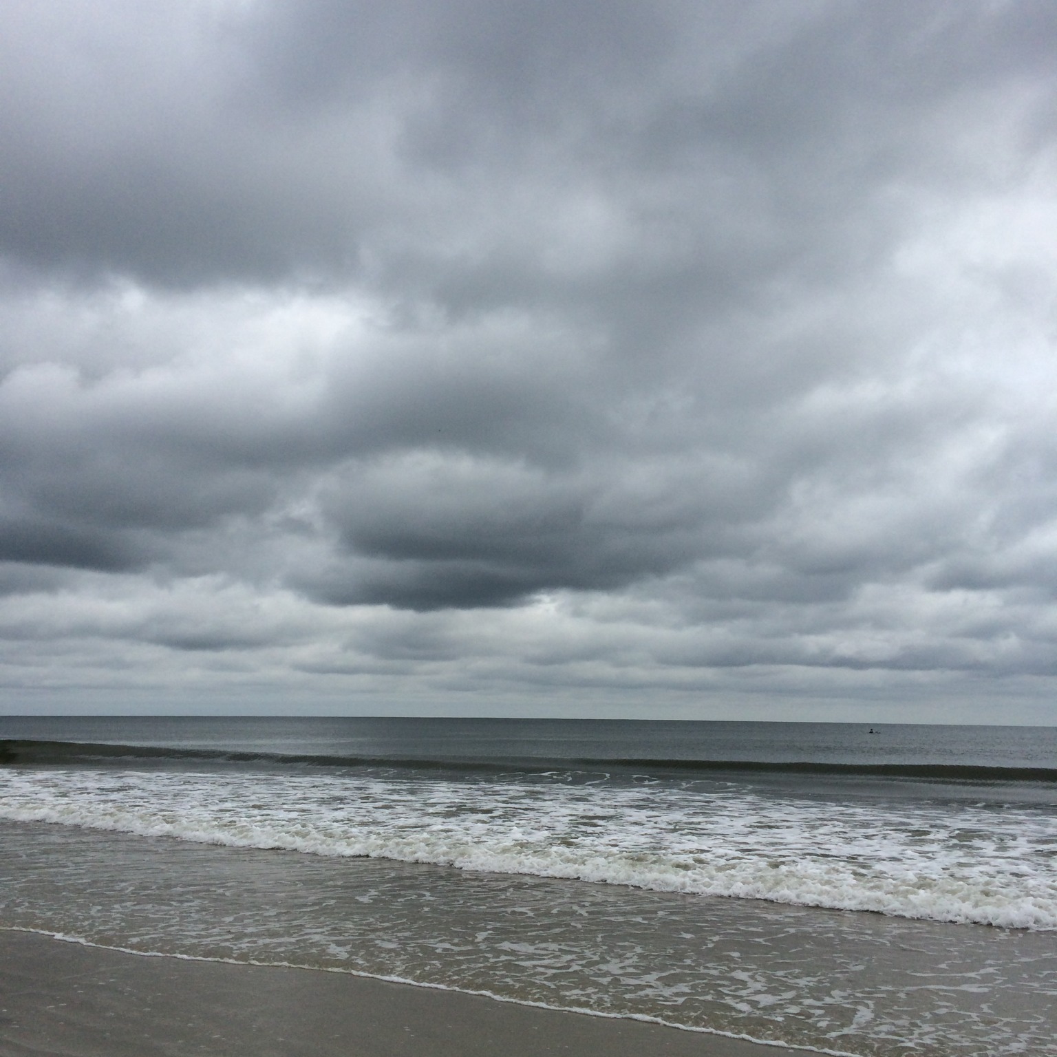
The most widespread of all cloud types, Stratocumulus is a low layer or patch of cloud that has a well-defined, clumpy base. The patches are either joined up, or have gaps in between. When the sky is overcast, and the cloud base appears to be low, with tones from white to dark grey, cloudspotters can confidently add Stratocumulus to their cloud collections.
High Stratocumulus that have cloudlets with gaps in between – a variety known as perlucidus – can be confused with the mid-level cloud Altocumulus. But Stratocumulus is usually less orderly in appearance and its cloudlets are bigger (appearing larger than the width of three fingers, held at arm’s length, when they are more than 30˚ above the horizon). Due to its sun-blocking tendencies, Stratocumulus may not be the most popular cloud, but it is one of the most varied.
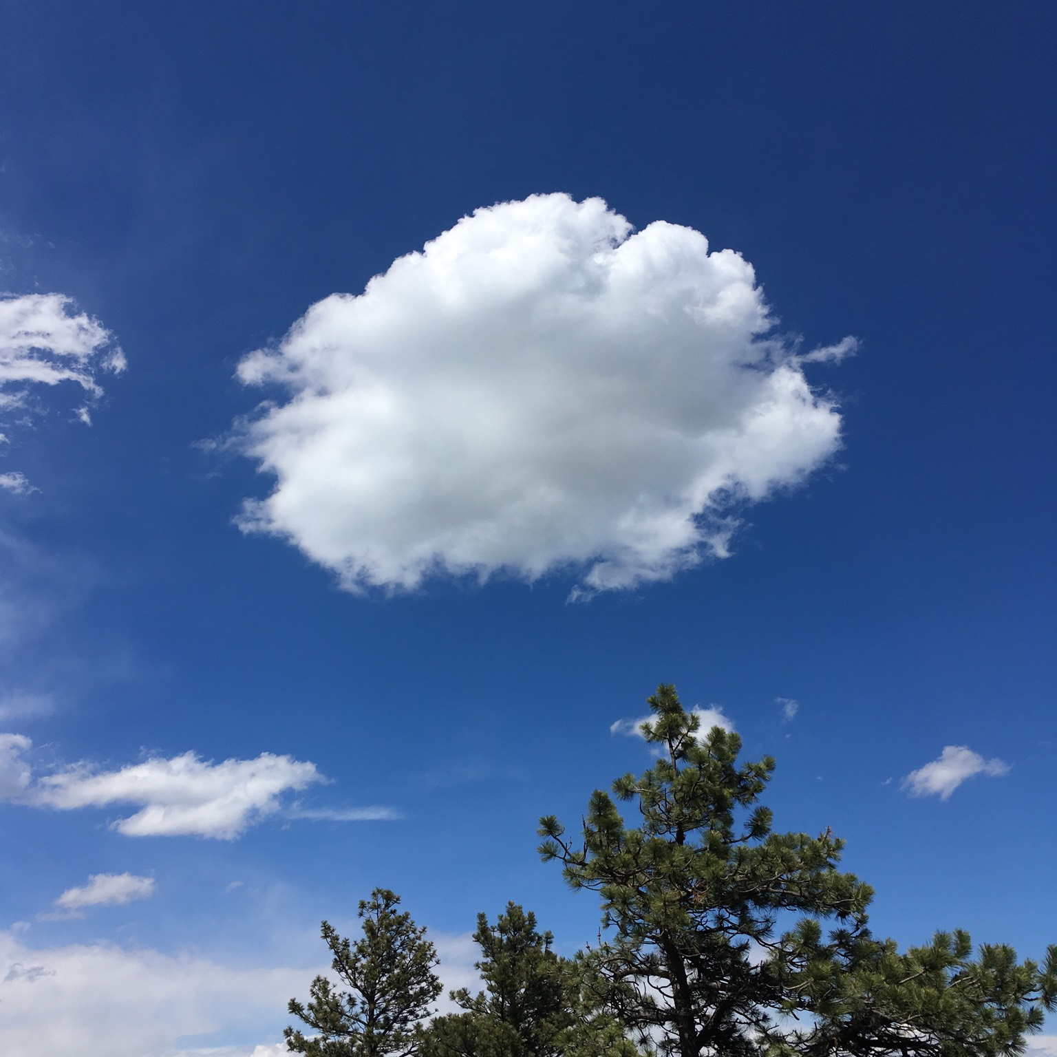
If you’ve never spotted a Cumulus cloud, then you need to get out more. This has to be one of the easiest types to add to your cloud collection. Cumulus clouds are the cotton-wool puffs, with flat bases, that drift lazily across the sky on a sunny day. Generally forming a few hours after daybreak, they tend to dissipate before sundown, for they form on thermals – invisible columns of air rising from the ground as it is warmed by the sun.
Most forms of Cumulus produce no rain or snow, and so are known as fair-weather clouds. But in unstable air, their bright, crisp cauliflower mounds can build upwards so that they develop from the small humilis species, through mediocris to the largest form, Cumulus congestus. With its ominous, shadowy base, this cloud is no longer fair-weather. Congestus can produce brief but sizeable showers, and can keep growing into fierce Cumulonimbus storm clouds.
The little ones, by contrast, are scary only when they take the form of David Hasselhoff.
