
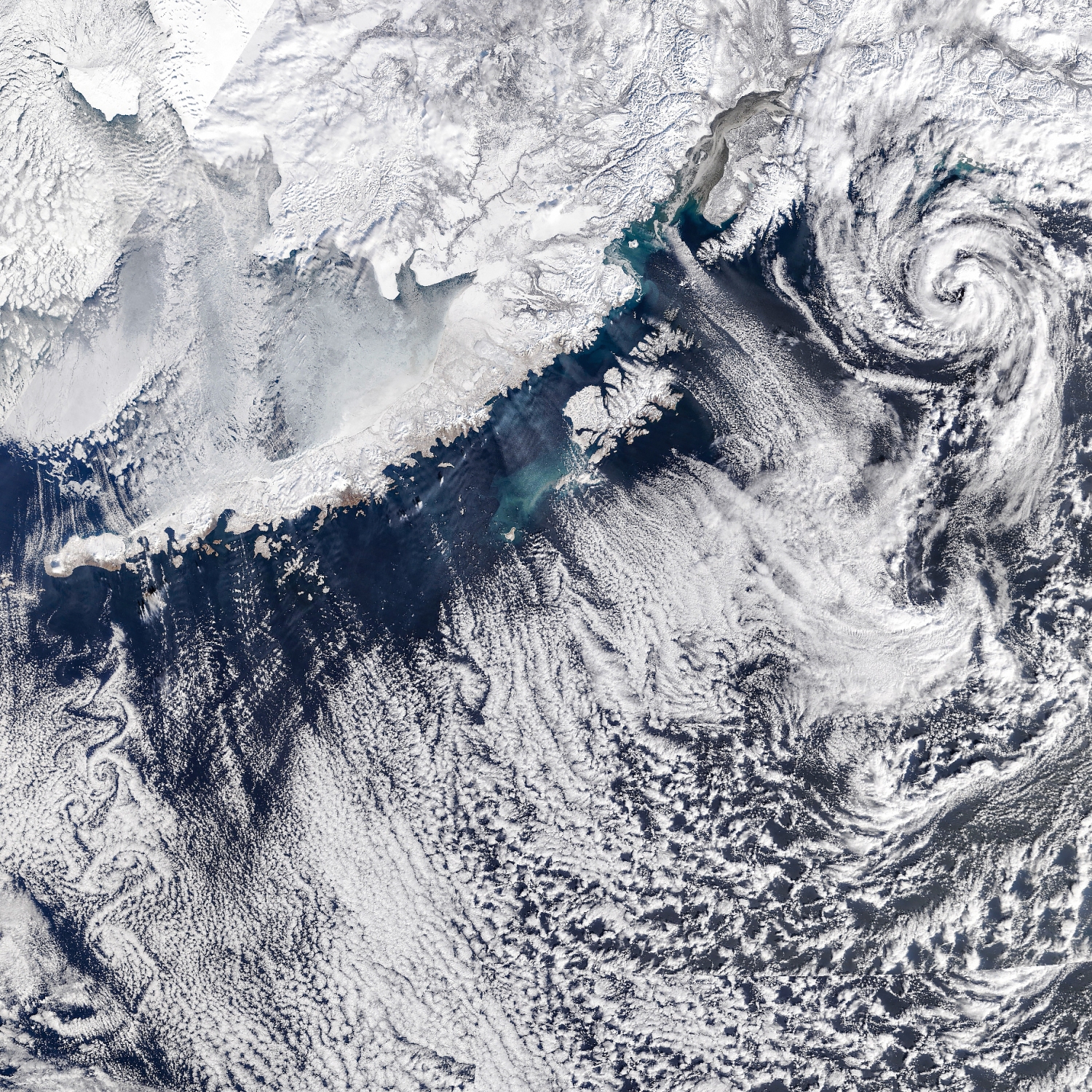
There is a lot going with the clouds in this sky over the Gulf of Alaska, US, observed from way above by NASA’s Terra satellite in March.
A low-pressure system in the top right, identifiable by its large rotating vortex, is a weather system, sometimes known as an Arctic hurricane. This can form as cold polar air advects, or drifts across, warmer sea water and brings intense precipitation and strong winds thanks to its embedded Cumulonimbus storm clouds.
In the middle, parallel bands of clouds known as cloud streets form in line with the wind. These patterns of low cloud also form as cold air flows off the land and is warmed by the sea surface below. Cumulus and Stratocumulus clouds form that are arranged into long rows parallel to the wind, known by the variety radiatus because they appear from below to radiate from the horizon. And there’s a little sea fog, or low Stratus, forming in the gap between the land and these cloud streets.
In the lower left, a chain of von Kármán vortex clouds extend downwind from the Alaskan Peninsula. These alternating swirls of cloud can appear in the wake of raised topography – in this case, Unimak Island, which rises 2,860 metres (9,370 feet) above the sea.
This was a busy day for the Alaskan clouds.
Image Credit: NASA Earth Observatory image by Michala Garrison, using MODIS data from NASA EOSDIS LANCE and GIBS/Worldview, taken on March 19, 2026.
