
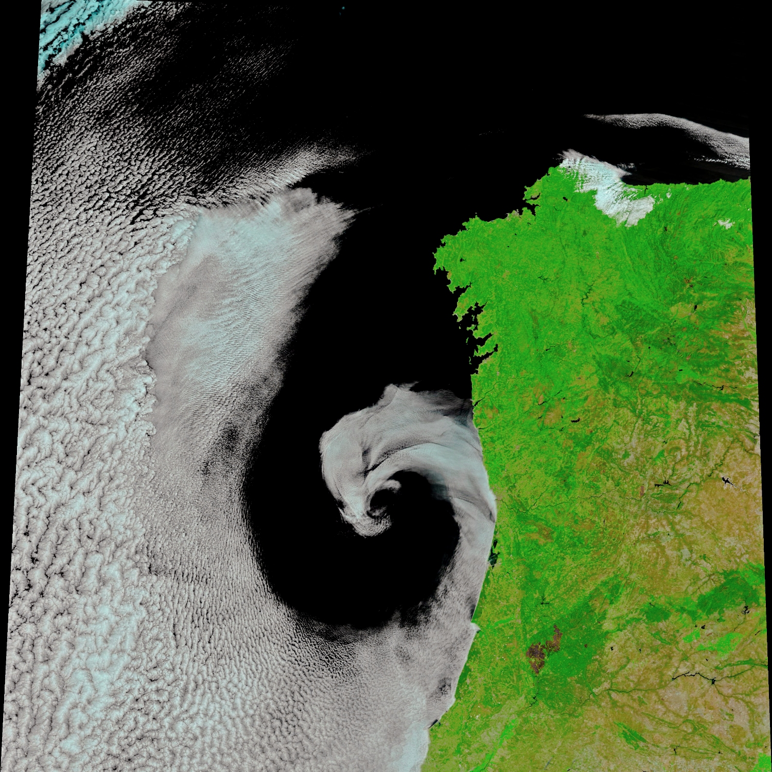
Not all cyclones are storms with torrential rain and howling winds. Some, like this one off the coast of Portugal, are more style than substance.
Captured in dramatic swirls by NASA’s MODIS satellite sensor, this slow-moving summer system might look the part, but it’s unlikely to have produced a single drop of rain. Warm-season cyclones near the Iberian Peninsula tend to be sluggish and cloud heavy, often spinning lazily without much bite.
In this case, the weather system formed a large, twirling eddy over the Atlantic, drawing in dry air from a broiling Iberian heatwave and moist air from the ocean to form a spiral of marine Stratocumulus clouds. The exact cause of the spin isn’t certain – perhaps a difference in friction between land and sea? Whatever the mechanics, this cyclone proves you don’t need thunder and lightning to create drama.
NASA Earth Observatory image by Joshua Stevens, using MODIS data from LANCE/EOSDIS Rapid Response.
