
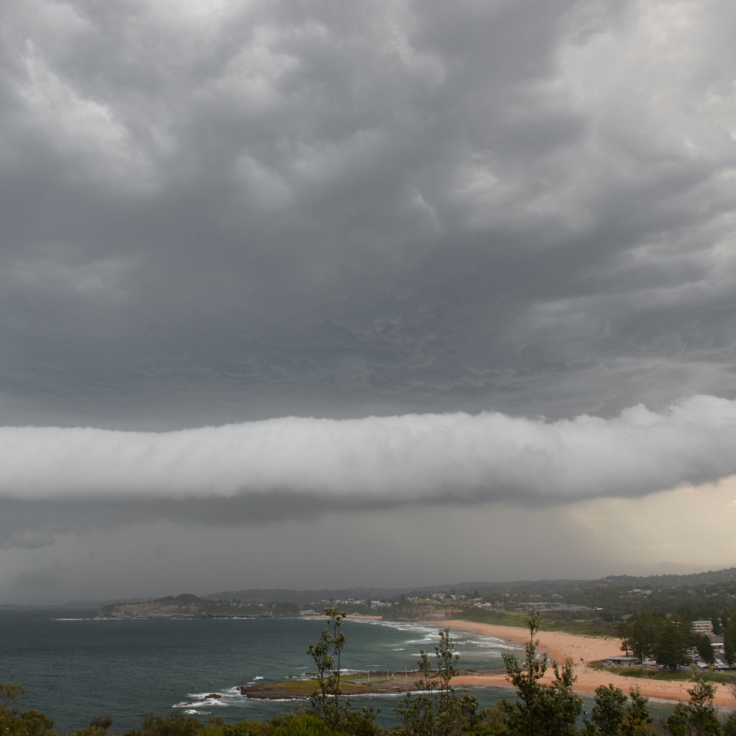
When heavy precipitation falls in a storm, it drags cold air downwards. Upon reaching the surface, this air spreads outwards, where it interacts with warmer air ahead, forming a rolling cloud known as a volutus. This detached tube-like cloud travels ahead of the storm, spinning along its axis as it moves.
Michael Milenko (Member 35,154) spotted this volutus travelling north along the coast near Mona Vale, Sydney, Australia, with a Cumulonimbus thunderstorm looming close behind. Unlike the related cloud feature known as an arcus, which remains attached to the storm base, a volutus like this appears separately, leading the charge. Think of it as a majorette’s baton – spinning rather than swirling – at the front of a stately storm procession.
