Long cloud ID needed
Forums › Cloud Identification Help › Long cloud ID needed
Tagged: Idaho
- This topic has 10 replies, 3 voices, and was last updated 5 years ago by
 Steven strick.
-
AuthorPosts
-
-
December 14, 2020 at 2:27 pm #458849
 Steven strickModerator
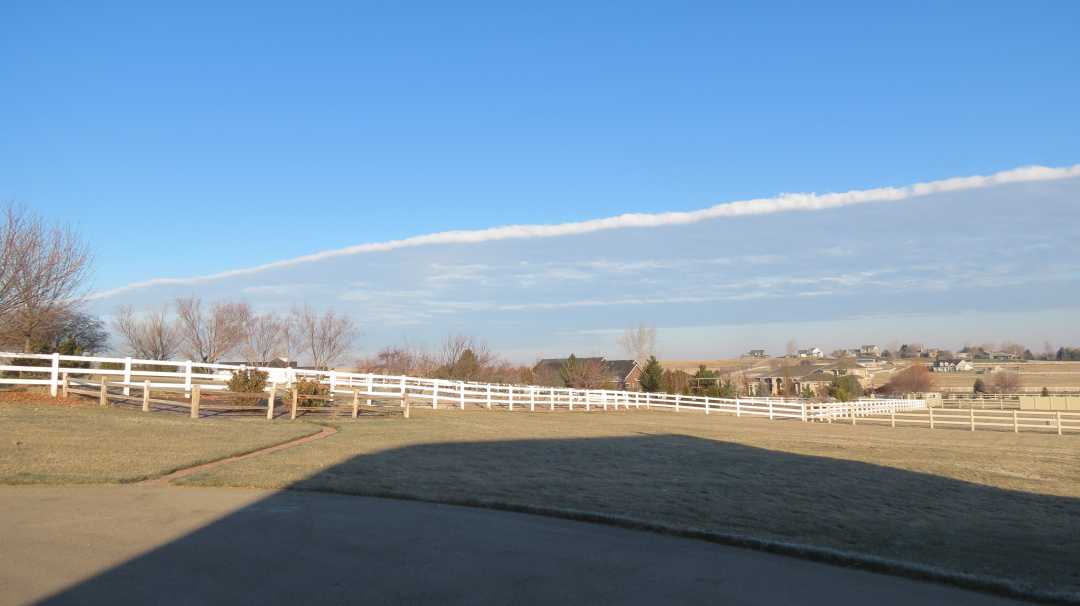
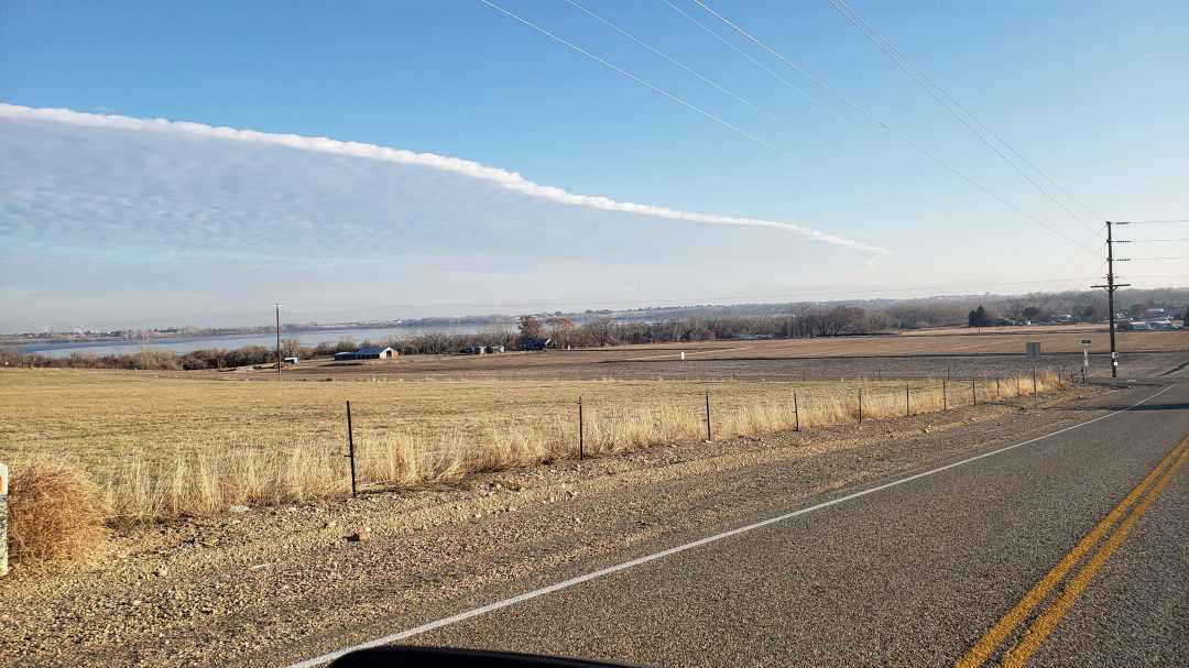
These were taken December 8th, 2020 in SW Idaho. It was very long…miles and miles. Not sue what I’m looking at. It stayed most of the day, then dissipated little by little. Thanks up front.


-
December 14, 2020 at 4:12 pm #458895
 Gregory VenarskyParticipant
Interesting Steven, wonderful catch by the way. Did you have a front moving through the area during that time? If so, this seems to be a deck of altocumulus associated with a front passing through.
-
December 15, 2020 at 12:40 am #459049
 Steven strickModerator
Not really. The cloud just stuck there for hours, then dissipated. We’ve been dry for weeks now with no rain or snow. Well, except for last night’s 3 inches.
Thank you!
-
December 15, 2020 at 3:27 am #459079
 Gregory VenarskyParticipant
Hmm… I admit that I am stuck. Are there any mountains in the area that could have caused a constant upflow of air? It may also be a specific stretch of land that releases a lot of moisture over a long area that could form a line of clouds like that. Is there a river along where this is?
Greg
-
December 15, 2020 at 4:05 am #459090
 Steven strickModerator
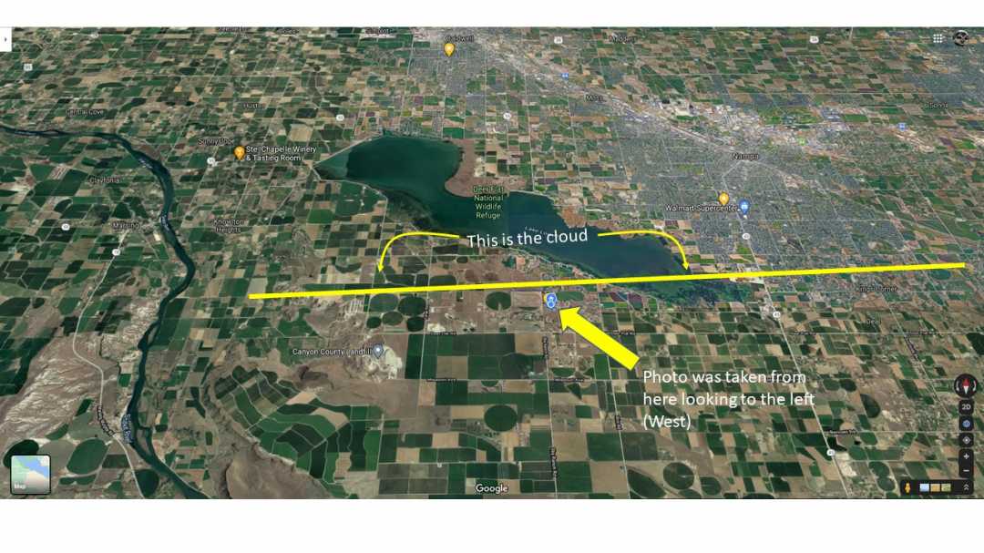
The Snake River is way to the west…and this is pretty much all farm land. I’m attaching a map with some graphics to show you more detail. See if this will help. Thank you for your interest !

-
December 15, 2020 at 7:15 pm #459429
 Gregory VenarskyParticipant
Yeah, I love this section of the forum, it’s nice to help people. Now pertaining to your map, I’d believe some of the moisture coming off of the lake could be rising to form clouds that stay over that lake for a long period of time.
I hope this helps, and thank you for the diagram!
Greg
-
January 9, 2021 at 12:14 am #464442
 Rob ThompsonParticipant
I just checked the weather data and there was a front that went through…
…. and the wind direction reversed around midday.
https://www.wunderground.com/history/daily/KBOI/date/2020-12-8
This type of situation is often associated with very different winds at different altitudes which can trigger air mass wave systems which are not necessarily associated with an underlying mountain range.
Rob
-
January 9, 2021 at 1:49 am #464453
 Steven strickModerator
Rob, I appreciate the answer. I’ve seen this before….there’s a formation in the sky but nowhere is there any indication as to why it’s there. But, looking at the upper or lower weather gives the answer. Just like your explanation. Thank you!
-
-
January 9, 2021 at 6:39 am #464464
 Rob ThompsonParticipant
Thank you for kicking off the topic!
Windy.com has a neat feature where you can choose the wind map to display winds at the different altitudes. There is a slider on the right side of the screen.
I have found that many interesting high clouds are associated with a sudden wind change. These shear layers are also responsible for turbulence in aircraft.
The boundary between different atmospheric layers tends to act similarly to the boundary between the ocean and winds above. Waves are created in both circumstances.
Rob
-
January 10, 2021 at 4:39 pm #464590
 Gregory VenarskyParticipant
I love Windy.com! I use it to look at the wind, and the different levels of clouds over time as well. Thanks for sharing!
-
January 11, 2021 at 4:12 pm #464732
 Steven strickModerator
Windy.com is very cool. Thank you!
-
-
-
AuthorPosts
- You must be logged in to reply to this topic.


