
Filter By:
Main Cloud Types
- Cumulus
- Stratus
- Stratocumulus
- Altocumulus
- Altostratus
- Cirrus
- Cirrocumulus
- Cirrostratus
- Nimbostratus
- Cumulonimbus
Other Clouds
- Arcus
- Asperitas
- Cap / banner clouds
- Capillatus
- Castellanus
- Cataractagenitus
- Cauda (Tail cloud)
- Cavum (Fallstreak hole)
- Congestus
- Contrail (homogenitus)
- Duplicatus
- Diamond dust
- Distrail
- Fibratus
- Flammagenitus (Pyrocumulus)
- Floccus
- Fluctus (Kelvin-Helmholtz)
- Fractus
- Homogenitus
- Horseshoe vortex
- Humilis
- Incus
- Intortus
- Lacunosus
- Lenticularis
- Mamma
- Morning Glory Cloud
- Murus (Wall cloud)
- Mediocris
- Nacreous
- Nebulosus
- Noctilucent
- Pannus
- Perlucidus
- Pileus
- Praecipitatio
- Radiatus
- Silvagenitus
- Spissatus
- Stratiformis
- 'Supercilium' (not official classification)
- Translucidus
- Tuba / Twister
- Uncinus
- Undulatus
- Velum
- Vertebratus
- Virga
- Volutus (Roll cloud)
Optical Effects
- 22° Halo
- 46° Halo
- Circumhorizon Arc
- Circumscribed halo
- Circumzenithal Arc
- Cloudbow / Fogbow
- Corona
- Crepuscular rays & shadows
- Diffuse arcs
- Green flash
- Glory
- Halos
- Helic arc
- Infralateral arc
- Iridescence
- Lower Sun Pillar
- Lower Tangent Arc
- Moonbow
- Moondogs
- Parhelic circle
- Parry antisolar arcs
- Parry arc
- Parry infralateral arc
- Parry supralateral arc
- Rainbow
- Sub parhelion
- Sub-sun
- Suncave parry arc
- Sun dog (Parhelion)
- Sun pillar
- Supernumerary bows
- Subparhelic circle
- Supralateral arc
- Upper tangent arc
- Wegener arc
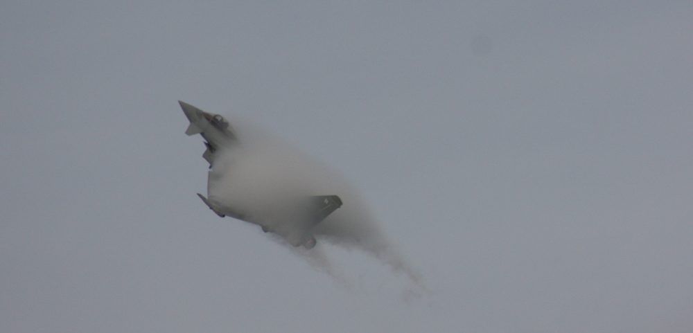
A visible cloud of condensed water forms around a Typhoon jet flying at high speed through moist air over Portrush, northern Ireland.
2 thoughts on “A visible cloud of condensed water forms around a Typhoon jet flying at high speed through moist air over Portrush, northern Ireland.”
Leave a Reply Cancel reply
You must be logged in to post a comment.
This site uses Akismet to reduce spam. Learn how your comment data is processed.

Strong high altitude shearing winds contributing to the development of Cirrus uncinus cloud formations over Cashmere, Washington, US.
Leave a Reply Cancel reply
You must be logged in to post a comment.
This site uses Akismet to reduce spam. Learn how your comment data is processed.

Corona over San Antonio Del Mar, Mexico
Leave a Reply Cancel reply
You must be logged in to post a comment.
This site uses Akismet to reduce spam. Learn how your comment data is processed.

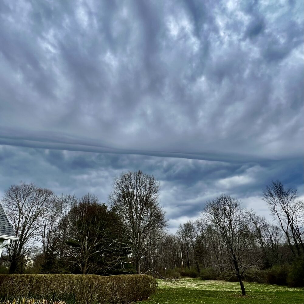
Mixed layers over Fort Saint James, British Columbia, Canada
Leave a Reply Cancel reply
You must be logged in to post a comment.
This site uses Akismet to reduce spam. Learn how your comment data is processed.
An evolving sky over Malakwa, British Columbia, Canada.
Leave a Reply Cancel reply
You must be logged in to post a comment.
This site uses Akismet to reduce spam. Learn how your comment data is processed.

Asperitas with falling precipitation in the distance, over Lincoln, Nebraska, US.
Leave a Reply Cancel reply
You must be logged in to post a comment.
This site uses Akismet to reduce spam. Learn how your comment data is processed.

Cirrus vertebratus over the Sierra Nevada mountains in Northern California, US.
Leave a Reply Cancel reply
You must be logged in to post a comment.
This site uses Akismet to reduce spam. Learn how your comment data is processed.
From what is visible in this mysterious photograph, it appears to be a unique Stratocumulus formation that produced a type of linear convergence across the sky over Upstate New York, US. Without a 360 view, it is not entirely clear as to what may have 'precipitated' it.
Leave a Reply Cancel reply
You must be logged in to post a comment.
This site uses Akismet to reduce spam. Learn how your comment data is processed.
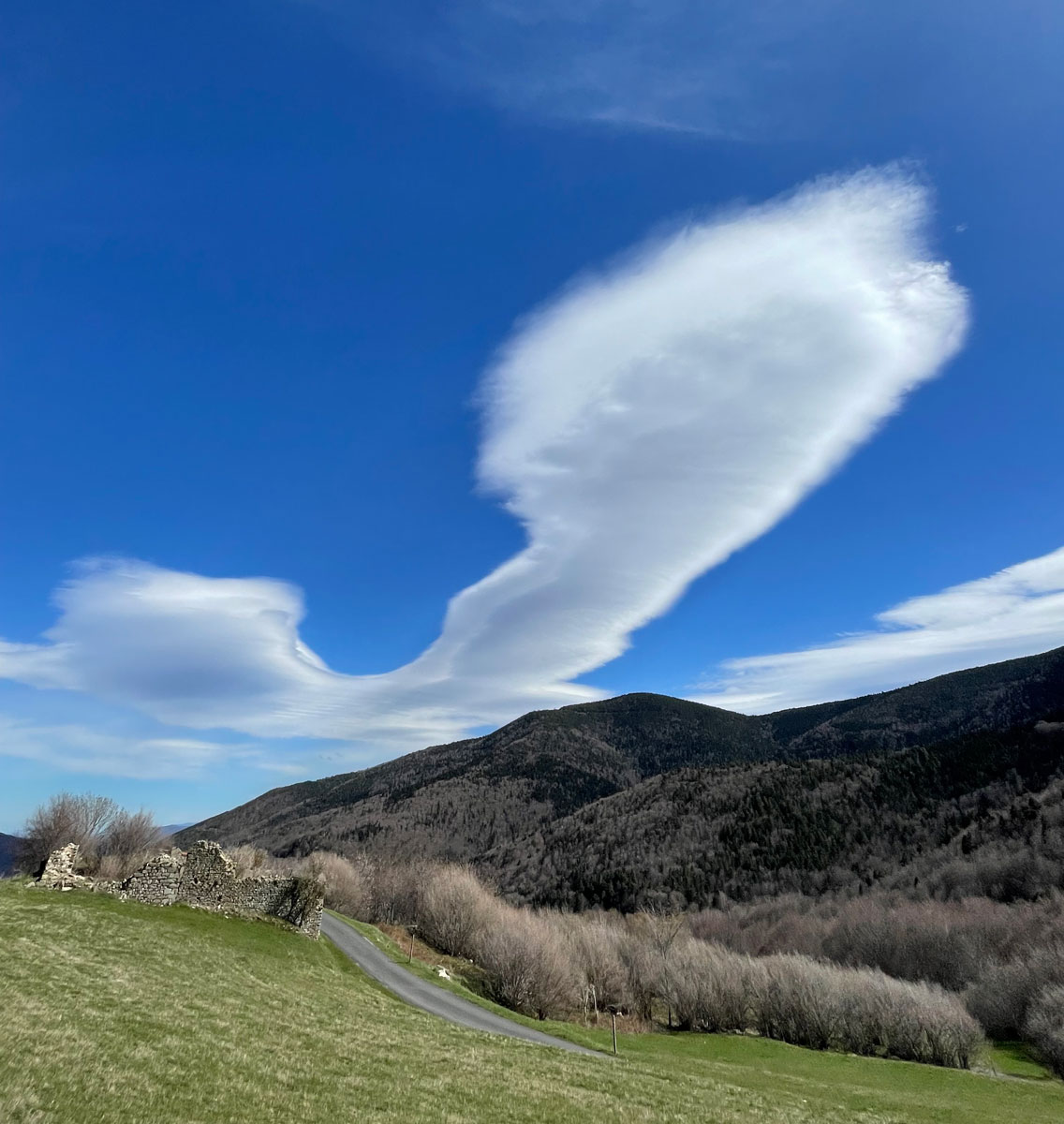
Alocumulus lenticularis forming in the airflows over Canigou, Pyrénées mountains, France.
Leave a Reply Cancel reply
You must be logged in to post a comment.
This site uses Akismet to reduce spam. Learn how your comment data is processed.
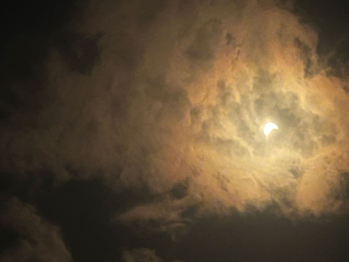
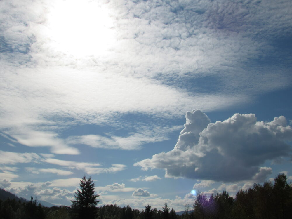
Altocumulus clouds around the beginning of the solar eclipse in April 2024 spotted over Hamilton, Ontario, Canada.
Leave a Reply Cancel reply
You must be logged in to post a comment.
This site uses Akismet to reduce spam. Learn how your comment data is processed.

A colorful display amidst the Stratocumulus clouds over Vermontville, New York, US
Leave a Reply Cancel reply
You must be logged in to post a comment.
This site uses Akismet to reduce spam. Learn how your comment data is processed.

Fluctus (Kelvin-Helmholtz) formation over Norg, The Netherlands
Leave a Reply Cancel reply
You must be logged in to post a comment.
This site uses Akismet to reduce spam. Learn how your comment data is processed.

Leave a Reply Cancel reply
You must be logged in to post a comment.
This site uses Akismet to reduce spam. Learn how your comment data is processed.

Cumulus congestus amidst the blue sky over Omaha, Nebraska, US
Leave a Reply Cancel reply
You must be logged in to post a comment.
This site uses Akismet to reduce spam. Learn how your comment data is processed.

Rainbow over the Fremont Bridge in Portland, Oregon, US
Leave a Reply Cancel reply
You must be logged in to post a comment.
This site uses Akismet to reduce spam. Learn how your comment data is processed.
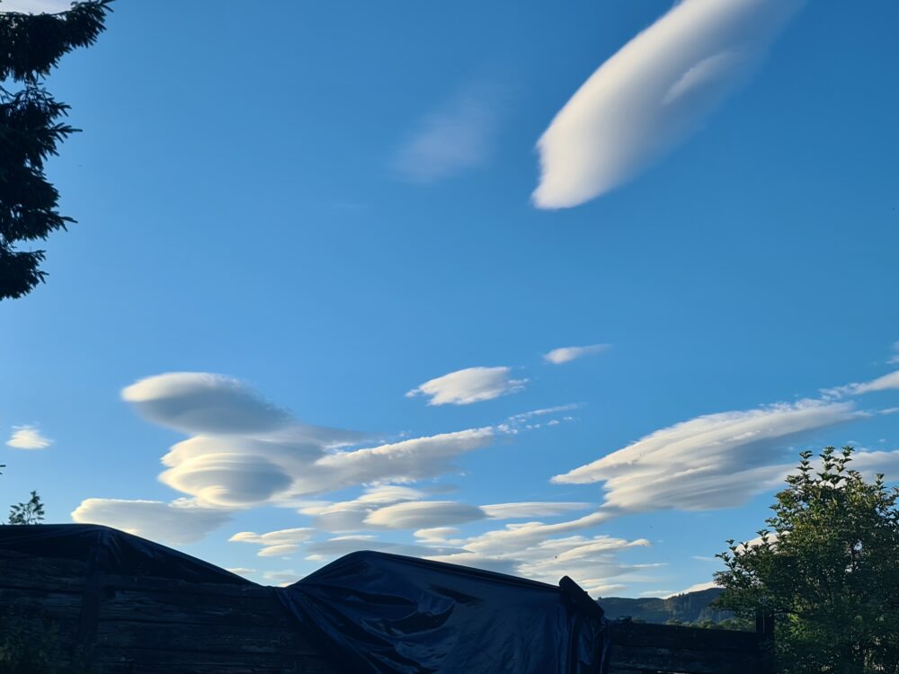
An impressive collection of Altocumulus lenticularis cloud formations over Aberfoyle, Scotland
Leave a Reply Cancel reply
You must be logged in to post a comment.
This site uses Akismet to reduce spam. Learn how your comment data is processed.

Mike,
A correction to your aircraft observation, Sir. The aircraft depicted is the Eurofighter Typhoon, not the McDonnell Douglas F4 Phantom aircraft. The latter entered UK service in 1969 and was used employed in the Royal Navy’s Fleet Air Arm and latterly, the RAF. It was withdrawn from active service in the late 1990’s.
Laurence
I don’t think this is a contrail
The cloud collectors guide says a contrail is the condensation of water in the exhaust from a jet engine.
The cloud in this excellent photograph is the result of a decreased air pressure caused by the Phantom.
It’s a Condensation Cloud not a Contrail
Mike McLaughlin